Waking up at Rabothytta, at the feet of the magnificent Okstindan mountains, your best option would be to stay. I am sure I could spend a full day enjoying the views and the quietness, that is if I could avoid exploring the surrounding mountains. This time I had to move on, and already at eight in the morning I started the one hour hike down from the cabin in the morning sun.
After the almost spiritual experience near Okstindan mountains, I had decided to head out to the coast for the remaining part of the road trip. The first destination was Rødøy, a small island about two hours with the ferry from the mainland, when arriving from the south (important information on travel planning to Rødøy below). With Rødøy on the itinerary, you get to explore the northern part of the coastal route (“Kystriksveien”) as a wonderful side effect.
The drive & the ferry
From the parking in Leirskardalen the drive to the harbour, Kilborghamn, where you can take the ferry to Rødøy, is about 2.5 hours. After about an hour you reach Mo I Rana, the last city of some size on the route. Take the opportunity to stock up on necessities. In another forty minutes you reach the coastal route. Several beautiful view points have been created along the road in order to inspire you to take a break and take in the surroundings, such as Hellåga, about an hour from Mo I Rana.
The ferry only runs twice a day, so make sure you check the schedule and plan your trip carefully, both for your arrival at Rødøy and your departure.
Klokkergården
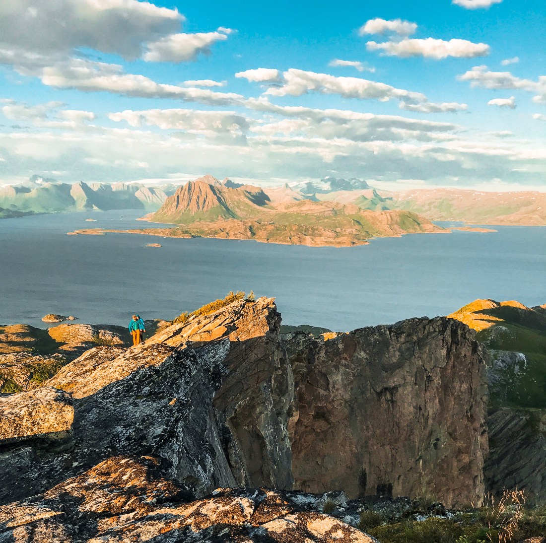
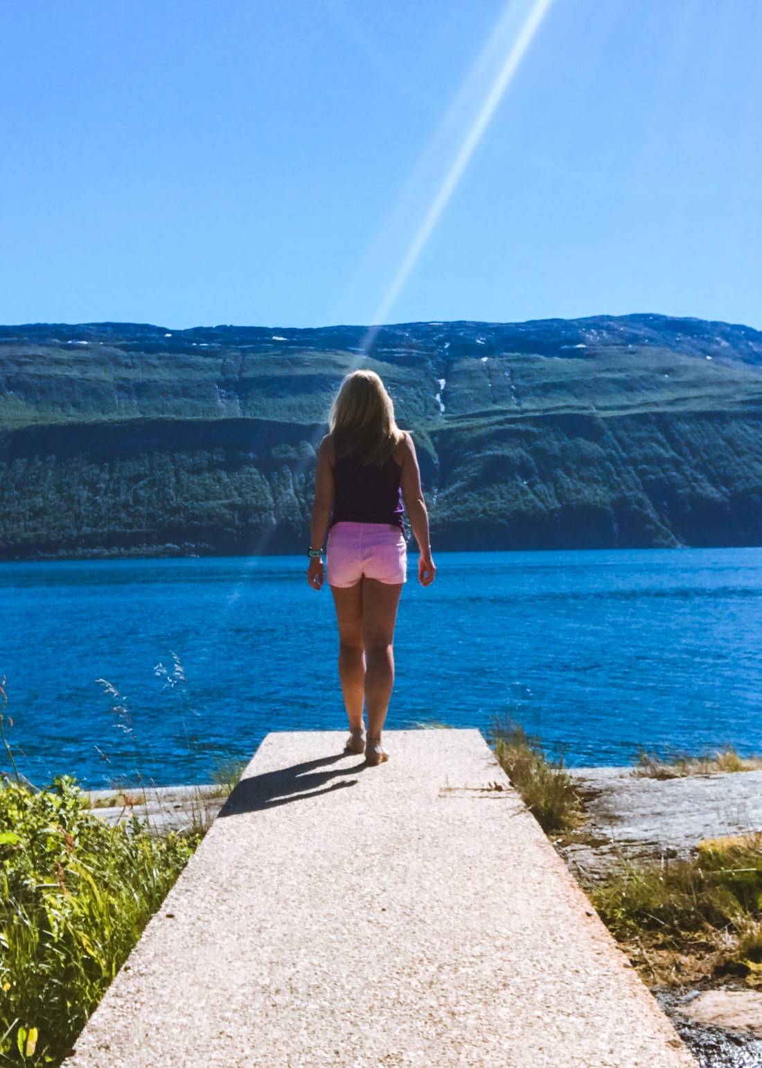
The place to stay at Rødøy is Klokkergården, a more than 100 years old school building, which has been renovated by Malin and her family to one of the most unique accommodation opportunities in Norway. The rooms give you the feeling of staying at someone’s home, and the restaurant downstairs serve impeccable food. Klokkergården is also the starting point for the climb to the famous mountain, Rødøyløva, which was my reason for adding Rødøy to my itinerary in the first place.
Rødøyløva – the hike
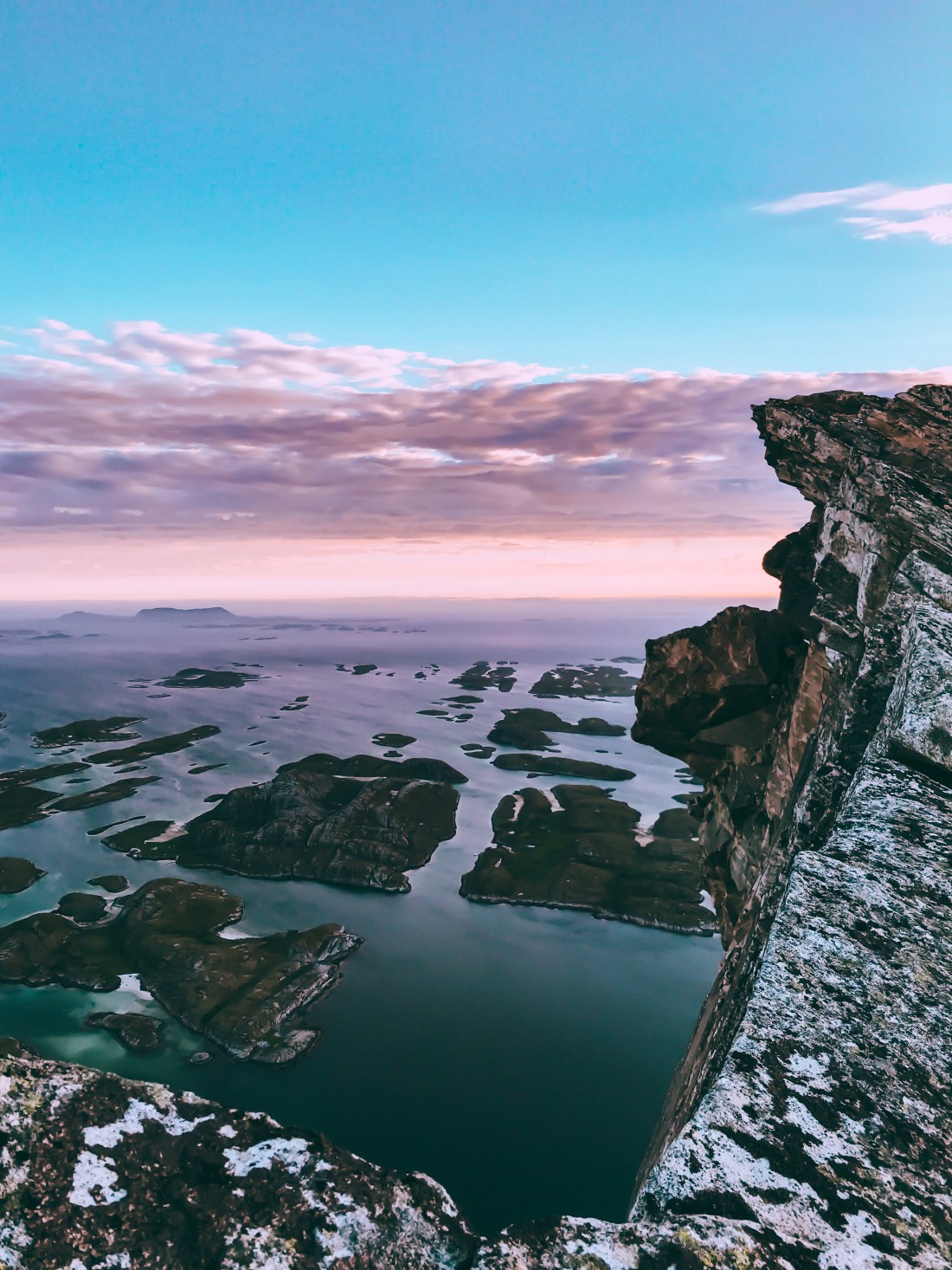
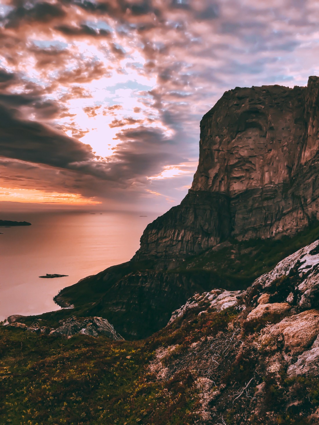
Hoping to experience the midnight sun from the top, I waited until late in the evening before running up to Rødøyløva. The mountain has its name from the resemblance of a lion (“Red island lion”). Watching clouds coming in, in the end I had to give it a go a couple of hours before midnight.
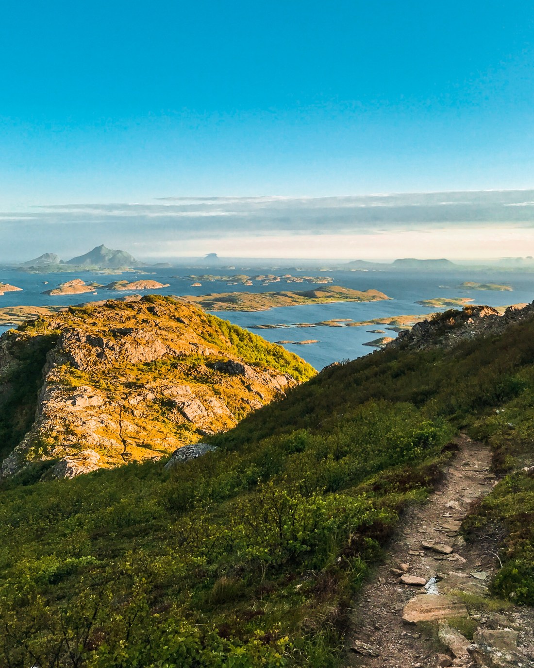
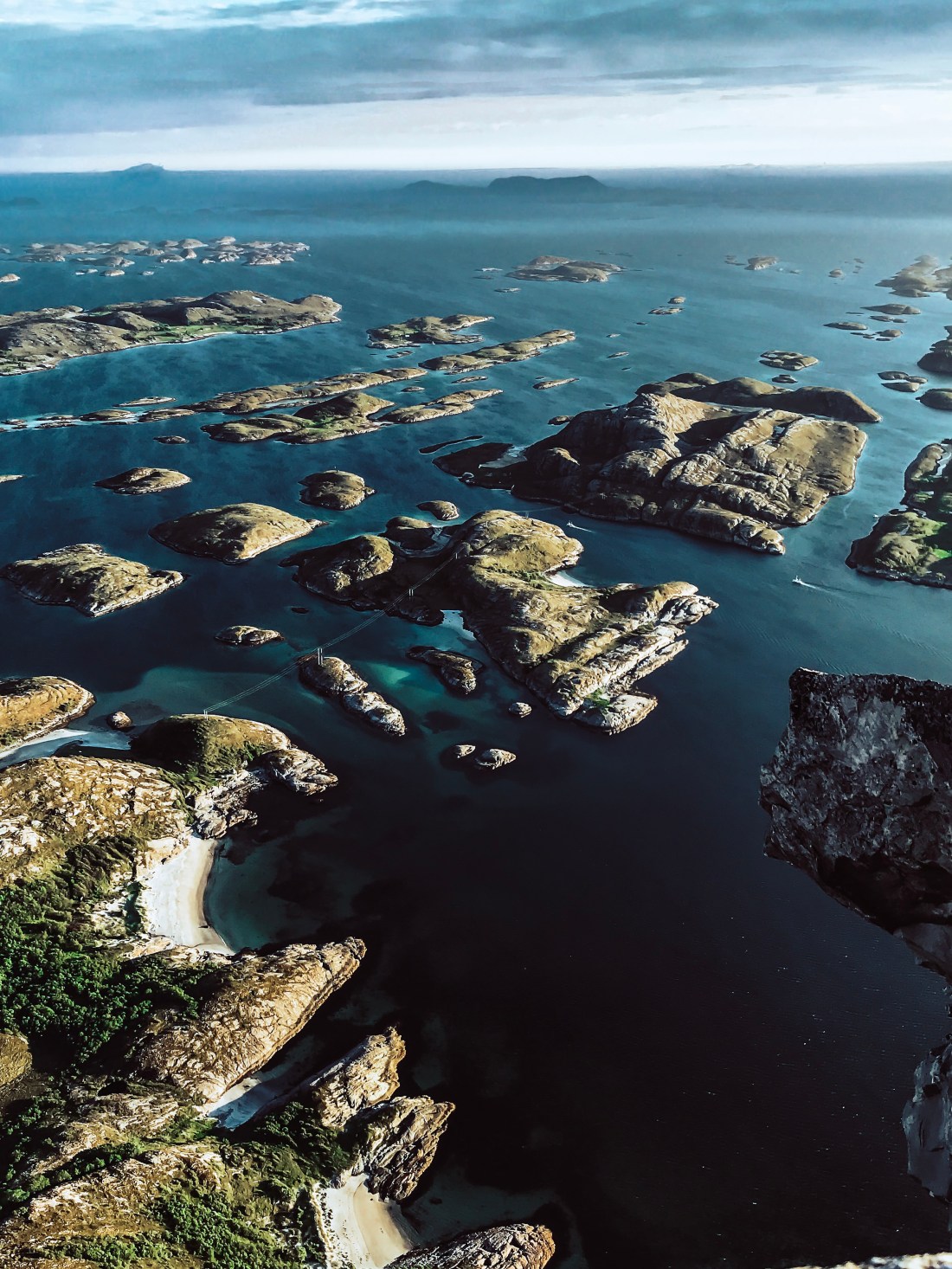
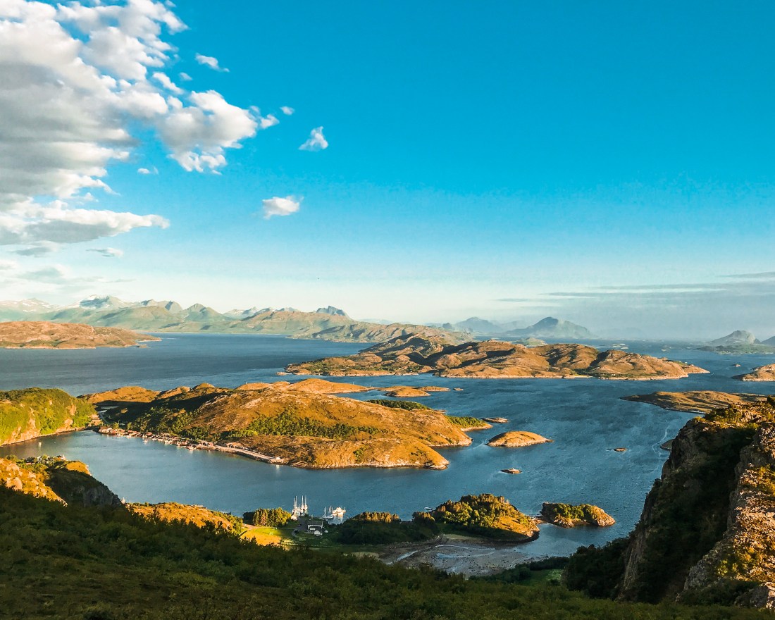
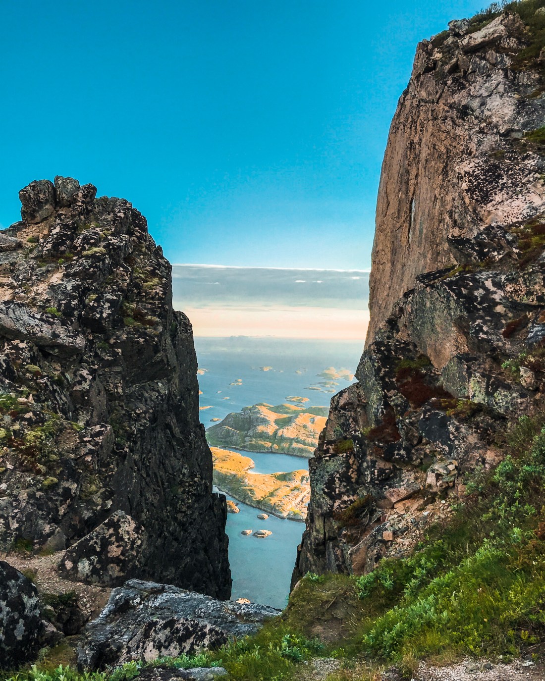 The peak is at 440 meters above sea level and if you are in shape you will reach the peak in around 30 minutes. The first part of the trail is in the forest and is improved by the help of steps laid down by sherpas. The last part is quit exposed, but feels safe as long as the stone is dry. As you gain height quickly the view is simply amazing all the way up to the lion peak, and there are several opportunities for grammable pictures, even if the clouds get in the way of the midnight sun. If it is windy, you will hear a spectacular “noise” from the front wall of Rødøyløva.
If you have the time, check out all the connecting trails you see on your way down, one takes you to a beautiful white sand beach. The island is not big, so you wont get lost.
I love this run/hike/climb so much, I would have done it twice if I had the time!
Strava for details: Rødøyløva (and some of the connecting trails)