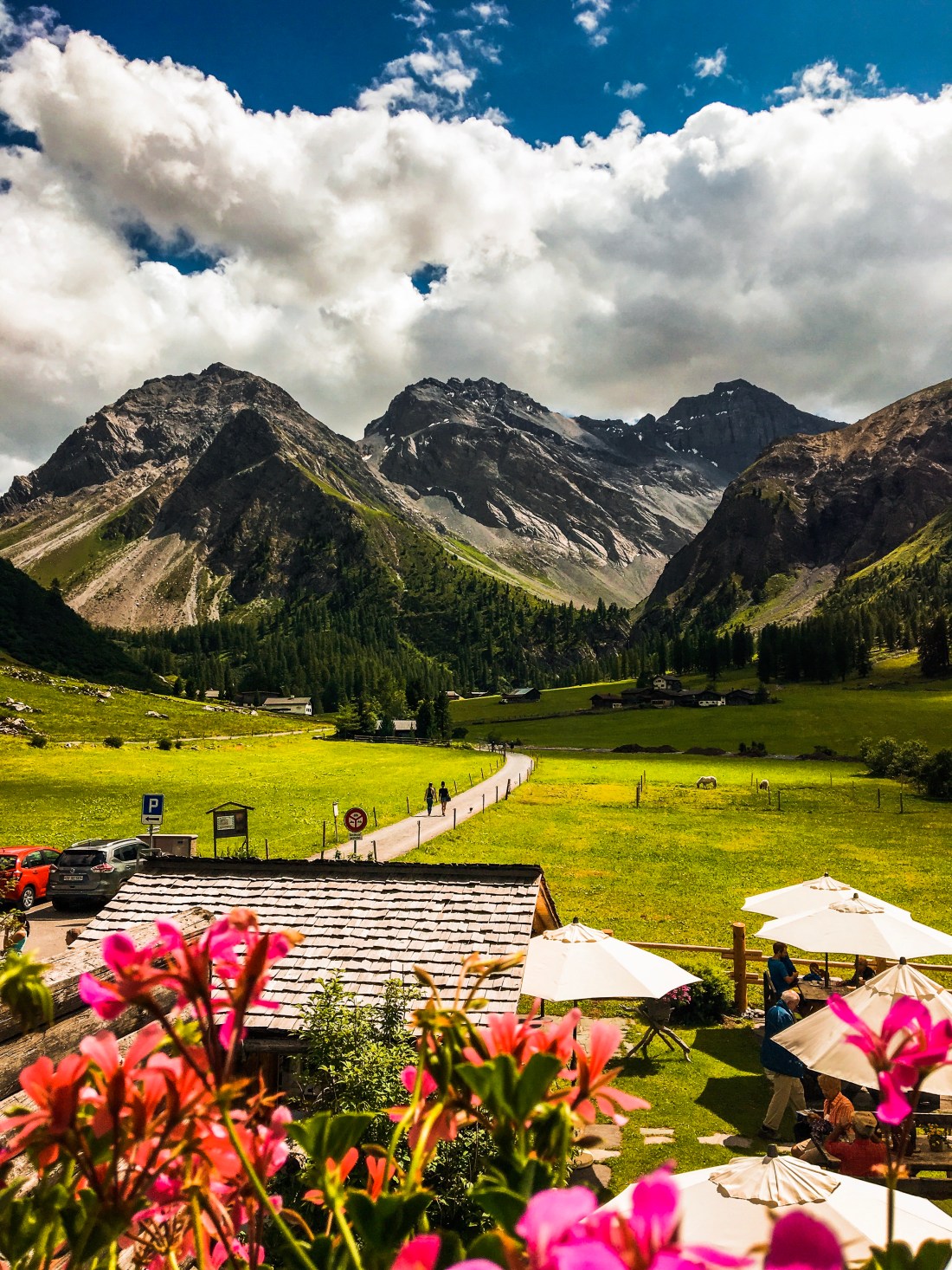
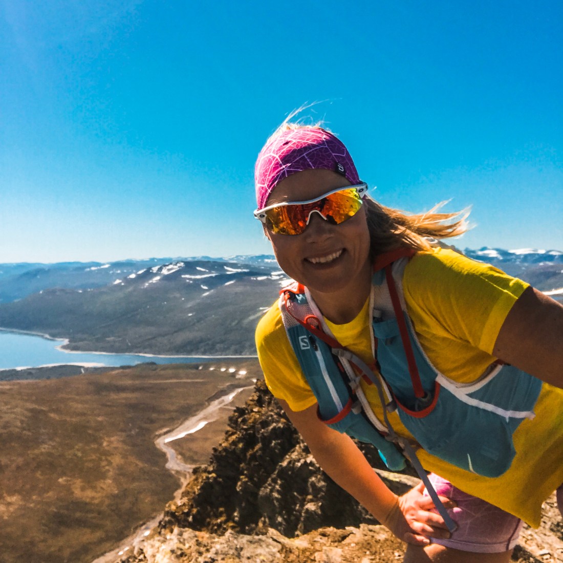
Waking up at Gjevilvasshytta in Trollheimen you have multiple hiking and running options on your doorstep. I had decided on a run to Blåhøa, peaking at 1671 meter about 12 km from Gjevilvasshytta. You can take the car to a parking 1-2 km from the cabin if you want to avoid running the hard sufaced road. The path is surprisingly runable and not too technical, except for the last couple of km. The view from the summit is amazing on a sunny day!
Make time for a coffee and a cinnamon bun outside Gjevilvasshytta and, if you didn’t the evening before, a stroll along Gjevilvatnet, before you hit the road.
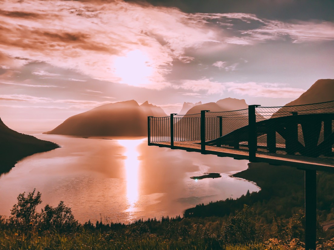
The Drive, 245 km/3 h 40 min
In Oppdal, about 25 minutes from Gjevilvasshytta, Bakeriet Sprø is worth a stop for loading up on sandwiches and coffee for the road. Unless you want to make a stop in Trondheim, in another three hours or so driving the route E6, you reach Inderøya. Inderøya has created its own concept, The Golden Road, catering for tourist on the road, or as a destination in itself.
Accomodation & Restaurant
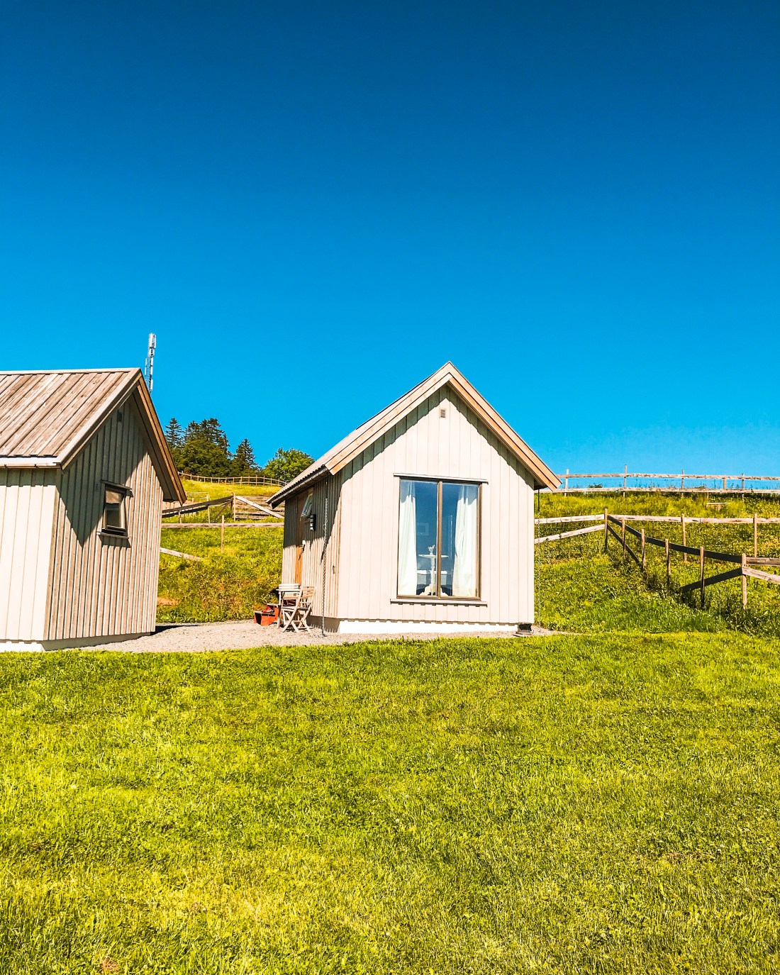
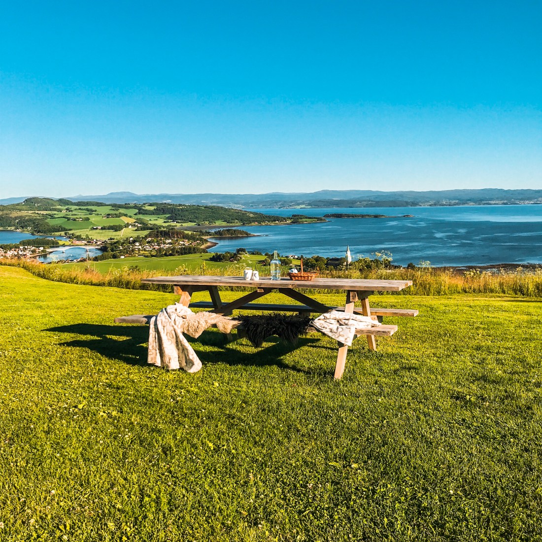
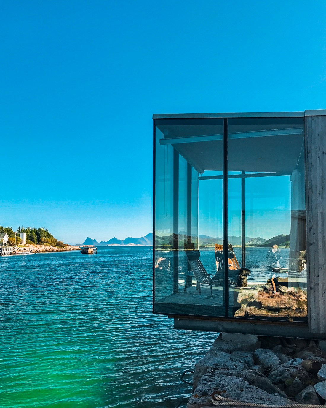
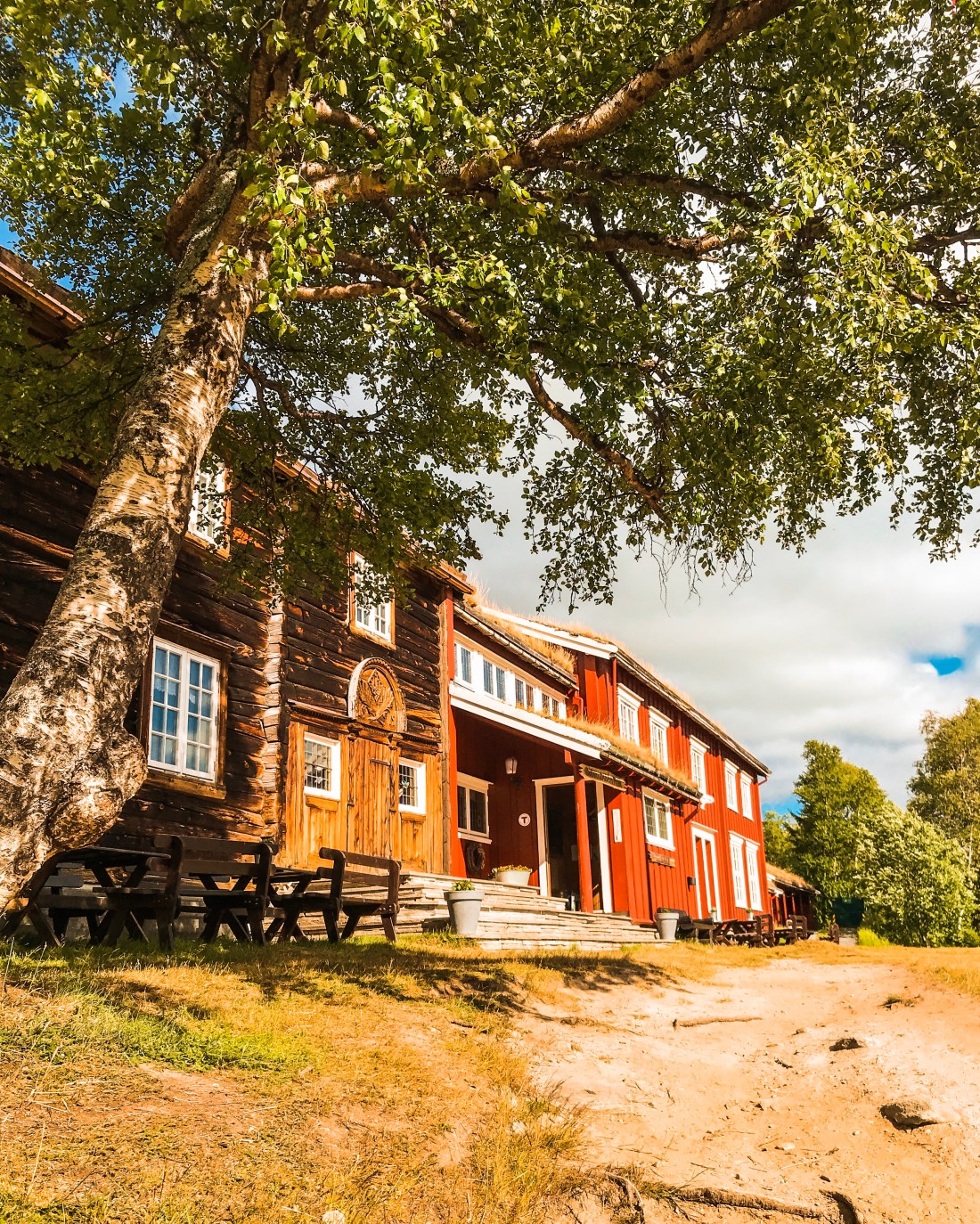
At Inderøya you have several unique accomocation alternatives. This time I stayed at Husfrua, a country farm hotel situated on a hill top with great views of the fjord. Husfrua offers rooms in historic surroundings as well as modern free-standing small external houses in the farm yard. The highlight of my stay was the home made breakfast served on the sunny terrace of the main building. Another option would be Jegtvolden Fjordhotell.
Husfrua
A few hundred meters away from Husfrua you find Øyna, a truly fantastic place offering local food and magnificient views of the fjord. Remember to make a reservation in advance, and if the weather is good, ask to be seated outside.
I don’t know about you, but I have already started planning my travels for 2019. Last year I did a spectacular road trip to the north of Norway. I spent months planning it to make sure I could secure my preferred accommodation options, explore the trails I had made notes of when browsing Ute and other magazines, blogs and websites over the last years, and don’t miss out on any of the remarkable sites created along the scenic routes I had decided to explore. The planning of this road trip and the experiences I had during my travel inspired this website and thus I have been looking forward to take you through the trip I made, and inspire you to plan your own.
I started my journey from Øyer in Gudbrandsdalen, where I have a place in the mountain, but you may start of from Oslo, Gardermoen (airport), or anywhere you like of course.
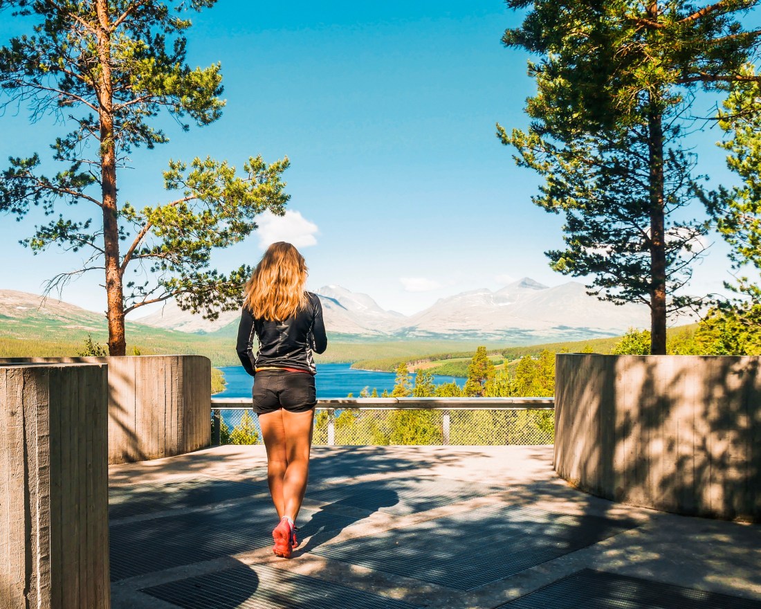
Beautiful surrounding for running/roller skiing/biking
Let’s go!
Day 1: Øyer/Lillehammer – Trollheimen
Sohlbergplassen
The Drive, 220 km/3 h 10 min
For a long time I have been a big fan of the Norwegian Public Roads Administration’s project “Norwegian Scenic Routes“, which to a great extent inspires my travel in Norway. The destination for the first leg of my road trip was Gjevilvasshytta in Trollheimen, not far away from Oppdal. Instead of driving the “highway”, E6 I chose to drive county road 27, which makes out the Rondane Scenic Route from Ringebu to Hjerkinn.
Venabygdsfjellet
When reaching the mountain plateau Venabygdsfjellet the scenery is absolutely amazing, with the mountain Muen as the natural focal point. Continuing through Folldal towards Hjerkinn, there are a few attractions along the road. My favorite was Sohlbergplassen, a view point at Atnsjøen lake. The platform frames the view towards the lake and the rounded peaks of the Rondane massif almost exactly as they appear in Harald Sohlberg’s famous painting “Winter’s Night in Rondane”. I also made a stop in Folldal to load up on waffles.
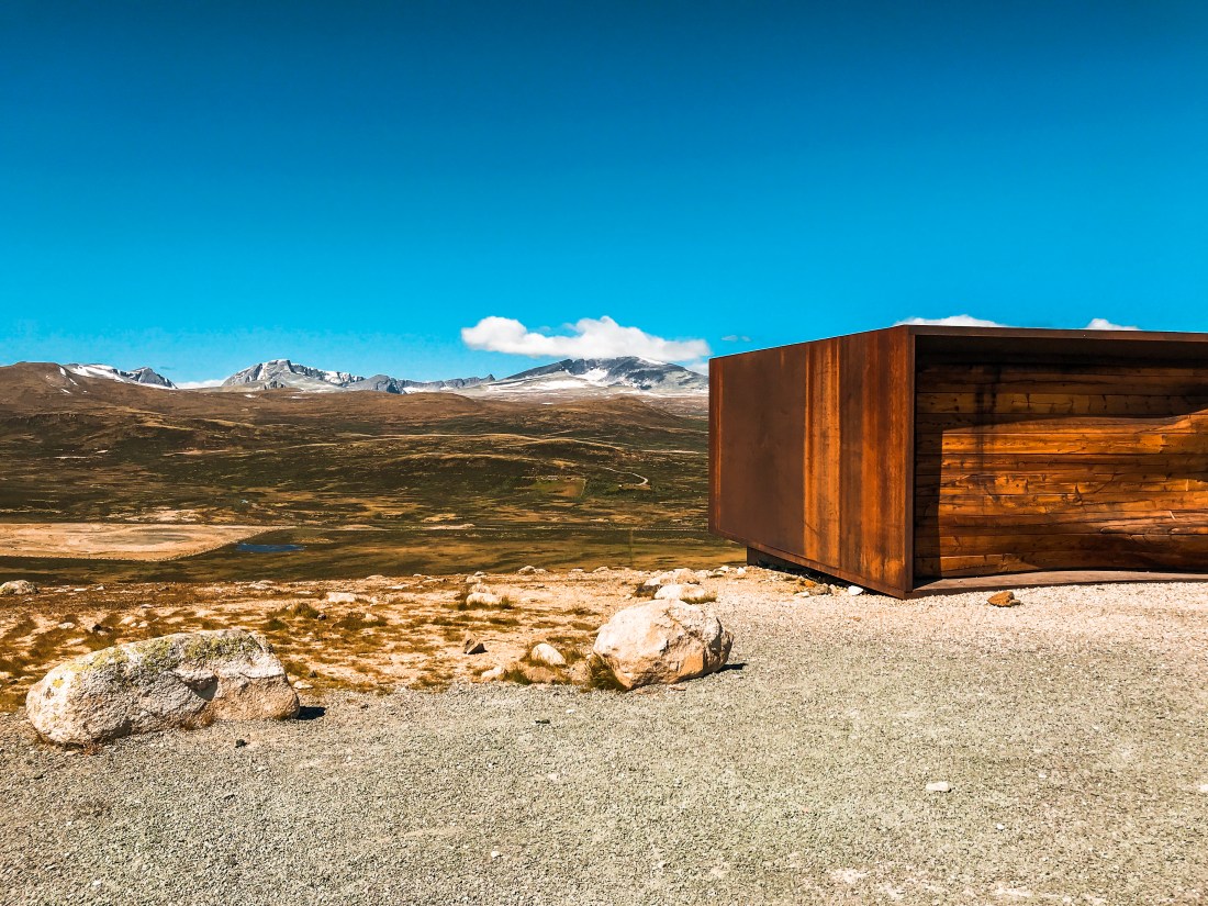
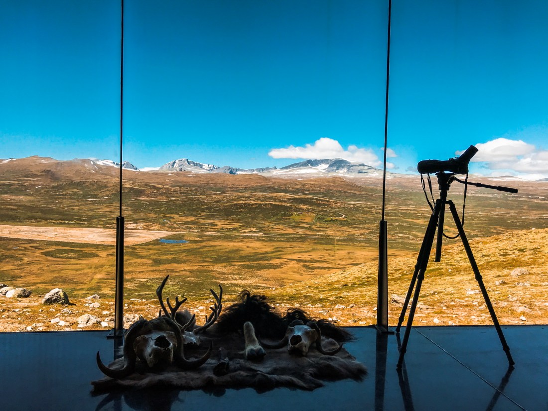
At Hjerkinn I made a short detour to Viewpoint Snøhetta. The viewpoint is a short hike from the parking, providing an excellent opportunity to stretch your legs.
Snøhetta ViewpointFrom inside the viewpoint looking towards the mountain Snøhetta
From Hjerkinn there is another hour drive to Gjevilvasshytta, my suggested accommodation for the night.
Today’s Activity
Mount Muen
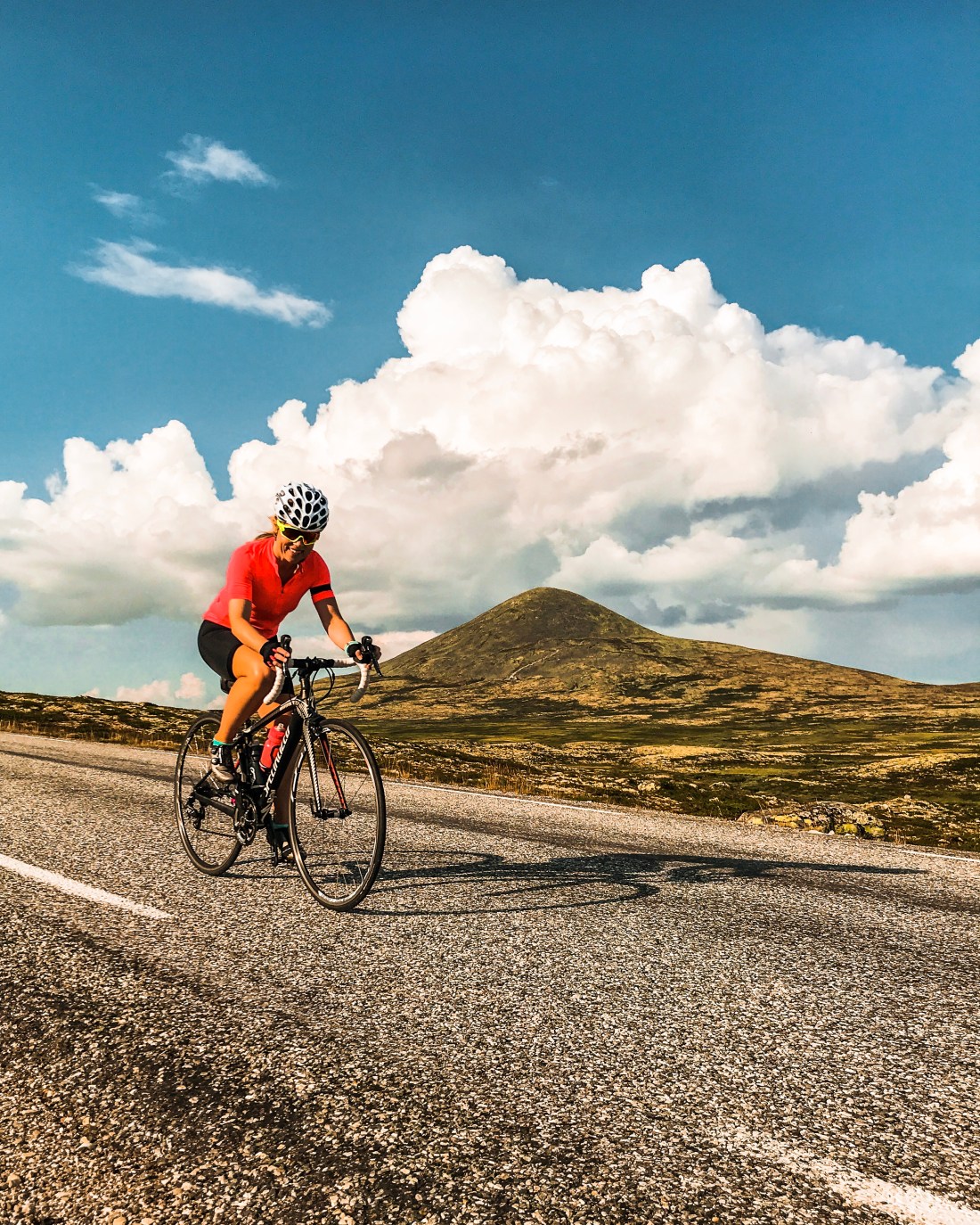
My planned activity for this first day of driving was to go roller skiing on Venabygdsfjellet. Due to heavy winds and a recent rib fracture I had to skip it for this time. If you bring your bike I would highly recommend that you make a stop for biking over Venabygdsfjellet, see feature in the cycle magazine Landevei (I went back to do that later in the summer). This time I did a beautiful evening trail run from Gjevilvasshytta, finishing of with some nice stretching at the nearby lake.
My choice of accommodation was Gjevilvasshytta. Built in 1819, it is the oldest building being used for accommodation by Turistforeningen (the Norwegian Trekking Association), and is situated 710 meters above sea level at Gjevilvatnet, offering a great starting point for hiking and trail running in Trollheimen. The cabin is very popular and its atmosphere and location are amazing, however the sleeping comfort rather basic with shared bathrooms in the hall and thin walls.
Day 1 Highlight
The view of the lake, Gjevilvatnet, when arriving at Gjevilvasshytta. Google it!
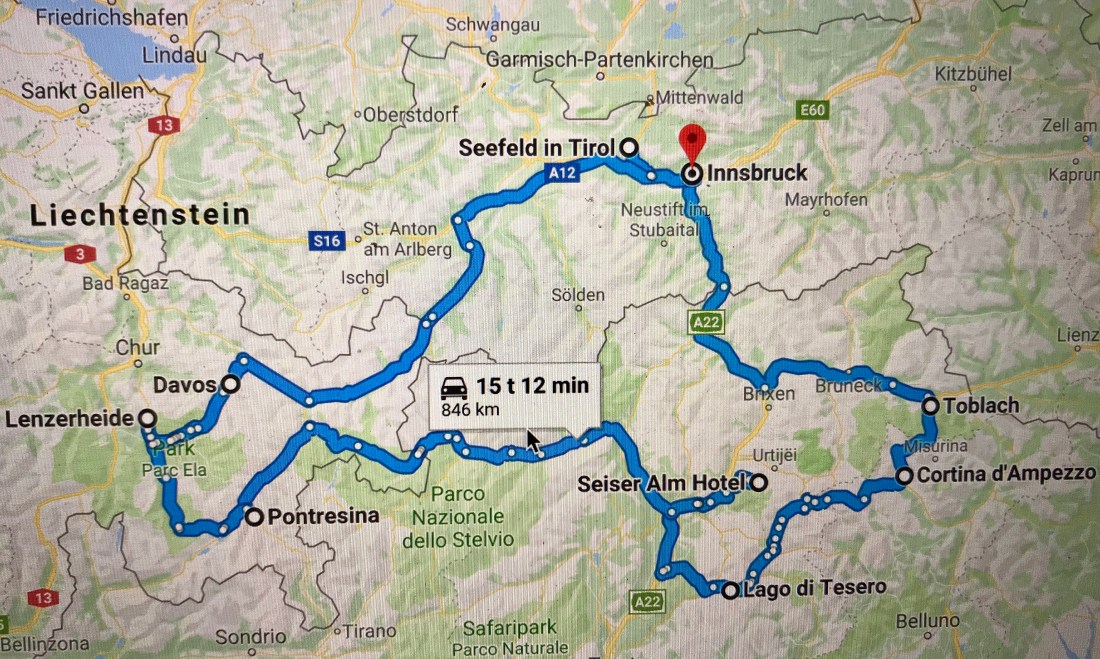
I was recently invited by Raske Gutter Podden (podcast) to talk about cross-country skiing in the Alps (you can listen to the podcast, which is in Norwegian, here). I thought I would take the opportunity to share some information on my favorite places to do cross-country skiing in the Alps, as well as some fun races to attend.
So, let’s pretend we have a few weeks to hang around in the Alps with a fancy car loaded with our cross-country skiing equipment. Of course, you are allowed to bring alpine skis as well, and I will tell you where you can do both, but for the best information on downhill skiing you will have to find another guru.
Unless you already live in the Alps or nearby, you may choose to fly in to Munich Airport or, even better, Innsbruck. You can also fly to Zürich, Milan, Verona, or Venice. Make sure you rent a car with winter tires and enough space for your skis.
The Roundtrip
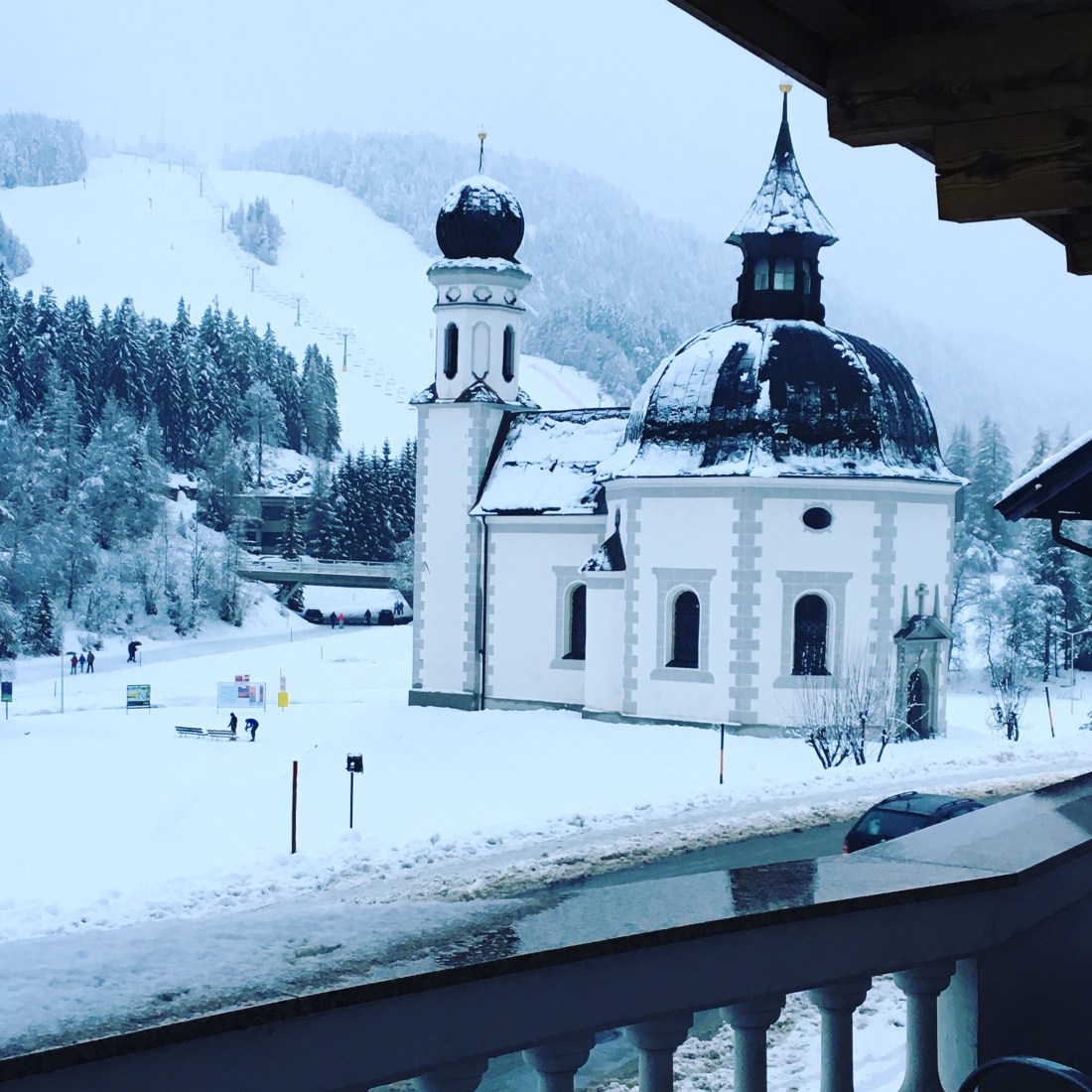
First stop: Seefeld
There’s no better place to start your adventure than the site of the 2019 cross-country World Championship, Seefeld in Tirol. Seefeld is situated on a sunny plateau high above Innsbruck, about 1200 meters above sea level and can be easily reached by train. The ski tracks start right in the middle of the city centre with several nearby hotels to choose from. We stayed at the four star St. Peter Hotel just across the street from the ski tracks and two conveniently located sport shops.
The ski tracks from the hotel.
Tirol claims to offer a total of 4000 km of tracks throughout the region, many of them accessible from Seefeld or nearby villages. You will find easy terrain as well as long and tough ascents and can also try out the world cup tracks which will be used during the world championship in February/March 2019.
When you are ready to leave Seefeld behind, the Italian village of Toblach in south Tirol is a great choice. The drive from Seefeld takes about two hours and I recommend that you make a short stop for lunch and some shopping in Innsbruck on your way there. Toblach traditionally hosts one or more races forming part of the legendary Tour de Ski in January every year. The events are free for spectators and have a great atmosphere. During race days the world cup tracks will be closed for other than the athletes, but there are many other nearby tracks to choose from, including my favorite, the track from Cortina (Fiames Ski Arena) to Toblach, which is the same track being used for the men’s long distance during Tour de Ski as well as the Visma Ski Classic event (see below).
Once in Toblach, your obvious choice of accommodation may be the perfectly located Hotel Santer, which is basically on the ski arena, Apparthotel Germania for great breakfast as well as easy access to the ski arena, or the friendly Hotel Stauder, which also serves great food. Don’t miss out on Pizzeria Hans while in town!
Races to join: Pustertaler Skimarathon, 11 January 2020 and Toblach-Cortina 1-2 February 2020 (classic technique and Visma Ski Classic on Saturday and free technique on Sunday) and Gsieser Tal Lauf 15-16 February 2020 (classic technique on Saturday and free technique on Sunday).
Third stop: Val di Fiemme
In Tour de Ski the races in Toblach are usually followed by the final races in Val di Fiemme, and I suggest you follow the same route. Leaving Toblach you should plan for a stop in the sophisticated village of Cortina, stroll the pedestrian street and have lunch at San Brite (reservations recommended) before you enjoy the beautiful drive via Passo Pordoi to Val di Fiemme. Passing by Cortina and Canazei, this is also your opportunity to add a day or two of downhill skiing.
In Val di Fiemme my choice of hotel is the Castelir Suite Hotel, a quiet, intimate hotel with large rooms, great service and walking distance of the world cup ski arena at Lago di Tesero. Another option would be Hotel La Stua, a hotel popular among Norwegian skiers and the location of the massive Marcialonga after party. For lunch or dinner, try out the wine bar El Molin or La Stua.
Watching Tour de Ski.
Although a traditional cross-country skiing race destination and the host of several world championships and the legendary Marcialonga, Val di Fiemme does not have that many options for cross-country skiing. In two days you have it covered, nevertheless, having a slightly more Italian flare to it compared to the other destinations, and the cozy village of Cavalese, it is worth a visit. On day one I suggest you try out the world cup tracks from the Lago di Tesero Nordic Ski Arena. If enough snow, tracks will also be open along the river from leaving the world cup arena. During Tour de Ski you may opt to participate in the Rampa con i Campioni, a race open to the public which is equal to the Tour de Ski finale and includes the monstrous climb up Alpe Cermis.
On day two the tracks on the beautiful plateau of Passo Lavazè is worth a visit. Passo Lavazè is a beloved destination for participants of Marcialonga in the days leading up to the race and has easy as well as more strenuous tracks. Be aware though, that the plateau is about 1800 meters above sea level, which adds additional strain on the body. Thus you should save your speed for later.
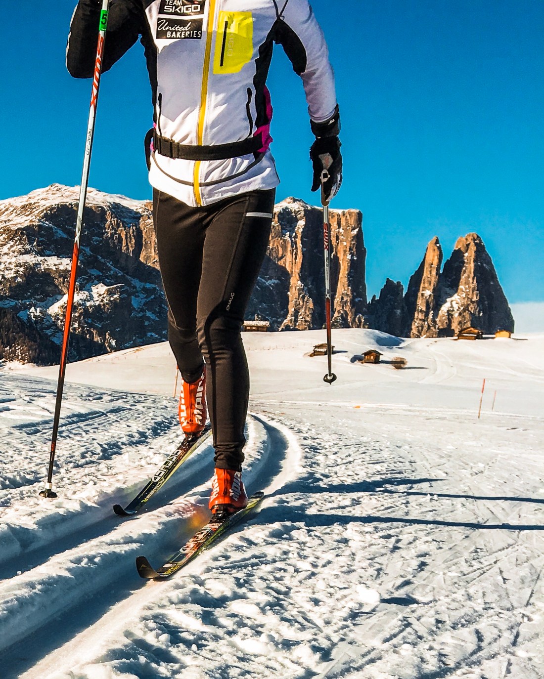
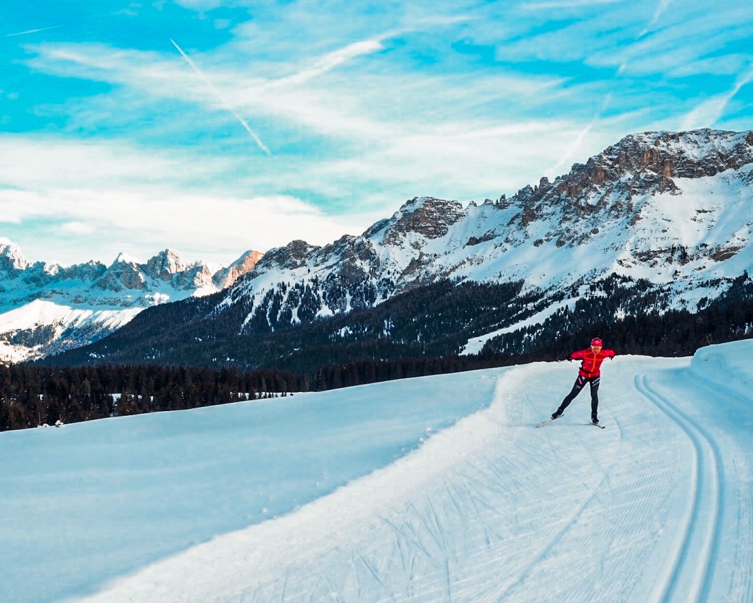
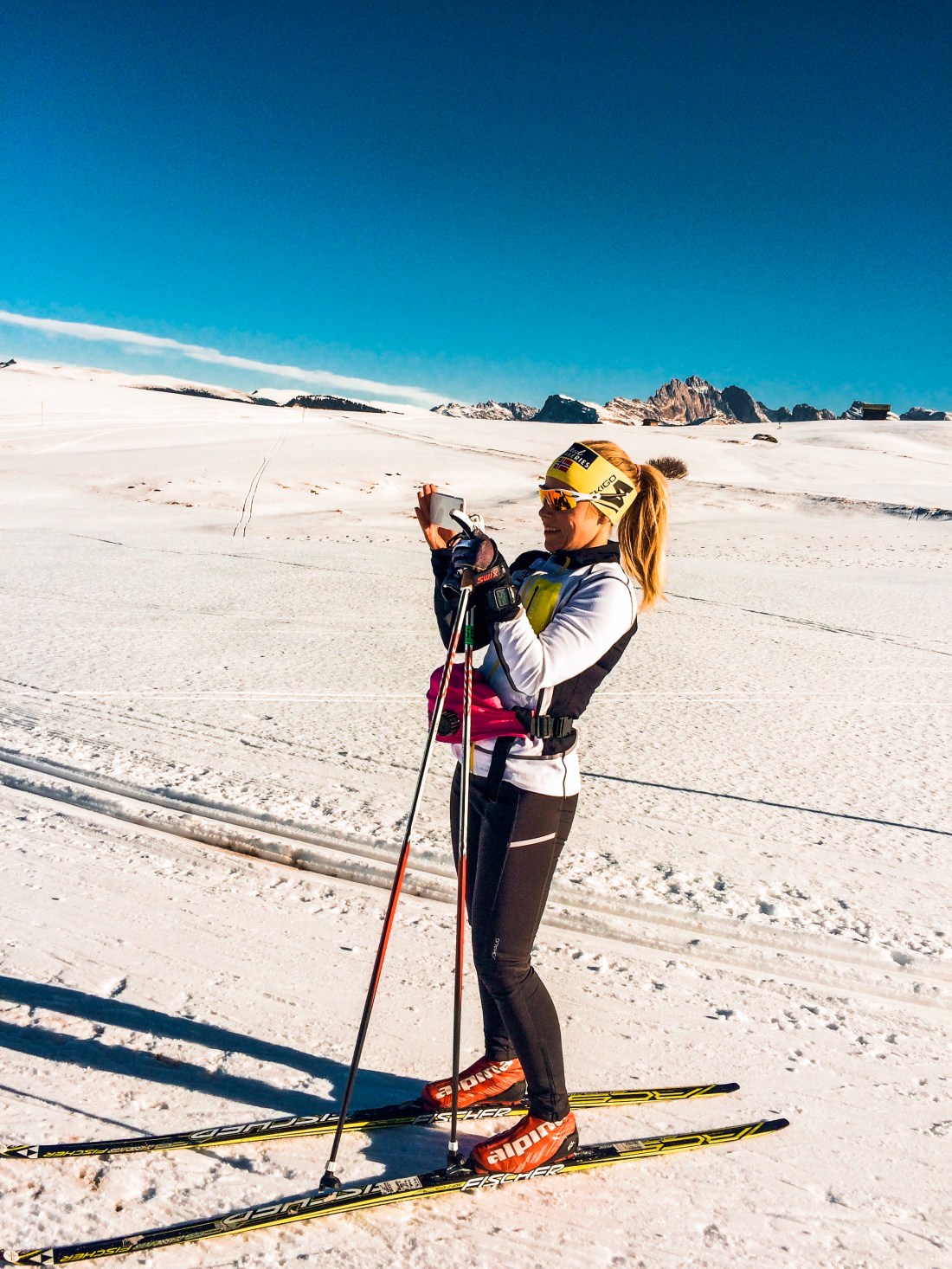
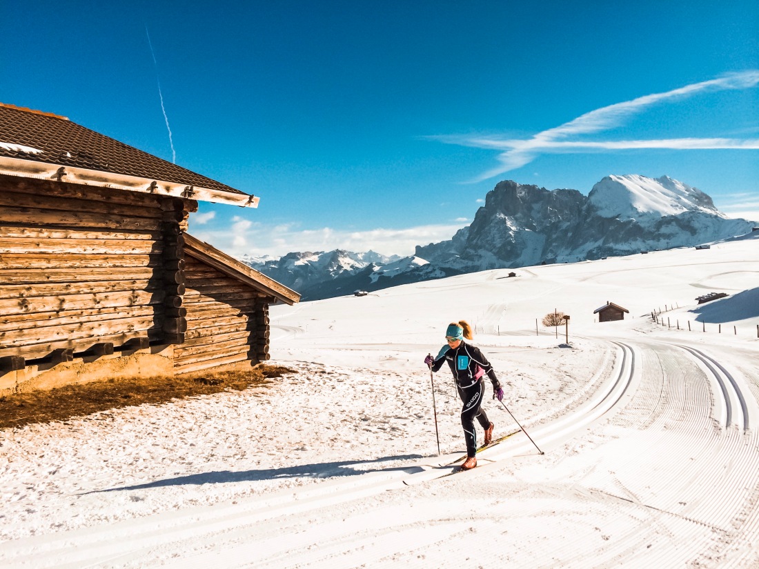
Having had a taste of the altitude at Passo Lavazè the natural next stop is the paradise-like destination of Seiser Alm. You can drive directly to Seiser Alm from Passo Lavazè, it is not the fastest route from Val di Fiemme, but for sure the most beautiful. For hotel options, check out my previous post on trailrunning in Seiser Alm here. I love staying at Ritsch Schwaige, but if money is no issue, you may want to check out Adler Mountain Lodge.
Grammable days in Seiser Alm.
Seiser Alm is the preferred location for many national teams when preparing for championships. On this high altitude plateau the perfectly groomed tracks are surrounded with spectacular mountains and huts and restaurants serving delicious food when taking a break in the sun. Highlights include sunset coloring the sky pink while cruising the longest loop facing the characteristic Schiliar mountain. If you did not know paradise, you do now. For more details on the about 80 km of tracks, go here and here.
If you are looking to do some downhill skiing on this road trip, Seiser Alm is a great starting point for skiing the Sella Ronda.
On your way from peaceful Seiser Alm to Pontresina in the Engadine valley in Switzerland I suggest you make a pitstop in either Bolzano or Meran for some nice Italian small-city vibe. The total driving time from Seiser Alm to Pontresina is about 3:30, mostly on regional roads. Take time to enjoy your surroundings. In Pontresina Hotel Rosatsch is a good option, located on the main street in short distance of my favorite hang out, Gianottis. Pontresina also has a few ok shops for cross-country skiing in case you find yourself in need of anything.
My personal winter experience of the Engadine valley is unfortunately limited to the Engadine Ski Marathon tracks, , which provide for a great high-speed skating experience on the lakes in the valley before more hilly parts take you to the finish line in Pontresina. However, this area has much more to offer, including illuminated night tracks, all of which is surrounded by spectacular mountains. And I have been told that you should not miss out on skiing in Val Roseg, tracks starting from the Nordic ski arena near the train station in Pontresina. For more information, turn to this site. With St. Moritz right in the middle of it, this is naturally also the place to leave your cross-country skis behind for some downhill skiing, and, if you wish, some shopping.
On our way to Zürich Airport after Engadin Skimarathon we stopped in Lenzerheide to ski in the sun in their fairly new Nordic ski arena, financed mainly by an enthusiastic local family. I suggest you do the same driving from Pontresina to your final cross-country skiing gemstone, Davos. Drive early in the morning from Pontresina and grab a coffee (or even breakfast) at Bio-Alp Alesch near the Albula pass on the way. The driving time from Pontresina to Lenzerheide is less than 90 minutes. See strava link below for where we parked. This is also one of the places where you can access changing rooms. For more information, go to this site.
After exploring the trails, which run along the main street cutting through Lenzerheide, find yourself a nice spot in the sun for lunch while enjoying the view of the mountain sides hosting the world cup final for the downhill skiers in 2014.
Saving the best for last! Davos is the centre of cross-country skiing in Switzerland and is regularly on the cross-country skiing world cup calendar. About 1550 meters above sea level, the altitude will have impact on your performance, but also ensures good skiing conditions during the winter season with some tracks opening already in October. This alpine resort town is surrounded with beautiful mountains providing great opportunities to take your alpine skis for a spin as well.
Although having visited Davos several times during summer, I have never been there in the winter. Thus I turned to former top cross-country skier Tor-Arne Hetland for guidance on how to best explore Davos on skis. Of the three beautiful valleys you can ski, his number one choice is skiing up the Sertig valley. For some extra uphill you can ski via Junkerboden. When finally reaching the end of the valley you will find yourself in the middle of this typical alp idyll we are all dreaming of, surrounded with wooden huts and magnificent mountains. Drop in at Walserhuus or Bergführer and load up on Apfelstrudel with vanilla sauce before you enjoy the downhill back to Davos. Note that the upper five kilometers are prepped only for classic technique.
Davos has loads of accommodation options. In the summertime, my choice has always been Walserhuus. During winter I would maybe opt for a hotel close to the Nordic ski arena, such as for example Hotel Bünda.
Go here for more on cross-country skiing in Davos.
Obviously, most of us are not in position to do the whole roundtrip described above and many of the destinations described are worthy of being your one-stop for cross-country skiing in the Alps. Create your own roundtrips or combine one of the destinations with one of the many long distance ski races in the area. Realizing that I have missed out on the great cross-country skiing possibilities in Davos, this will for sure be on my 2019 bucket list, maybe combined with participation in the Sertig Classic race.
Bringing the Senja trilogy to an end (for now), let me take you to three breathtaking peaks, Grytetippen, Keipen and Sukkertoppen. These three may be done in one day as Grytetippen and Keipen are right next to each other sharing most of the same trails, and Sukkertoppen is short enough to make a quick morning or evening run. The drive between the two is about one hour and in between you find the beautiful Ersfjordstranda, the perfect spot for recharging and refueling.
Let´s go!
Grytetippen & Keipen
Segla, Hesten and “Kongene” from Grytetippen
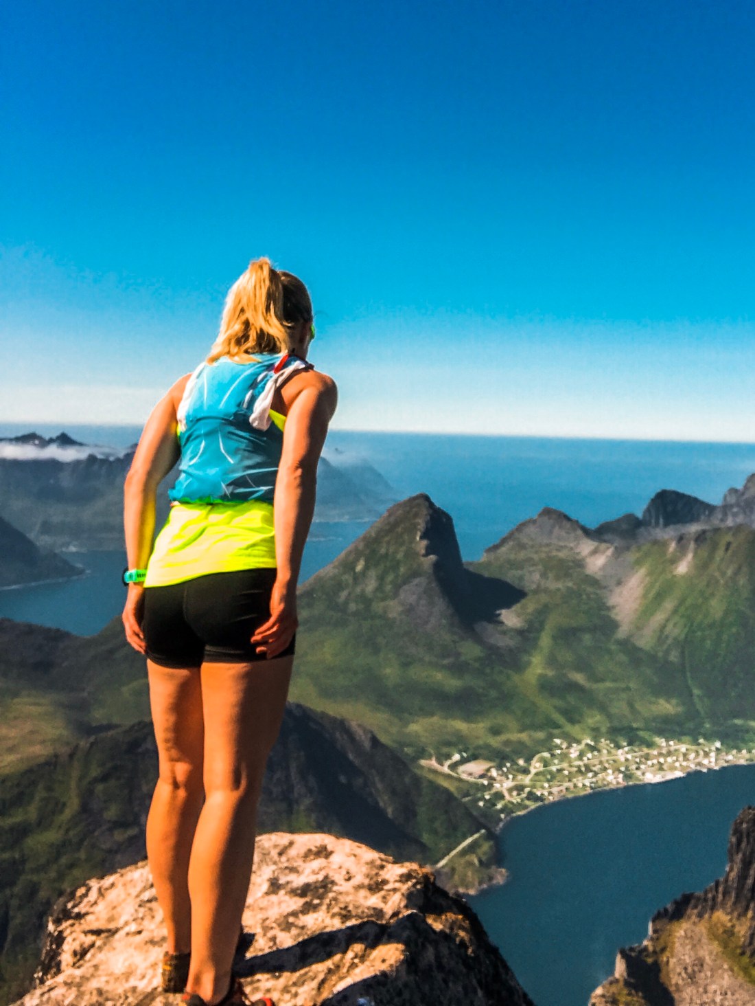
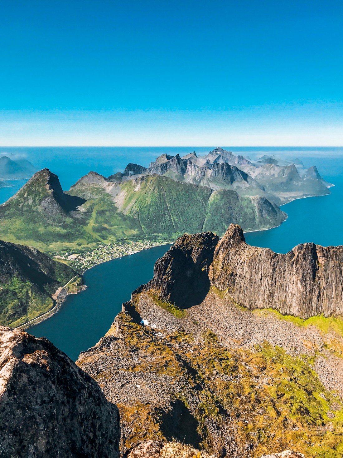
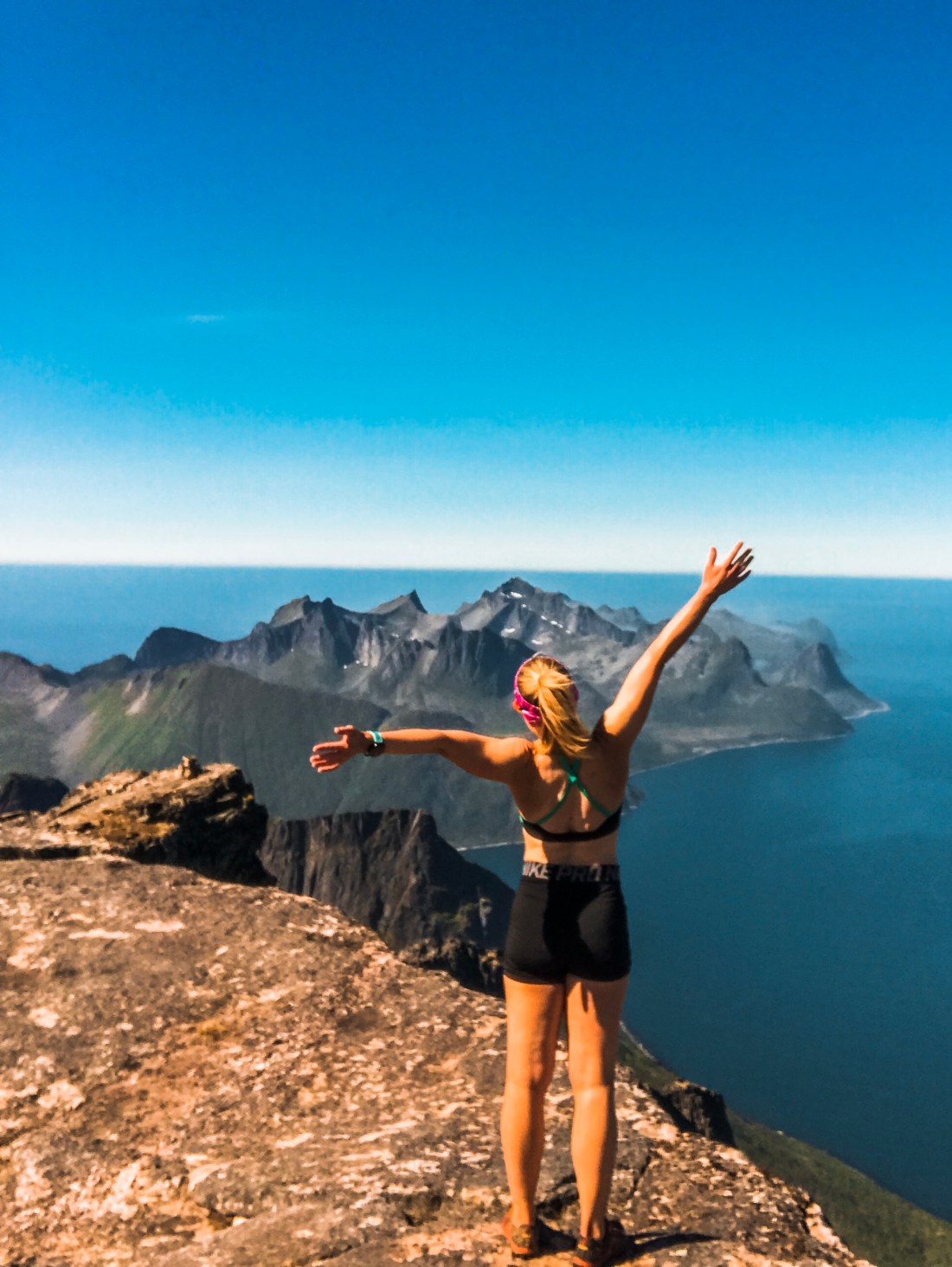
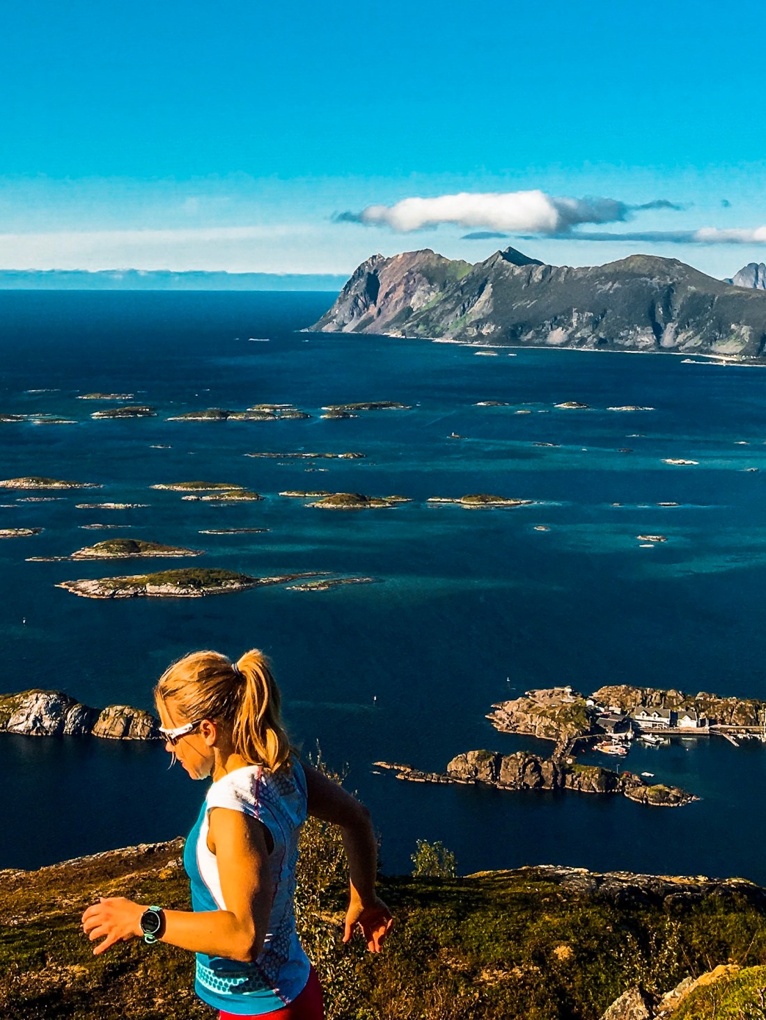
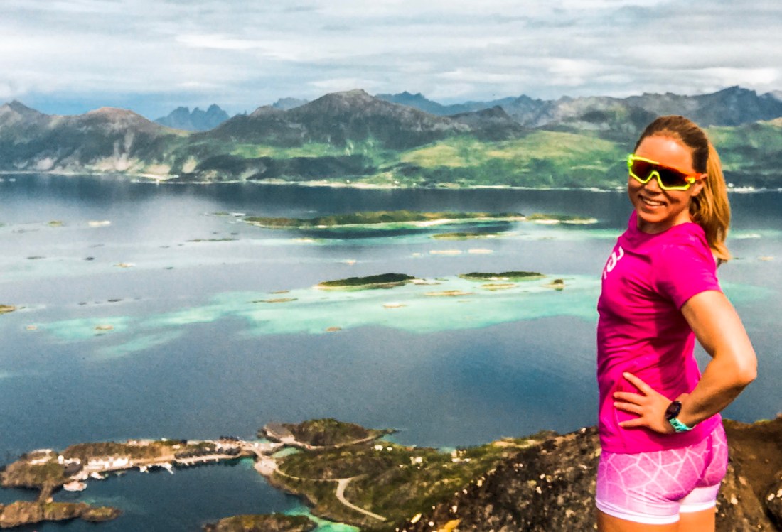
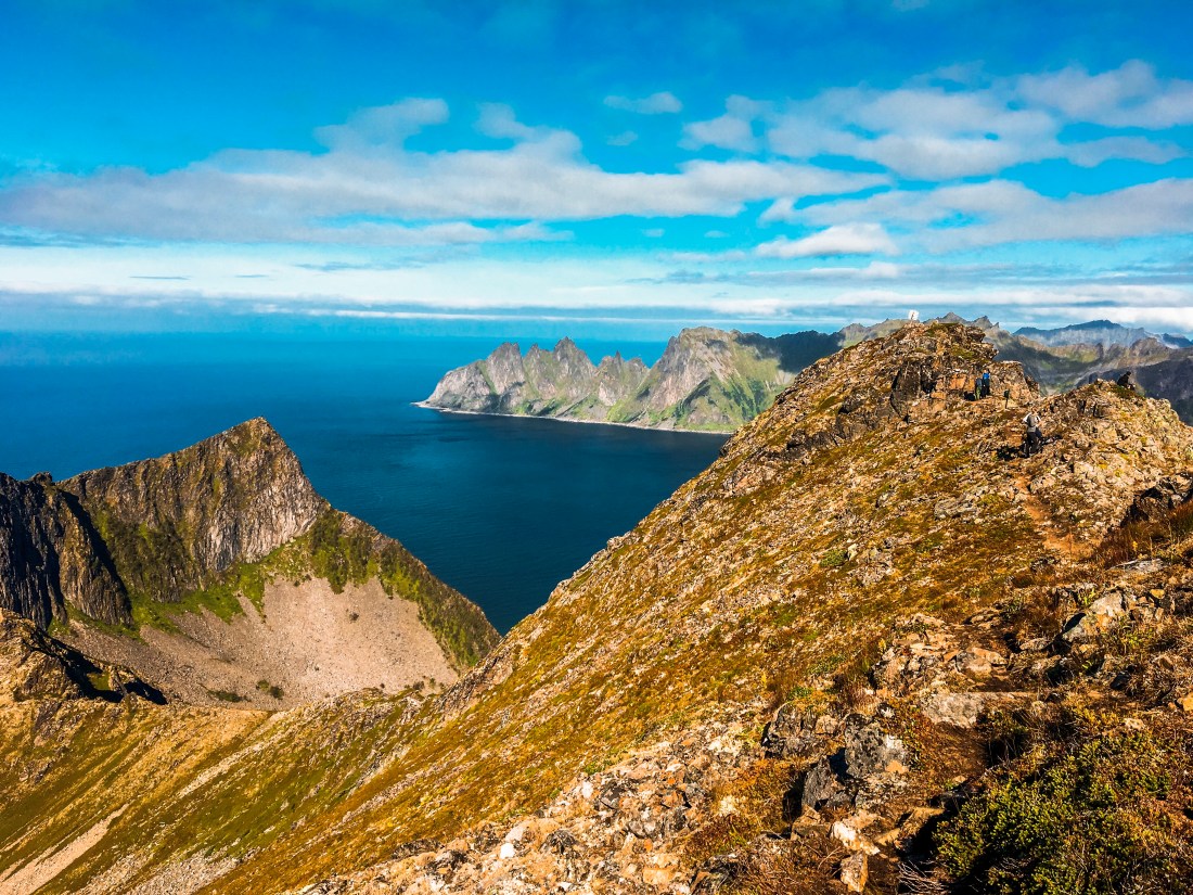
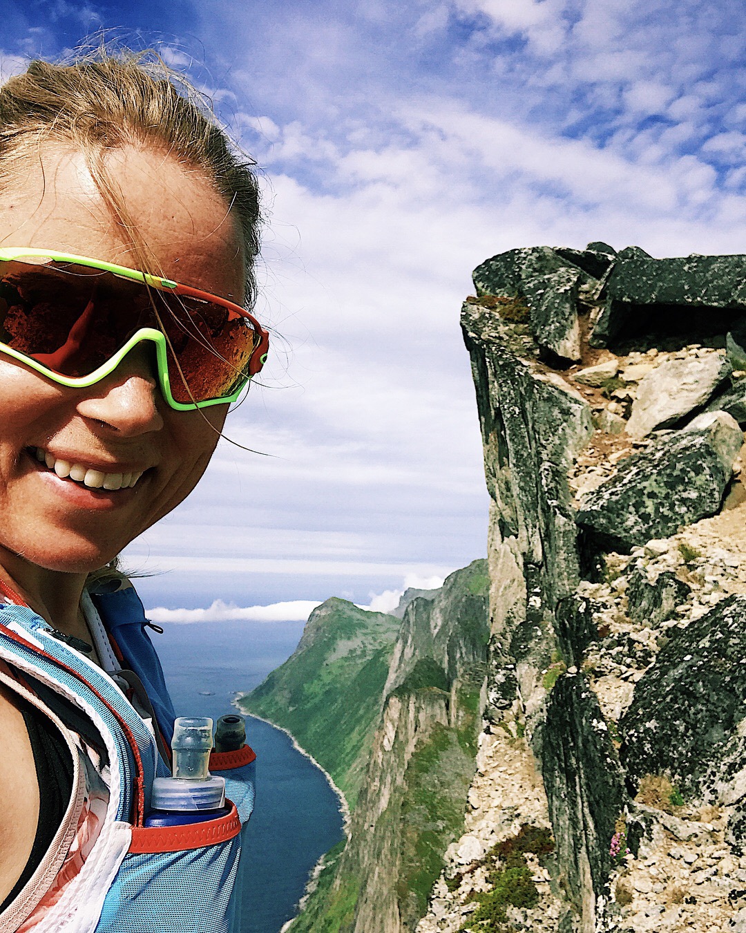
You find the joint trailhead of Grytetippen and Keipen next to the road half way along the lake Mefjordvatnan. There is a sign next to the road. For exact position see the Strava link provided below. It is also possible to start the run from the tunnel at Mefjordbotneidet (direction Fjordgård). The start of the trail from Mefjordvatnan is a bit messy and wet with more than 450 meters of ascent in less than two kilometers, after which you can enjoy about a kilometer of easy running and maybe get a glimpse of reindeers. The view is great already from the start and you will have Breidtinden on your left side during the climb. After about 2.5 km from the trailhead the steep climb towards the ridge between Grytetippen and Keipen starts. I went for Grytetippen, the southern and lower peak with 885 meters first and reached the top after about 70 minutes. Despite having been to legendary mountains as Segla and Husfjellet the previous days, my jaw dropped by the sight that awaited me and I was screaming for joy! The view of the “black wall” is brutal and Segla from this new angle looks almost like a small hill. You can also see Husøy, where the TV-program “Da damene dro” was recorded.
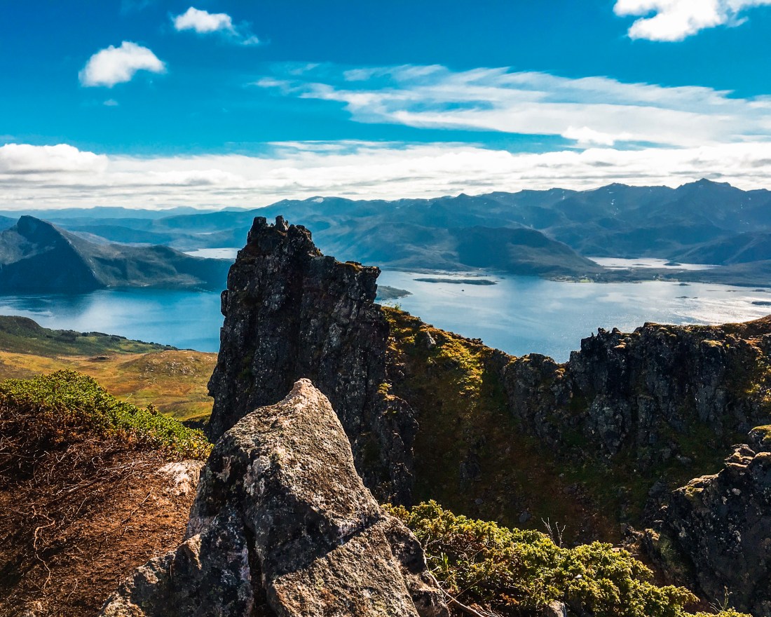
Make sure you take a lot of photos before you start the descent of about 160 meters before the climb towards Keipen. On my way to Keipen I met a couple who told me that the view from Keipen was even better than from Grytetippen, and its 360 degrees of glory from 938 meters above sea level did not let me down.
The view from Keipen
Both Grytetippen and Keipen have steep and dramatic edges and instagramable outcrops, but the trails are safe and fairly easy.
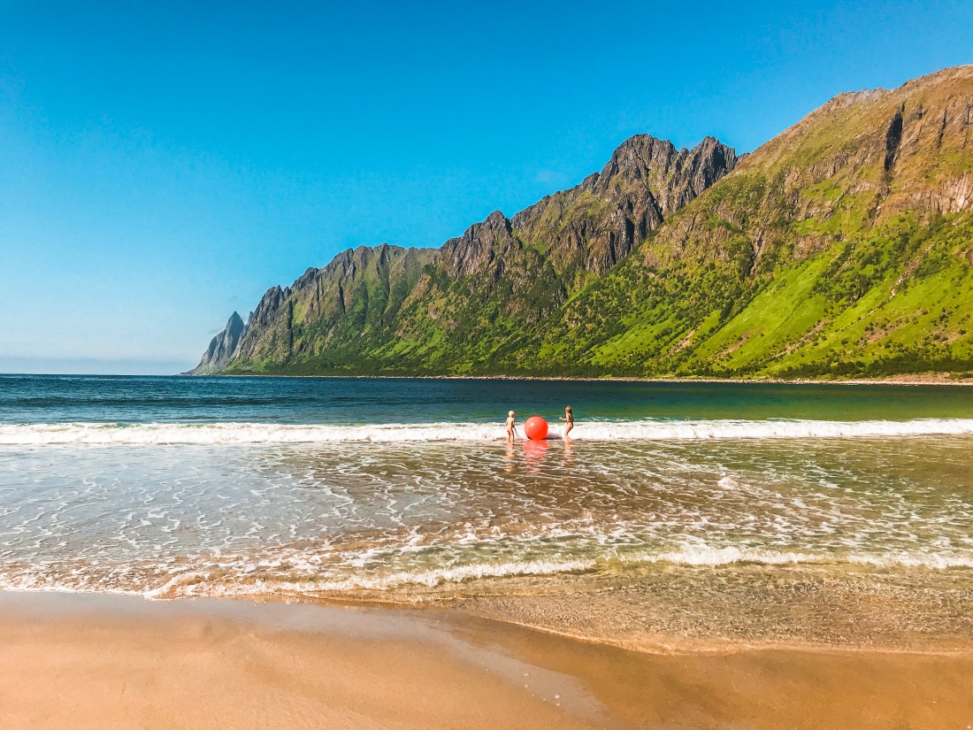
Make sure you pack what you need for a picnic at Ersfjordstranda when driving between Keipen/Grytetippen and Sukkertoppen. There are no shops or restaurants nearby. This beach is the location of the famous golden toilette and a popular site for camping. There is also an outdoor shower next to the toilette.
Ersfjordstranda
Sukkertoppen
Sukkertoppen is only 456 meters above sea level and a fairly short run close to the hotel and restaurant Hamn. You can start the run from the hotel or take the car to the parking next to “Nikkelverket”, about a km from Hamn. The Strava link provided below starts from Nikkelverket and finishes at the hotel.
From SukkertoppenFrom Sukkertoppen towards Hamn and Husfjellet
The trail is easy to find and is marked towards Sukkertoppen. The beginning is quite easy and runable, while the last climb gets steeper and raises your heart rate. Given the short distance and reasonable climb it provides a great opportunity to play with some speed, also because you will have your back towards the view for the most of the climb. Don´t forget your camera though. Once you reach the top you will be rewarded with a beautiful view of the archipelago of Hamn. In the distance you can also see Husfjellet.
The best season to check out the trails is June – September. Go in June/July for the midnight sun and try to do at least some of your runs in the late evening in order to enjoy the midnight sun from a mountain top (weather permitting).
Remember to fill up a cooler with food and beverages as there are few supermarkets and even less restaurants on the island.
Coming up
I have a series of posts in the making, which will take you on an exciting road trip all the way from Oslo to Senja. Stay tuned!
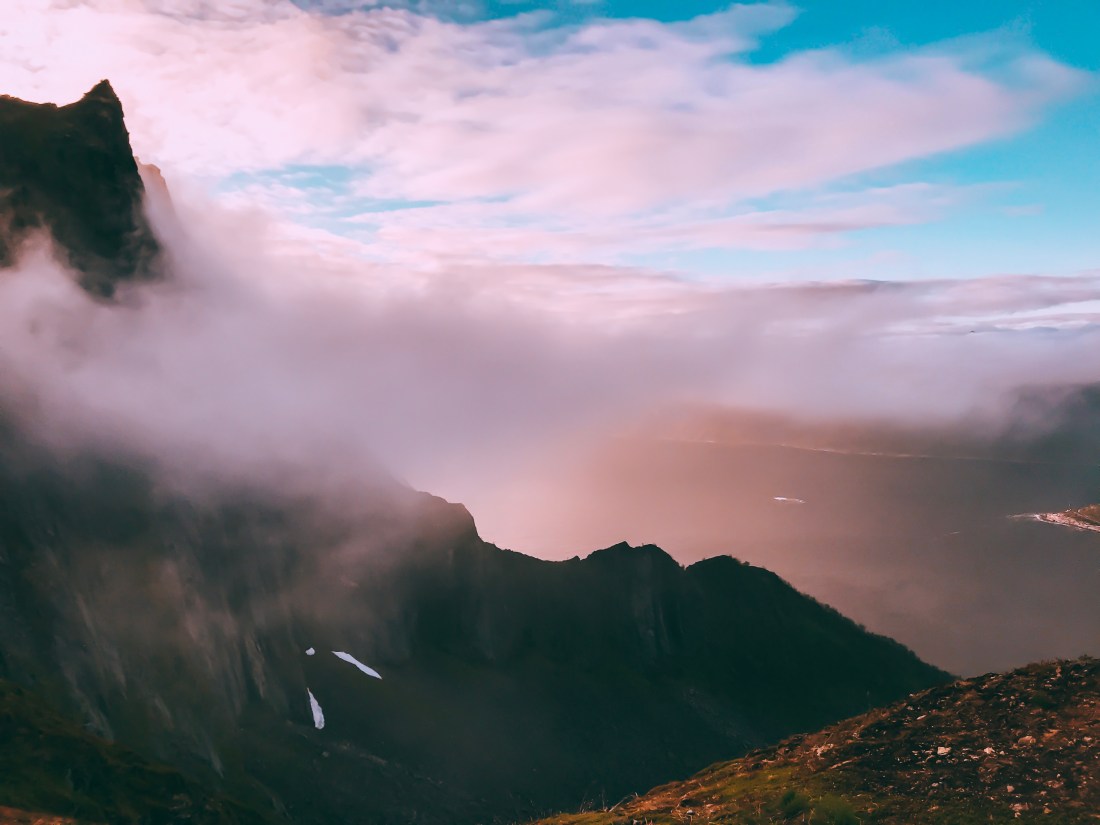
The trails of Senja continue and I decided that Husfjellet deserves its own post. This beautiful run/hike is my definite favorite on Senja, and the tale goes also the queen´s. One reason may be that it saved the day when I with great disappointment failed to reach the peak of Breidtinden, but there are so many other reasons to love this mountain: The amazing views, the kind terrain, and the thrill of exploring the outcrops when you reach the top – all this without the crowds you usually meet on the more famous Segla. Last summer I tried to time my run with the midnight sun, only to be surprised by heavy fog when reaching the ridge. The added excitement of not knowing if and when I could make a safe return and the spectacular view created by the fog compensated for the lost view of the midnight sun and gives me another reason to return.
Halfway up to Husfjellet facing Okstindan (the Devil´s teeth) behind the fog
The Trails
You find the trailhead behind the picnic area next to the church in Skaland, where you can also park your car. After a few hundred meters a sign points you to a trail on your left, but you can also continue straight ahead for a dryer option through the forest and follow the next sign towards Sommerdalen. Soon you gain some height and can enjoy the views of Bergfjorden to your left. Don´t bother to take up your camera just yet, the views will only get better.
Follow the trail across the boardwalk and the ascent towards Husfjellet starts. Stay safe running with good distance from the edge on your right, but don´t be afraid to move close to the edge to take in the views.
Husfjellet towards Okstindan
After less than 3.5 km and reaching 635 meters above sea level, you are on the top of Husfjellet, hopefully with the weather on your side to take in the panoramic views and to explore the outcrops. Bring some extra clothes so you can afford to stay a bit before you return the same way or down towards the beautiful Bøvær beach. On my last run to Husfjellet I met two girls who set up their tent on the top. I can only imagine the beauty of watching the midnight sun from here.
The best time for running up Husfjellet is june – september. If you are there during the summer, do plan for a midnight sun run if the weather is on your side.
Include the Bøvær beach in your run (I will, next time), either by doing your descent from Husfjellet towards Bøvær, or go for a run or drive there after returning to your car (the beach is less than 5 km by road from the trailhead next to the church).
Stock up on groceries at the store in Skaland (grocery stores are scarce on Senja).
You can also attack Husfjellet on the bike, of course.
From one paradise to another, Senja is my magic place, the place I always dream of returning to. The island is said to be a miniature of Norway, and with its spectacular fjords and mountains it very much lives up to this tale, and is as perfect for road trips as it is for trail running. If you have not visited the region before, I recommend to fly to Tromsø (more about Tromsø in a post later) and spend a night or two there before or after visiting Senja.
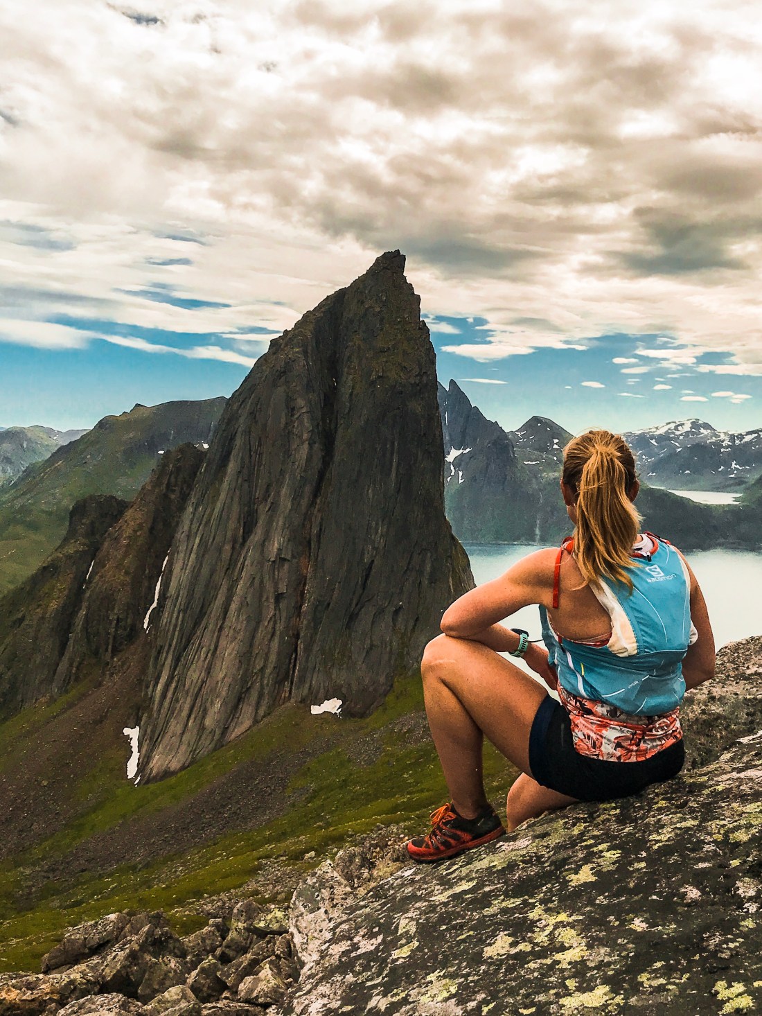
There are a number of peaks and runs to explore in Senja, and I love that most of them are fairly short, which enables you to reach several summits in a day. In this post I will take you to the legendary peak Segla, which is featured over and over again on several instagram accounts promoting Norwegian nature, its neighbor peak, Hesten (“the Horse”), and Senja´s highest mountain, Breidtinden. In the next post we will explore Sukkertoppen, Husfjellet, Grytetippen and Keipen.
Segla
Segla
The climb to Segla starts from the school in the village of Fjordgård. Go in the early morning or in the evening if you can. During the summer, you will have 24 hours of daylight.
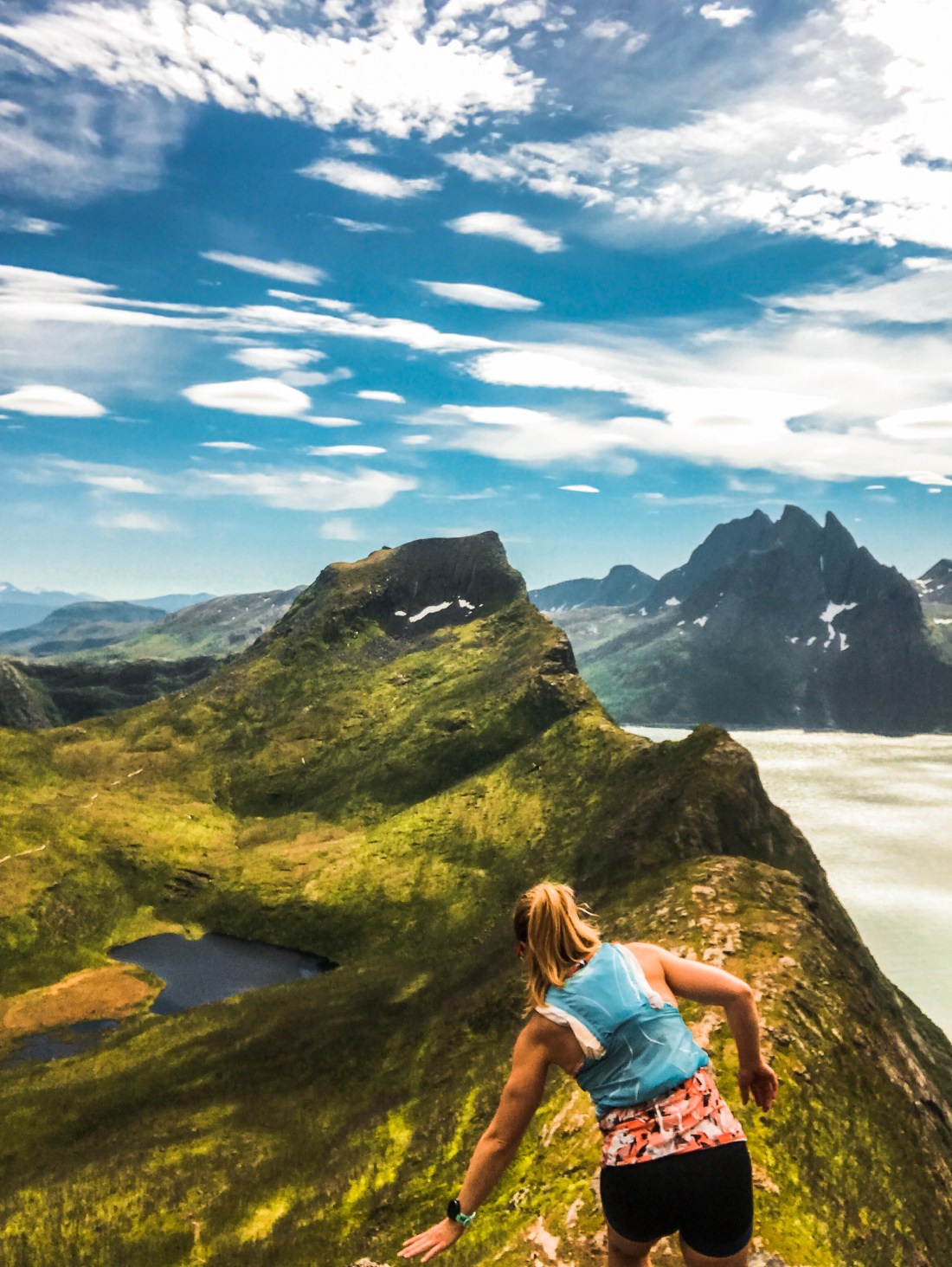
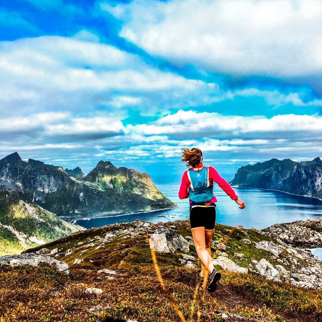
The path is well marked and easy to find. The distance to the top is only 2 km, but with a total elevation gain of almost 600 meter, it will get your heart pumping. The start is pretty easy, with about 15% incline during the first kilometer, before the tough last kilometer with an average of 40% incline. For safety keep to your right when climbing the ridge, but do look for the gramable spots close to the edge on your left, without taking any chances. The paths will show you where it is safe. Once you have reached the summit, do allow for some time to enjoy the panoramic view. Although Segla is already a social media hero, most photos are taken from the other side, from Hesten or the area between the two peaks. For this reason, Hesten is your next run.
After Segla, the easiest way to reach Hesten is to run all the way down to the parking and a few hundred meters through the village to the bottom of the ski slopes (see Strava link for guidance). The path starts next to the wooden shelter and is easy to follow all the way to the peak. The last part of the climb is a bit technical, but no equipment is needed. From Hesten you have the iconic view of Segla to the south and the multiple Kongen peaks to the north. More about these mountains here.
The Hesten run is not as steep as Segla, but a little longer. It took me around 2:30h to complete both (with additional time for photographing, of course).
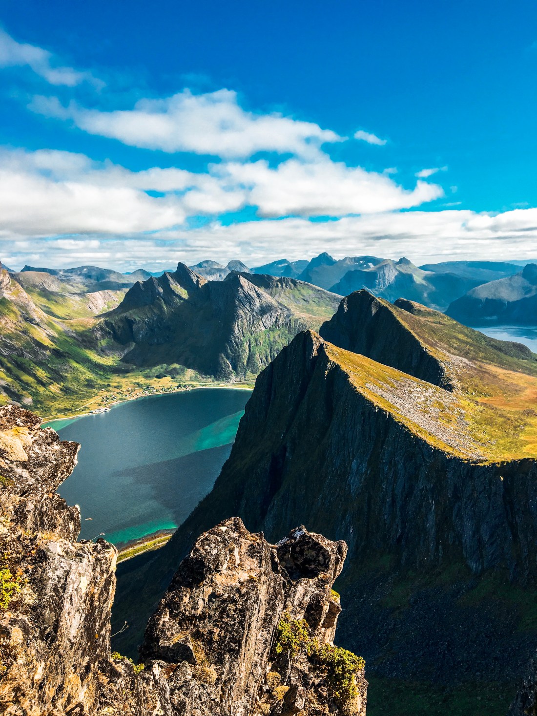
I have seen people run down the ridge of Breidtinden and was caught by surprise when fear prevented me from reaching the summit. It was with great disappointment I had to give up Senja´s highest mountain. Maybe it would be easier had I not been on my own, thus I am determined to give it a second chance. In the meantime, why don´t you give it a try? The run is beautiful whether you reach the peak or not. In any case, leave a comment on the blog if you give it a go.
To reach the trail, park on the right side of the road after the tunnel “Svartholla” if driving south.
Sans Senja Skyrace takes place in the early summer every year, in 2019 on 22 June. Its 25 kilometer and 2800 meters of elevation gain will take you over some of the most spectacular mountains in Senja.
How to get to Senja
You need a car to explore Senja. Unless you bring your own, I would suggest flying in to Tromsø. In the summer, the ferry will take you from Brensholmen, about 50 minutes from Tromsø Airport, to Botnhamn. From Botnhamn I highly recommend to follow the Norwegian Scenic Route driving south. You can return the same way, or make it a round trip via Ånderdalen National Park and Finnsnes back to Tromsø, or, if you have even more time, take the ferry (only in the summer) to Andøya and explore Vesterålen islands before returning to Tromsø.
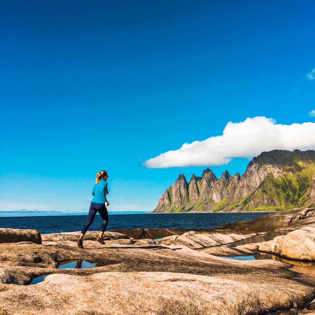
One of the 18 Norwegian Scenic Routes goes through Senja and makes it almost as much a pleasure to stay on the road as on the trails. However, the roads are narrow and bumpy, so pay attention, and make sure to take a break or two at one of the many attractions along the road. For sure, Ersfjordstanda, with its amazing beach and mountain backdrop as well as a toilet made in gold, should be on your radar. Other spots are the “Devil´s teeth” (Tungeneset) and the viewpoint Bergsbotn.
Tungeneset
Where to stay
Unfortunately, there are not that many options for accommodation in Senja. My preferred option is renting an apartment at Hamn. The location is great and the apartments are fairly new and with great views. If you don´t mind sleeping in a tent, Ersfjordstranda provides an amazing spot to do that, but you will probably not be alone. For other options, check out Visit Senja.
Suggested itinerary
Day 1: Morning ferry from Brensholmen to Botnhamn. Hike/run to Keipen and Grytetippen (next blog post). Drive to Ersfjordstranda. Make sure you bring a cooler and some food, or pick up some food at the store in Mefjordvær (check opening hours). Stay at Mefjordvær or Hamn.
Day 2: Early morning run to Segla and Hesten. Pick up some food in Fjordgård after the run and have a break at Tungeneset or the beach in Bøvær.
Day 3: Breidtinden in the morning and Husfjellet (next blog post) in the evening (try to catch the midnight sun).
Day 4: Morning run to Sukkertoppen (next blog post) before departure.

 My personal winter experience of the Engadine valley is unfortunately limited to the Engadine Ski Marathon tracks, , which provide for a great high-speed skating experience on the lakes in the valley before more hilly parts take you to the finish line in Pontresina. However, this area has much more to offer, including illuminated night tracks, all of which is surrounded by spectacular mountains. And I have been told that you should not miss out on skiing in Val Roseg, tracks starting from the Nordic ski arena near the train station in Pontresina. For more information, turn to