My Favorite Hikes – Tysfjord

IMG_0948 2

I have been looking so much forward to sharing these two “secret” hikes with you. Well, the first one, Kjerna, may not be so secret to the locals, but for sure many of you have already passed by without knowing that you just missed the northern equivalent to the insta-famous Prekestolen and Trolltunga.

Kjerna

IMG_1176
Kjerna seen from west.

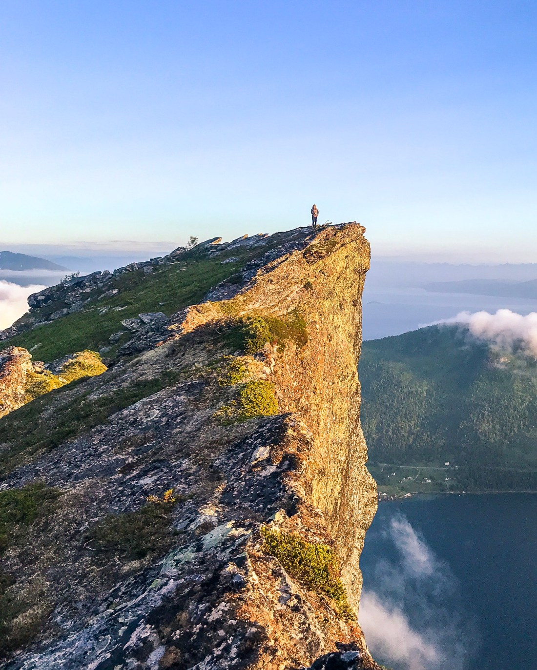
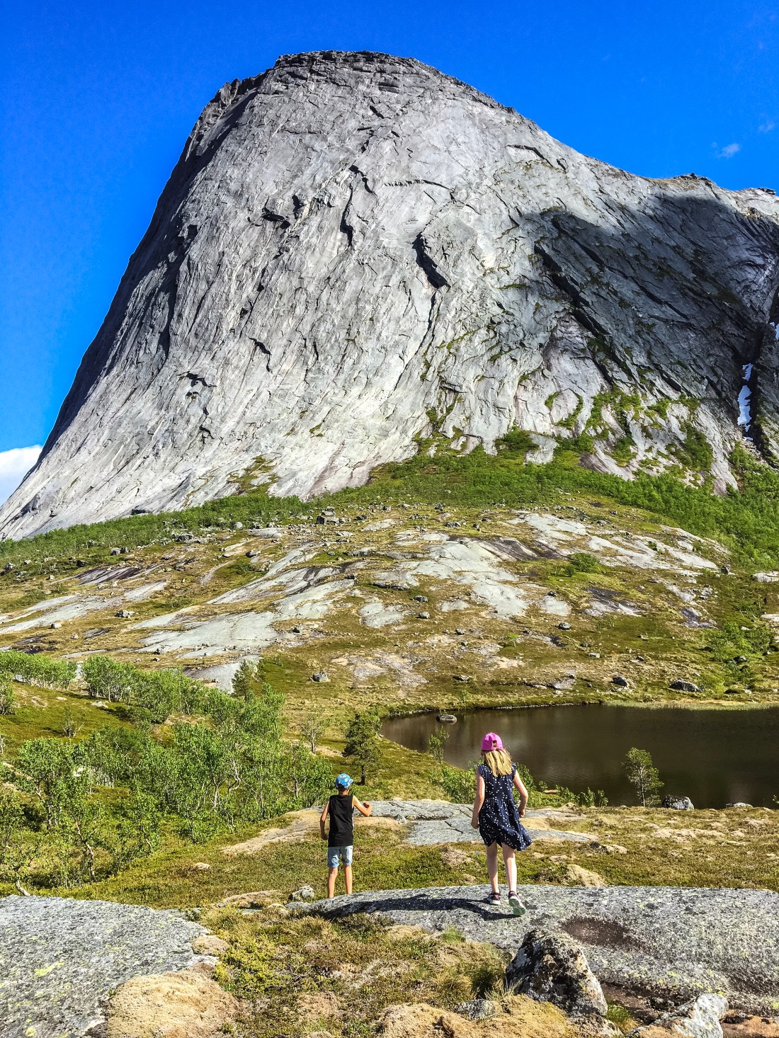
When I was a child I used to go fishing with my grandfather in the fjord under Kjerna. The tale goes that one day it would fall down, so I was always a little bit scared it would happen as we passed by. Recently I learned that this was not something my grandfather came up with. Movements around Kjerna have been monitored during the years, however without raising any red flags yet.

IMG_1169
Kjerna from east watching the sun go down. This was at about 10pm mid-July.

Kjerna is in Tysfjord, the municipality of the national mountain, Stetinden, accessible  directly from E6. The trailhead can be found on the west side, about 9.5 km north of Skarberget, where the ferry arrives if you are arriving from the south. There is a parking space on the east side of the road (see map below and link to Strava).

IMG_1159
Stetinden to your left.

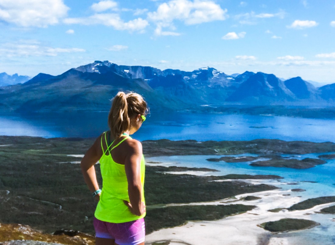
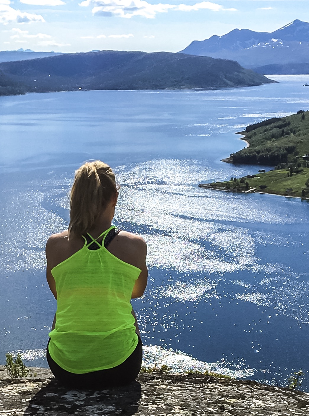
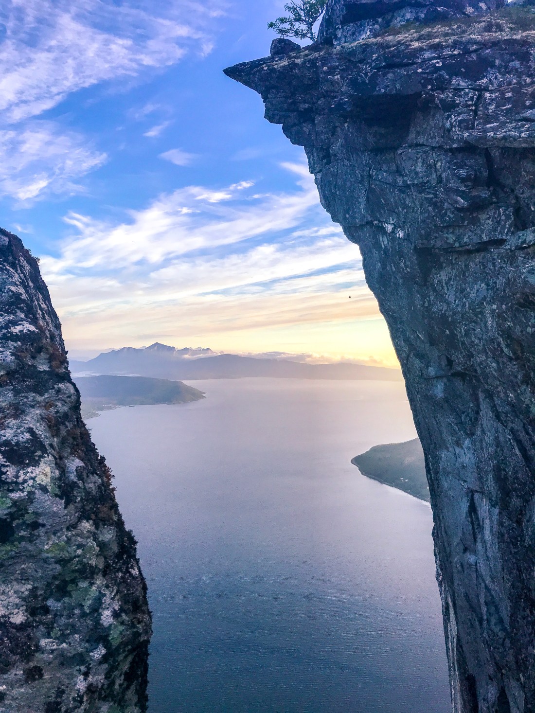
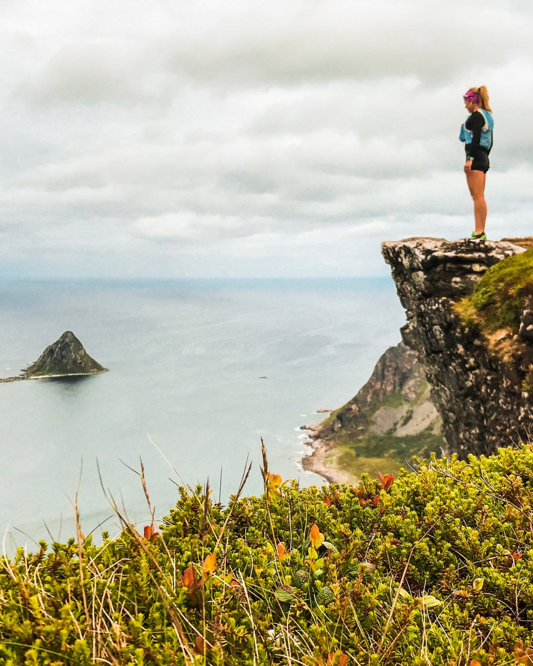
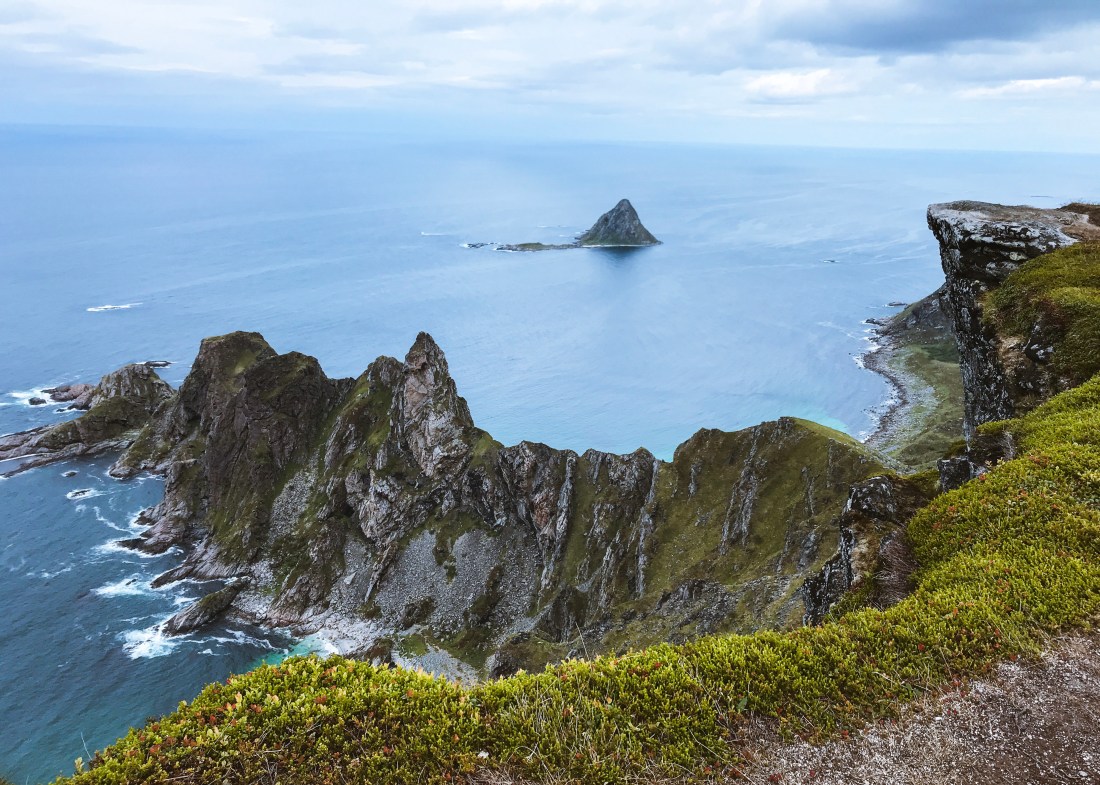
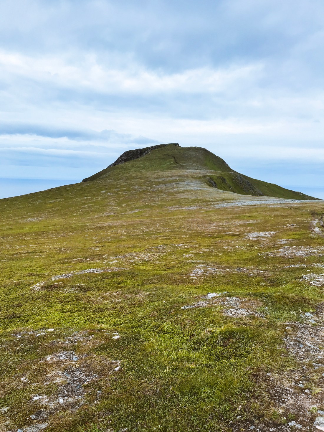
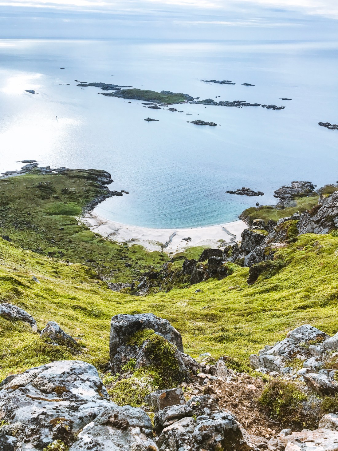
The main reason for adding Kjerna to your bucket list is obviously the view. And it comes surprisingly cheap. The hike is less than two kilometers (each way) on relatively easy trails and with about 400 meters of elevation gain. Once at the top you have amazing views and can easily spot Stetinden looking east. If you have the chance, I would recommend to do the hike in the late evening. There is nothing like watching the sunset from the peak.

IMG_1152
Viewpoint on the east side of Kjerna, looking south with a view of Skrovkjosen.

IMG_1147

From Kjerna you can continue towards Stortinden or drop down to about 500 m.a.s. to take the marked trail from the pond. For more on the Stortinden hike, go here.

Stortinden

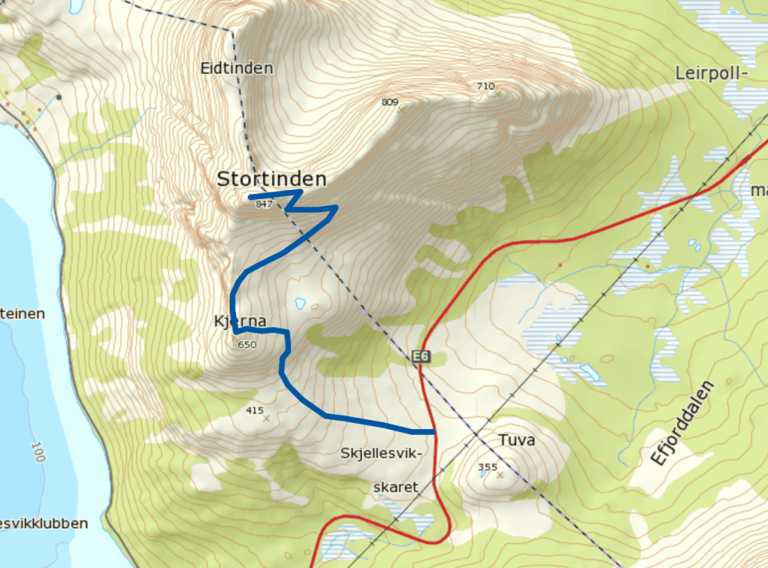
Strava for details: Family hike to Kjerna

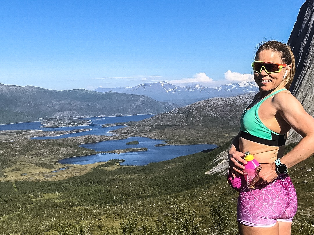
Eide Ridge Line Running

IMG_1052
Running the ridge with Eidtinden and Stortinden as backdrop.

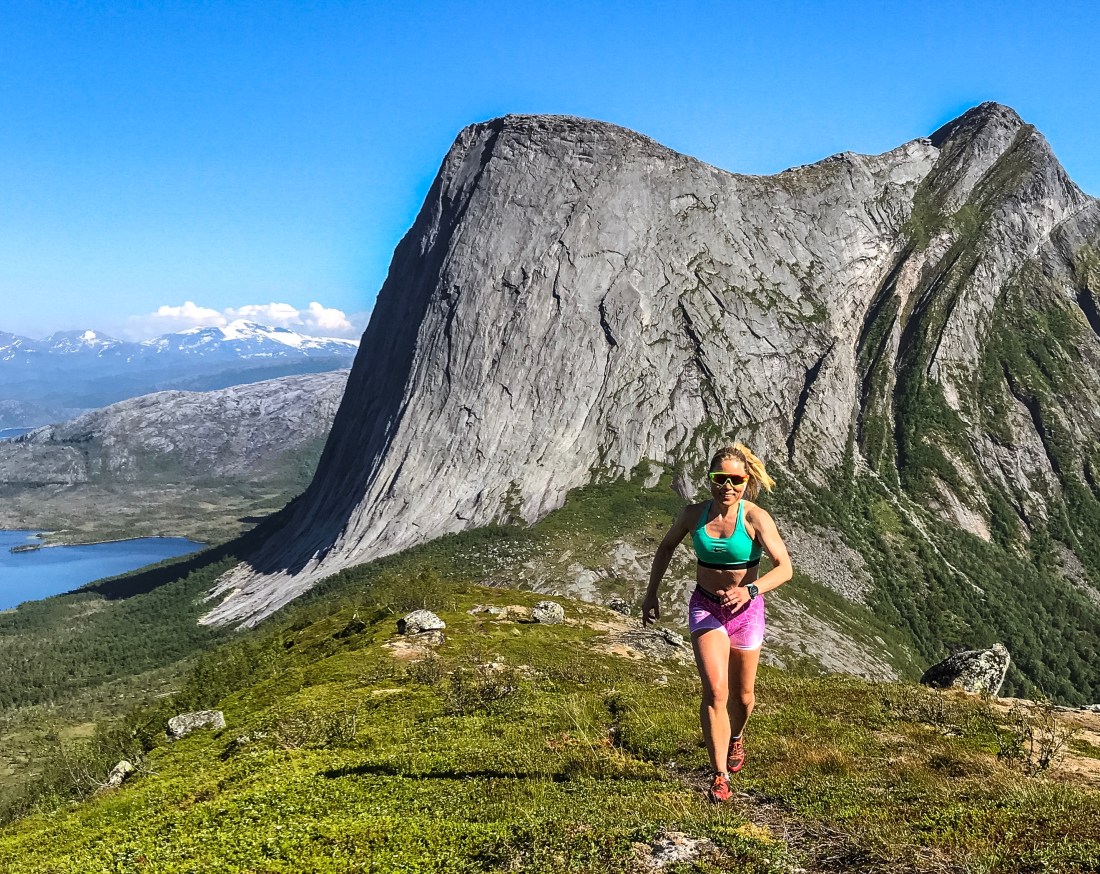
So, to something even more special to me, and maybe the most beautiful place I ever run. From the age of six, I spent the whole summer with my grandparents in Eide, a tiny place just beneath Kjerna and Stortinden, about 3.5 km drive from E6, turning left about 6 km north of Skarberget. There is a small parking about 100 meters before you reach Eide. Leave your car here and walk to the second house on your right hand. From here, walk straight up the lawn between the houses and look for the trail, which is slightly to your right when leaving the lawn walking uphill, and to the left of the cabin in the right corner where the forrest starts.

IMG_0912
This is how you know you are on the right track. If you turn around just before you find the trailhead, this is what you see. You will leave the road between the two houses to the left in this picture.

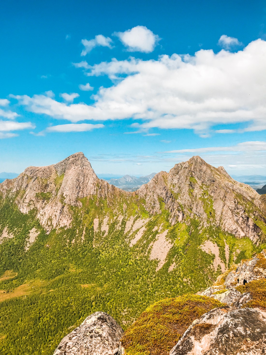
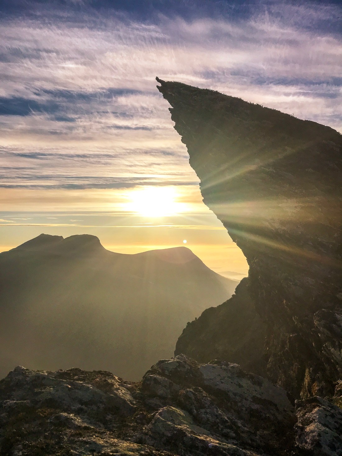
After about another 100 meters you reach the climb which is marked with red dots. You reach the ridge (Eidskaret) after about 600 meters steep climb with 200 meters elevation gain (the last part on rocks) and get a spectacular view of Eidtinden right in front of you. Already at this point you have marvelous views towards Ofoten (south) and Efjorden (north). From here, but after having made a loop around the pond, with your back to where you came from, you go left (west). It is not easy to find the trail, but if you seek the highest point on the ridge line you will find it eventually. If not, don’t worry, the terrain is easy to run off-track as you continue as far as you please towards the end of the ridge.

IMG_0932
The pond with Eidtinden as backdrop.

If you are as lucky as me, you may meet dozens of reindeers.

IMG_1071
View of the ridge facing Eidtinden, Stortinden and Kjerna, with your starting point down to your right and Stetinden in the upper right corner.
IMG_1140
View of Efjorden

Please note that this hike should not be done when it is wet as the rocks can be very slippery. Also, take note of the spot where you are leaving the marked trail (below the pond) to ensure you find the right way back down (you should not leave the path in the steep sections).

Strava for details: Very special skyrun

Oh, if my aunt is at home in the white house you pass on your left when starting the hike, say hi!

Andøya – Arctic Road Trip Day 8 and 9

IMG_0468
Høyvika, Andøya

Andøya is one of the islands forming the Vesterålen archipelago. In the summer you can take advantage of the ferry connecting Andøya and Senja, which makes for a scenic road trip along the coast as opposed to the main inland route, E6. 

Andøya has amazing beaches and is a great playground for road cycling, roller skiing, trailrunning and kayaking. It also offers tourist attractions such as whale safari, bird safari and the Aurora Space Ship, which unfortunately is closed down in 2019. 

I was there for the amazing trails around Måtind, a much photographed peak just south of the fishing village, Bleik, and to go roller skiing along the national scenic route on the west coast of Andøya. 

IMG_0493
Måtinden, with the view of the bird island, Bleiksøya.

The Trails

The coastal trail from Bleik to Stave, which passes Måtinden at 408 meters above sea level, is about 9 km. You can also reach Måtinden from Baugtua, a trailhead starting from a parking about midway on FV976 between Stave and Bleik.

IMG_0447

I did a return run to Måtinden from Stave beach and added a loop on the plateau behind Måtinden. From Stave most of the climb is at the beginning of the run, providing you with magnificent views of the Stave beach and village from the start and, after the first steep climb, you are rewarded with a great view of the beach Høyvika. To reach Måtinden you continue north. It is not always obvious where the path goes, but unless you are caught by the fog (as I was at the end of the run) it is easy to see where you are going and the terrain is easy and fun to overcome off-track. Once at the peak of Måtinden you have great views of Bleiksøya, a small characteristic bird island housing thousands of puffins as well as eagles. 

Strava for details: Måtinden trail runIMG_0470


IMG_0469

Rollerskiing and cycling

The national scenic route   along the west coast is almost flat and excellent for rollerskiing as well as cycling. I jumped out of the car at the west junction of FV974 and FV973 and roller skied the 30 kilometers to Stave beach, where we had rented an apartment (see below). After about 12 kilometer you reach the view point Bukkekjerka, and after another 10 kilometer you ski on a breakwater with the ocean on your left and the Skogvoll lake on your right. Another 7 kilometer and you reach the village of Stave while the road continues for additional 20 kilometers all the way up to Andenes, if you would like to go further.

Strava for details: Andøya rollerskiingProcessed with VSCO with l5 preset


Where to Stay

We stayed at Stave Camping in a one-bedroom fully-equipped apartment (sleeps 6) called the Shipwreck. The location was absolutely great and if you have the weather on your side, this is the place to be for sunset/midnight sun.

The Drive

The drive from Nyksund to Stave is about 2.5 hours and 140 kilometers. You will pass by Sortland again. Please see previous post on information about Sortland. Make sure you take time to stop at the view points provided, such as Bukkekjerka (mentioned above) and, when driving to Andenes for the ferry to Senja, Kleivodden.

The ferry between Andenes in Andøya and Gryllefjord in Senja takes about two hours and runs only in the summer. You can check the schedule here.

Nyksund in Vesterålen – Arctic Road Trip Day 7

IMG_0402 2.jpg
Queen’s Trail, Nyksund

Continuing north on our arctic road trip, our next destination is Nyksund, a small fisherman’s village in the Vesterålen archipelago, north of the more famous Lofoten archipelago. The traditional fisherman’s village slowly fell into disuse, but is now an active and creative place with artists and tourism businesses. My reason for going there was to run the Queen’s trail between Nyksund and Stø.

IMG_0300
Happy trailrunner!

The Queen’s Trail

The Queen’s trail between the two fiserman’s villages of Nyksund and Stø is a round trip of about 17 kilometers. Due to steep parts it is recommended to run the mountain part of the trail from Nyksund to Stø and the coast part coming back to Nyksund (anti-clockwise). I did the opposite direction, which also worked out fine, but would do the “correct” direction if I got the chance again. With small kids I recommend to take the coastal trail only. The highest point on the round trip is Finngamheia 448 m.a.s.l.

IMG_0411
Skipssanden
IMG_0399
View of Skipssanden

The trail takes you to the beautiful beach Skipssanden, the view of which you can also enjoy from the mountain part of the trail. The beach is a short hike from Stø in case you don’t have the time to do the full hike.

The Queen’s route was broadcasted as part of NRK’s summer program “minute by minute” with the outdoor celebrity Lars Monsen last year, and you can watch one of the episodes and the beautiful scenery here. This is one of my absolute favorite trails in Norway. There is no boring moment and if you do the hike in the evening you may be all alone on the trail and even see the midnight sun.

Strava for details: Nyksund – Stø – Nyksund

IMG_0396
The climb from Stø.

Accommodation

Truth be told, we did not enjoy our choice of accommodation, which was Holmvik Brygge, where we stayed at “Giseløya” with shared bathrooms. Although the place does indeed have an interesting historic vibe, it does not provide value for money in our opinion. I would recommend to try out other alternatives, suggested here, or stay at the camping ground in Stø.

IMG_0357
Stø

The Drive

The drive from Nordskot harbor to Nyksund is 250 kilometers and takes about 5 hours, including the ferry from Bognes to Lødingen. I recommend a stop in Sortland, where you can grab a bite at Miscela Kaffebar and stock up on snacks and other groceries. If open (check the website), I also suggest stopping at Eldhusbakeriet, a few kilometers south of Sortland.

Manshausen – Arctic Road Trip Day 5 & 6

Processed with VSCO with g6 preset
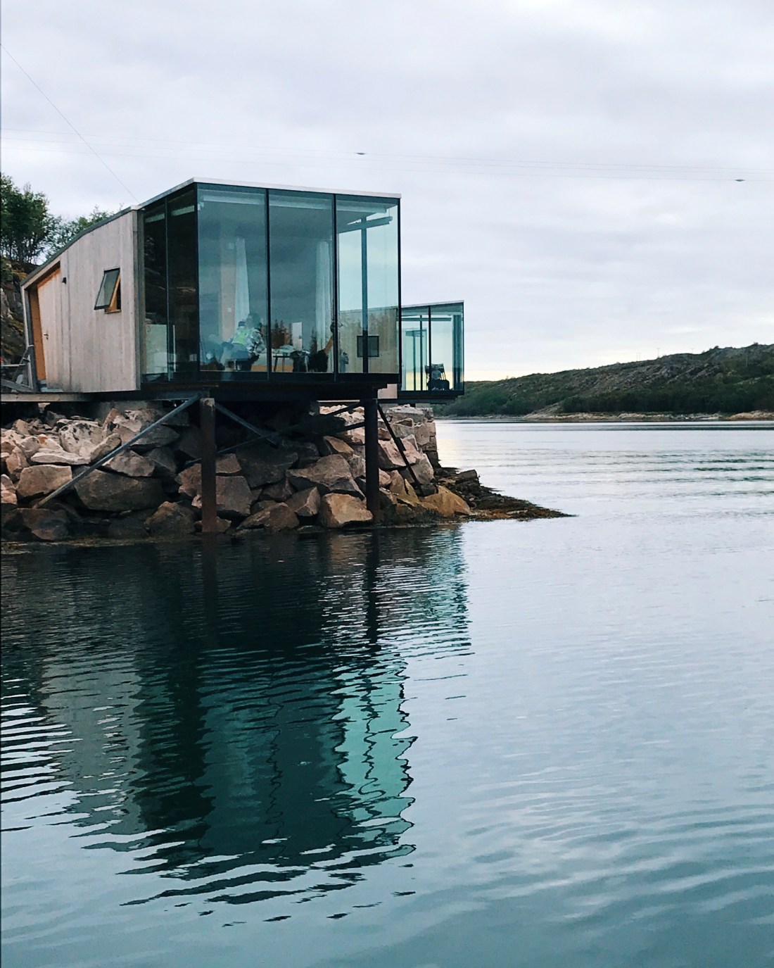
Next up on the Arctic Road Trip itinerary is Manshausen. You may already have seen pictures of the award-winning sea cabins on the island Manshausen on Instagram, blogs or in magazines. Manshausen is owned by the explorer Børge Ousland and is a unique destination if you want to experience nature, whether by simply sitting in your private sea cabin watching the ocean flow by or whether padling, hiking, running, diving, fishing or other activities are your thing. I applaud initiatives like Manshausen, which really takes traveling to a new level.

The fairy tale at Manshausen starts from the minute you are being picked up by boat at the harbor in Nordskot. The wind in your face during the short boat trip promises a fresh and different experience, which certainly continues as you walk into the sea cabin. You may feel like never wanting to leave.

The Cabins

The seven sea cabins provide compact living Scandinavian style and consist of a small bedroom with a 140cm bed and a single bed underneath, corian bathroom and a main room with a walkthrough corian kitchen, a 160cm bed in the back and living room in the front. There is nothing like waking up here in the morning! Be warned that in the summer 24 hours of daylight may mess up with your sleep. The curtains provided do not help with that.

You may cook your own food in the cabin, have lunch/dinner at the restaurant, or you can grill outside at one of the campfires provided. Breakfast is included and served at the main house, where you can also find a library/living room.

Activities

Although you may not want to leave your cabin, there are so many cool things to do at Manshausen. First on my agenda was to explore the beautiful white sanded beaches around Manshausen by kayak. And of course, I checked out some of the trails on the mainland. My choice as a hike/run to Sørskottinden, which takes you along a pretty steep trail in the forest up to a small lake, which provides Steigen with drinking water (bathing prohibited). From the lake and going further up you get a great view of Steigen and the Lofoten islands across the fjord. From Sørskottinden you can also continue along the ridge towards Nordskottinden. For the ridge a guide and proper equipment is advised and may be arranged with Manshausen.

Strava for details: Sørskottind

IMG_0209
View from Sørskottinden
IMG_0237
Nordskottinden and Sørskottinden

Another great run is “Dronningruta” (the queen’s trail) over Fløya, which starts at Skånland and takes you to Holkestad. The drive to Skånland from Nordskot is about 40 mintues.

You may also choose a more chill approach and try out the hot-tub and cool off in the saltwater pond. There is also a sauna next to the pond.

More on the activities offered here.

Getting there

If you have followed my itinerary, traveling to Manshausen from Rødøy takes about six hours in addition to the ferry, which takes between 40 minutes and two hours, depending on the schedule. I would therefore recommend adding another overnight stay on the road, especially since there are so many things to see and do along the road (make sure you get a glimpse of the glacier Svartisen I had planned to run up to Sandhornet in Gildeskål, and stayed overnight at Saltstraumen. Unfortunately, weather prevented me from doing the hike/run and Saltstraumen wasn’t that interesting, so I would recommend to search for other accommodation alternatives for example in Gildeskål.

Make sure you make a stop at some of the view points established along the road, such as Ureddplassen, Storvika and Gildeskål.

Manshausen is also worth the trip in its own. More on how to get there here: http://www.manshausen.no/en/travel-to-manshausen/