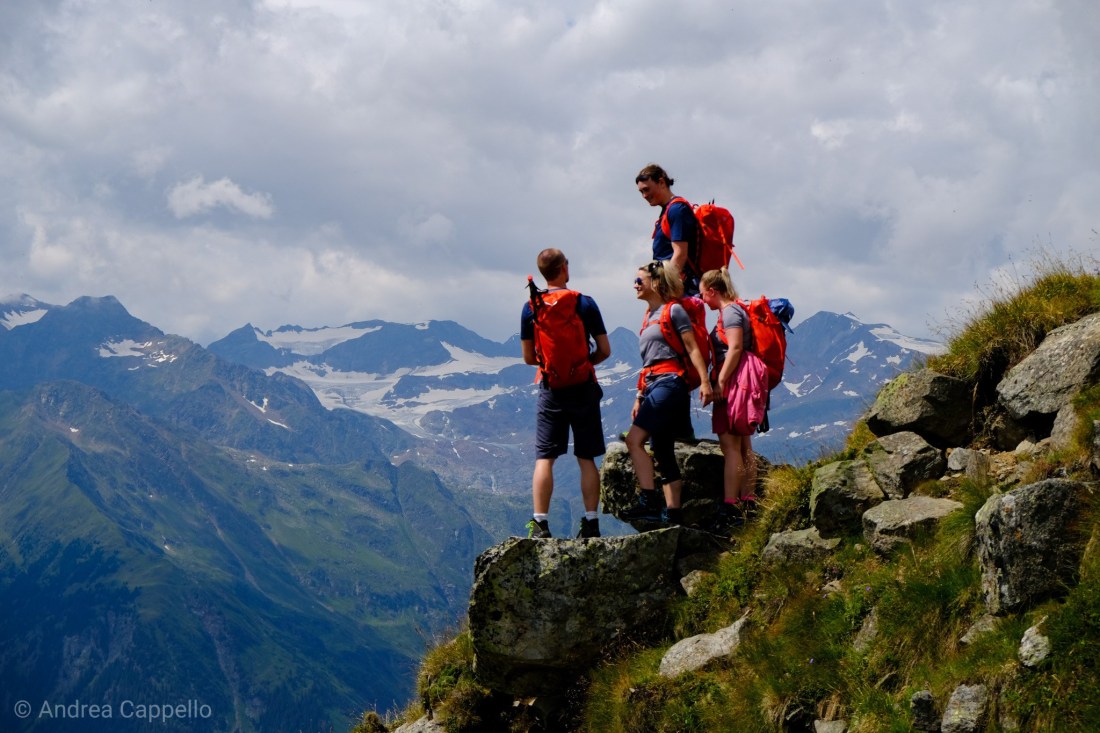
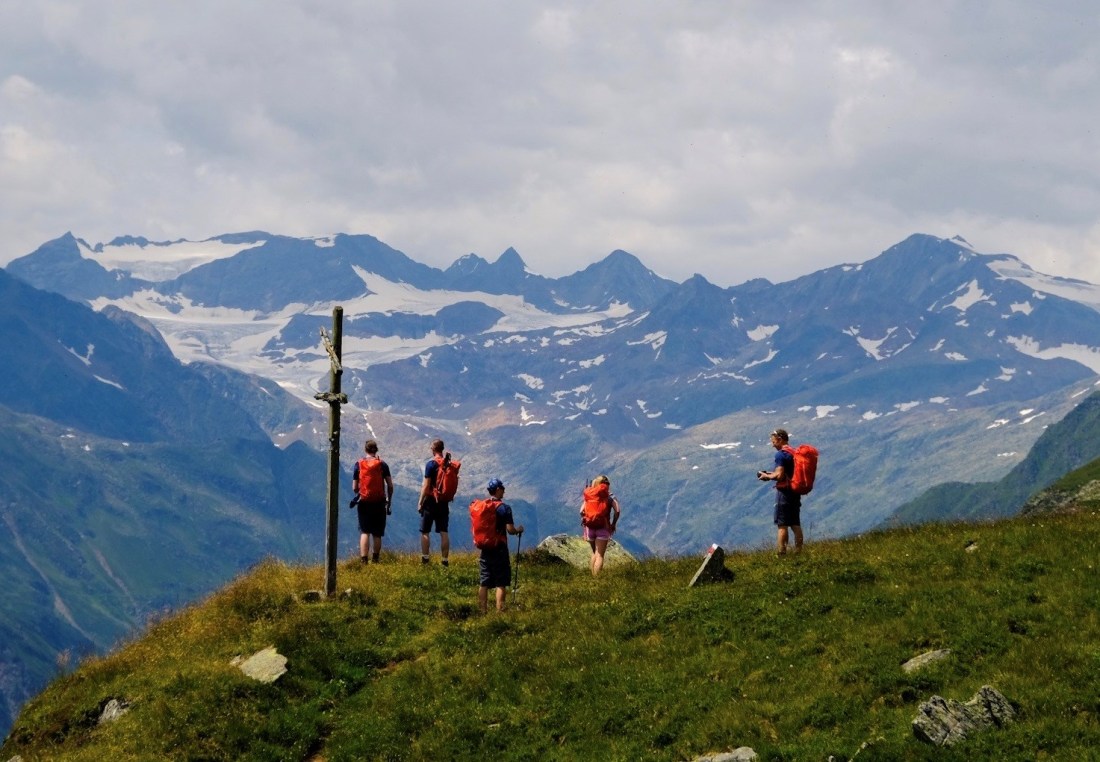
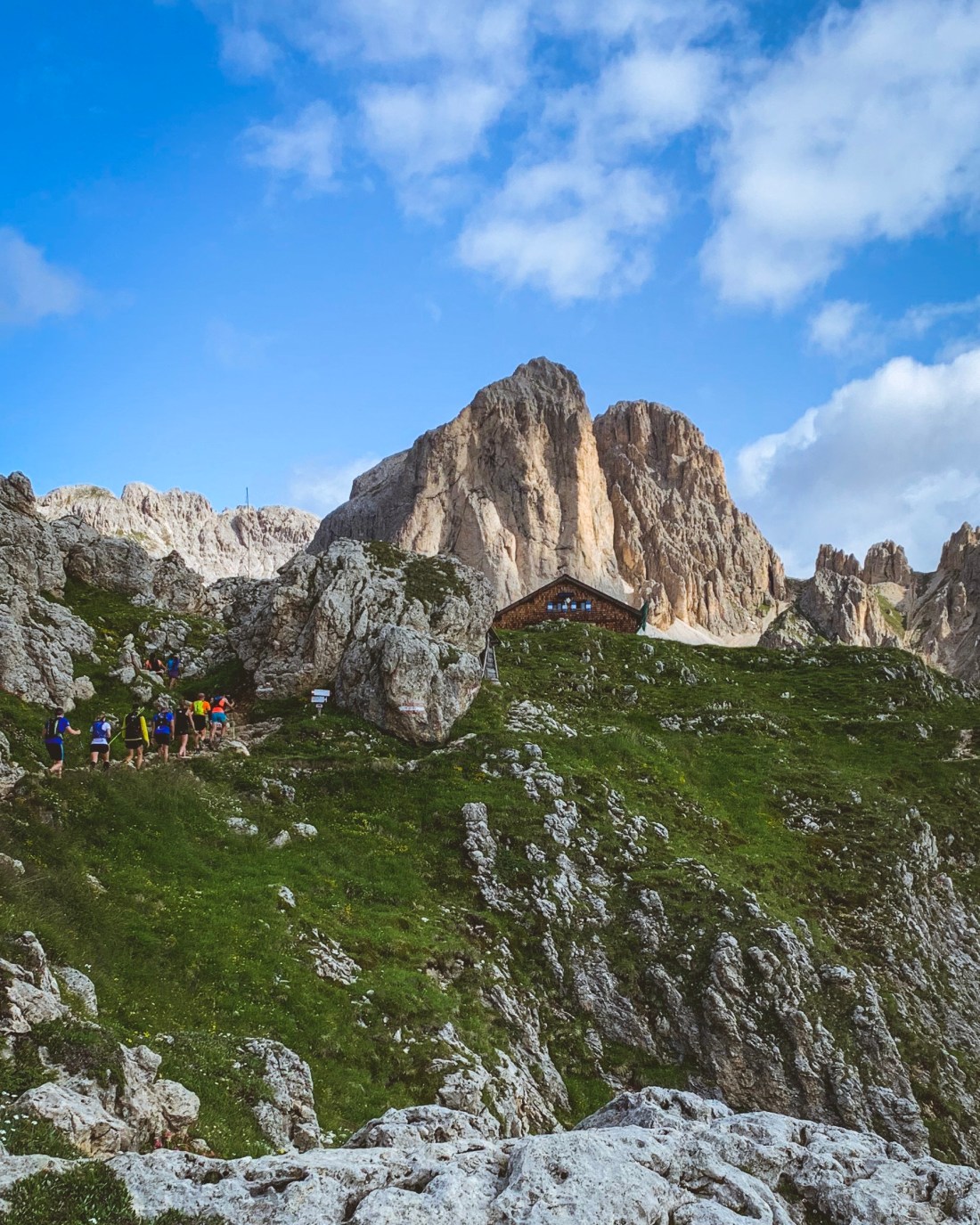
Looking back at our 6-day trekking adventure along the borders of South Tyrol, day two was certainly my favorite. Not because the entire hike was uphill, but because of the variation in the terrain, the glacier crossing and the absurdly beautiful location of our destination, the Müllerhütte. Another great thing about this hike, is that is also an amazing venture to do as an overnight hike without doing the whole 6-day trek. Please have in mind though, that you will need appropriate equipment to cross the glacier in order to reach the Müllerhütte, and, in the event you are not a group qualified to cross the glacier on your own, you will need a mountain guide (for which I can highly recommend Egon Resch).
The first part of the hike is zig-zagging through the forest, most of the time accompanied by a beautiful river and some waterfalls calling for your camera.
Video by Andrea Capello/@dolomistici
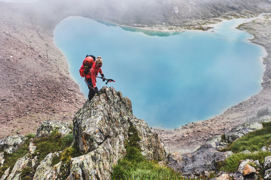
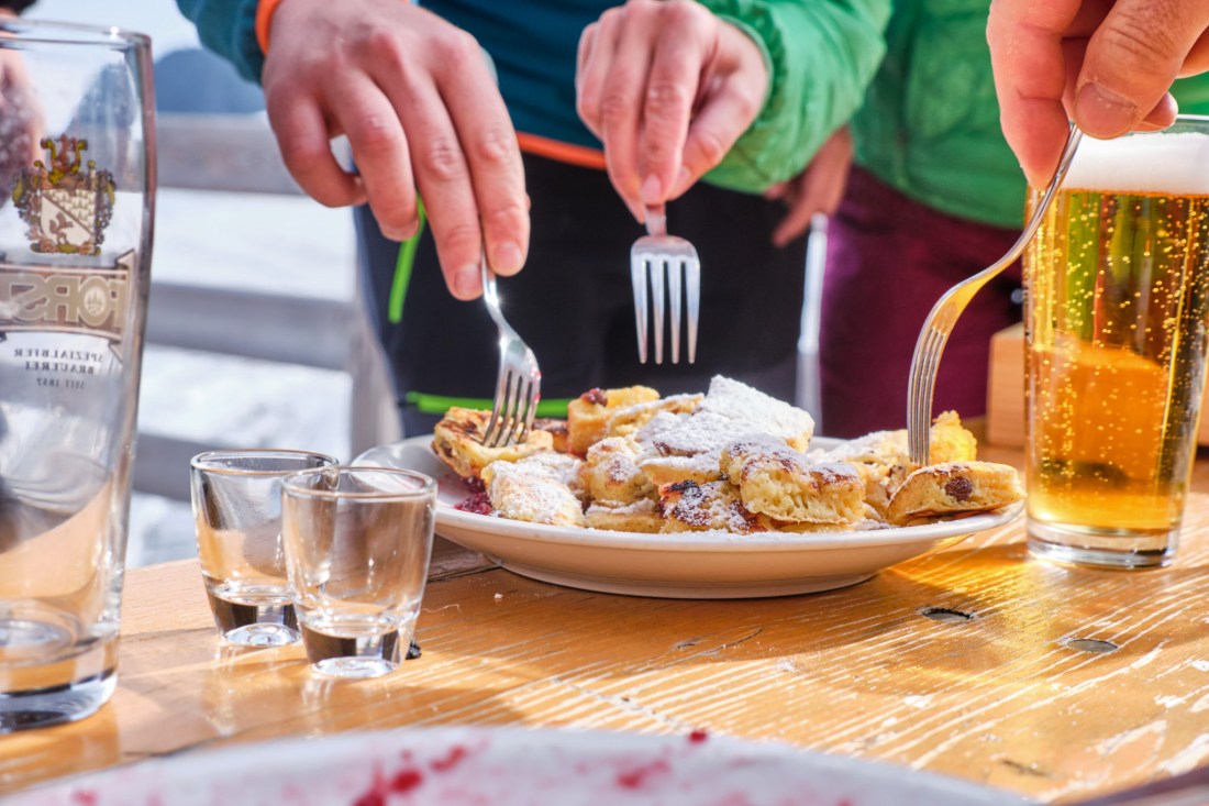
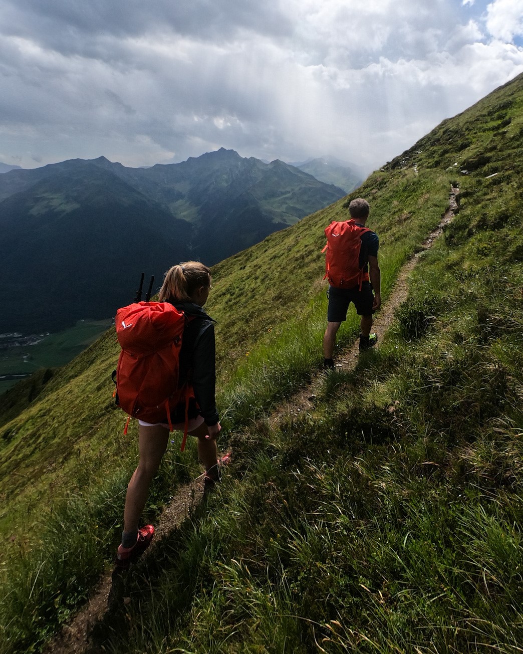
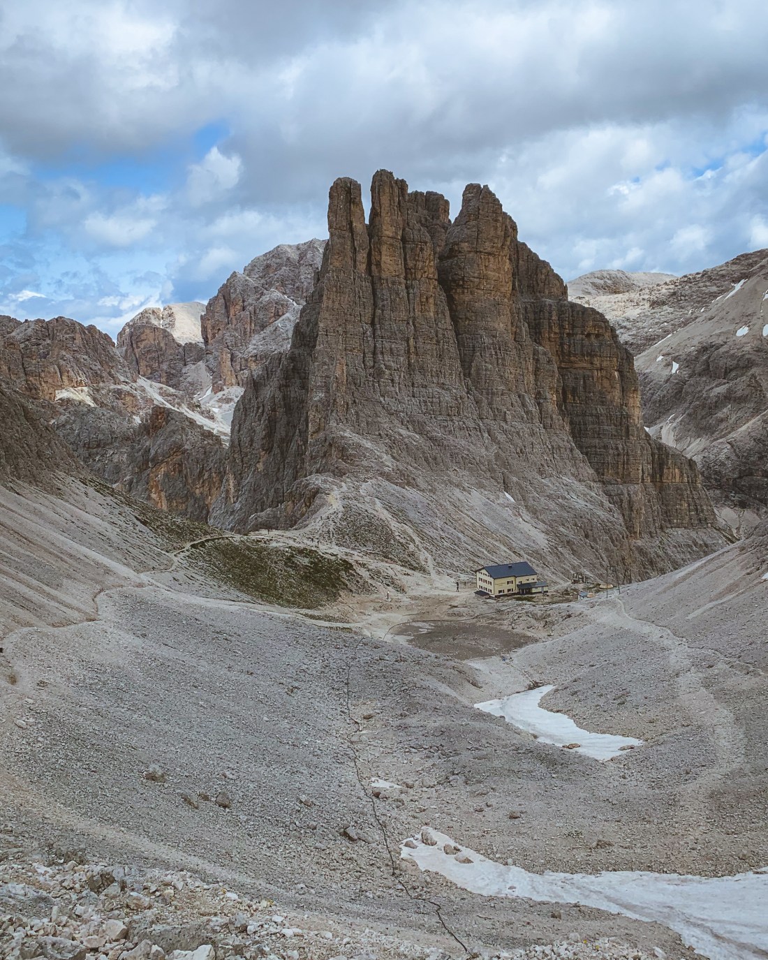
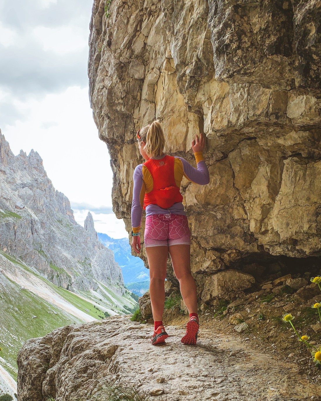
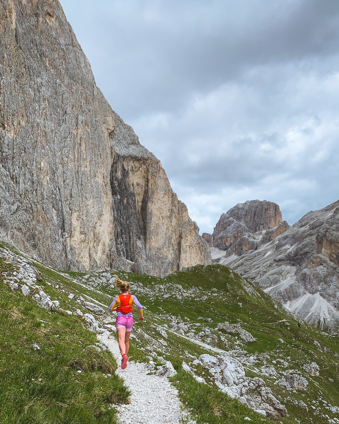
And what a day this should be! A short lunch at the Teplitzerhütte turned long as we tried to wait out the rainstorm. In the end we covered up and faced the challenge head on, equipped to connect to the fixed ropes provided at the most exposed sections of the hike. I enjoyed this wet part, moving confidently in the equipment and for the first time with poles, when not using the ropes to pull myself up. Suddenly the rain stopped and the fog lifted just in time for us to enjoy the most amazing view of the turquoise Lago di Malavalle. Fuelled by these amazing views we made it to the glacier and our last leg before reaching the Müller hut. Müller hut was my definite favorite, surrounded by glacier and mountains on 3145 meters, and with a welcoming Danish hostess securing a steady flow of biers and kaiserschmarren in the afternoon sun.
This slideshow requires JavaScript.
If you are not doing a hut-to-hut-hike, return the same way as you came up, with all the amazing views you turned your back to the day before. And don’t sleep in in the morning. The sunrise from the Müller hütte is not to be missed!
This slideshow requires JavaScript.
Distance: 15K Elevation gain: 2045m (highest point 3145 m.a.s.)
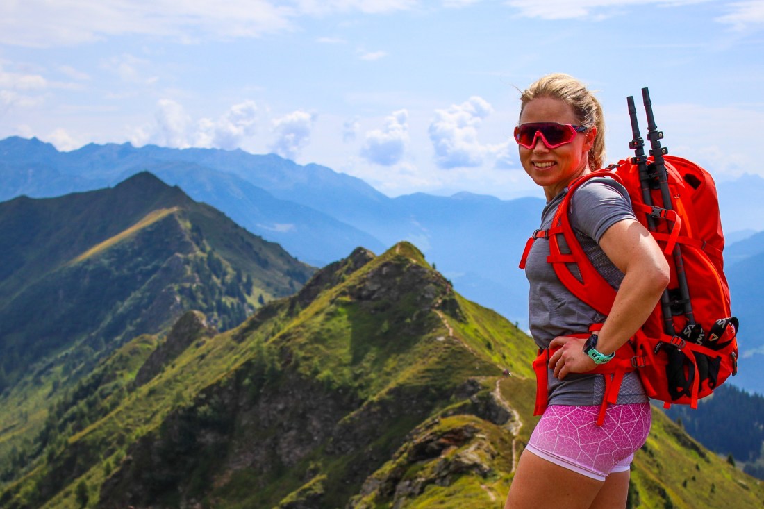
In August last year I was invited by the Italian mountaineering brand, Salewa, to participate in a 6-day trekking experience in the Dolomites. This was the third event of their project, Grande Circolo, an ode to the region of South Tyrol in the form of an alpine tour along the borders of the region.
I had just returned from a week in the Dolomites, determined to spend more time at the high altitude rifugios (mountain huts), and was already planing to return next summer, when I received the invitation, and could not believe my luck!
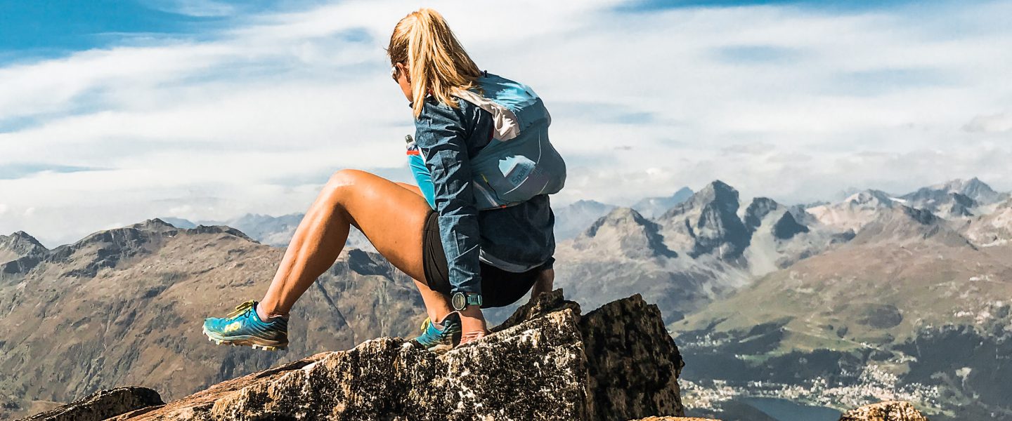
While I spend most of my time in the mountains with a super-light backpack and running shoes, this event would expose me to a much heavier backpack, glacier equipment, mountain shoes, and adapting my speed to the group. I am sure our guide would say I was not always successful at the latter, yet I enjoyed every second of it.
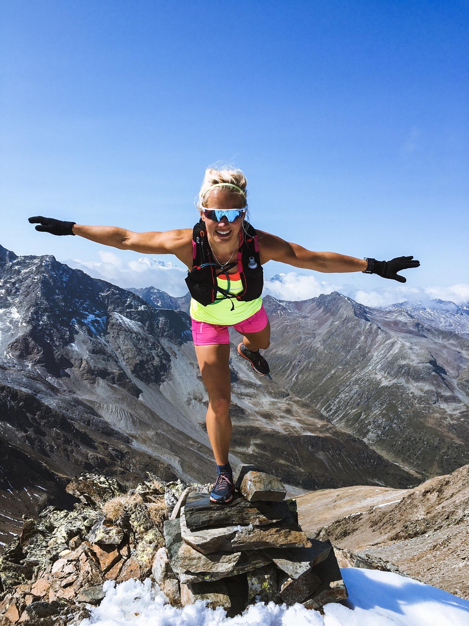
Flying high (photo: Andrea Cappello for Dolomistici)
Day 1: Gossensass – Maiern
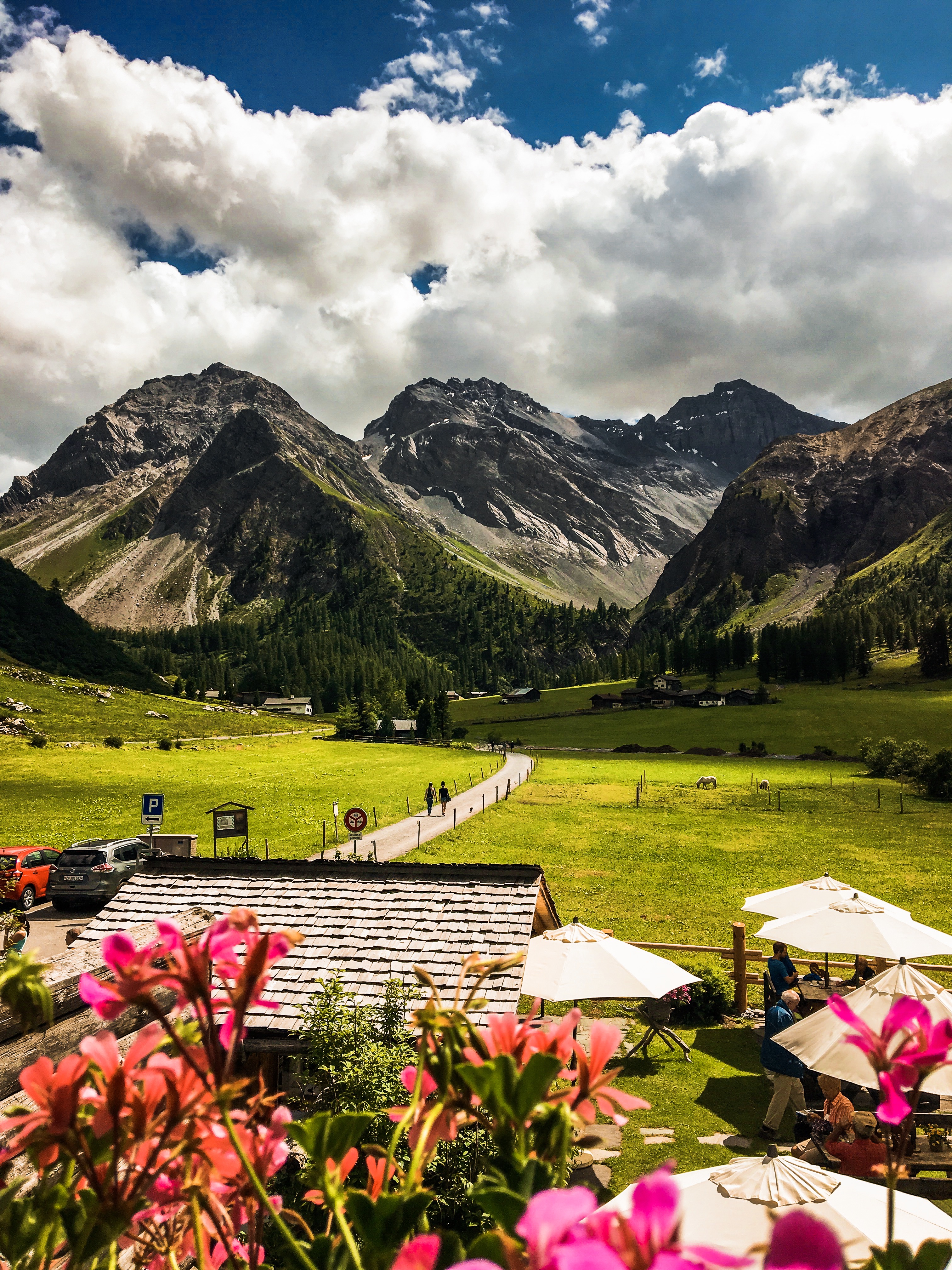
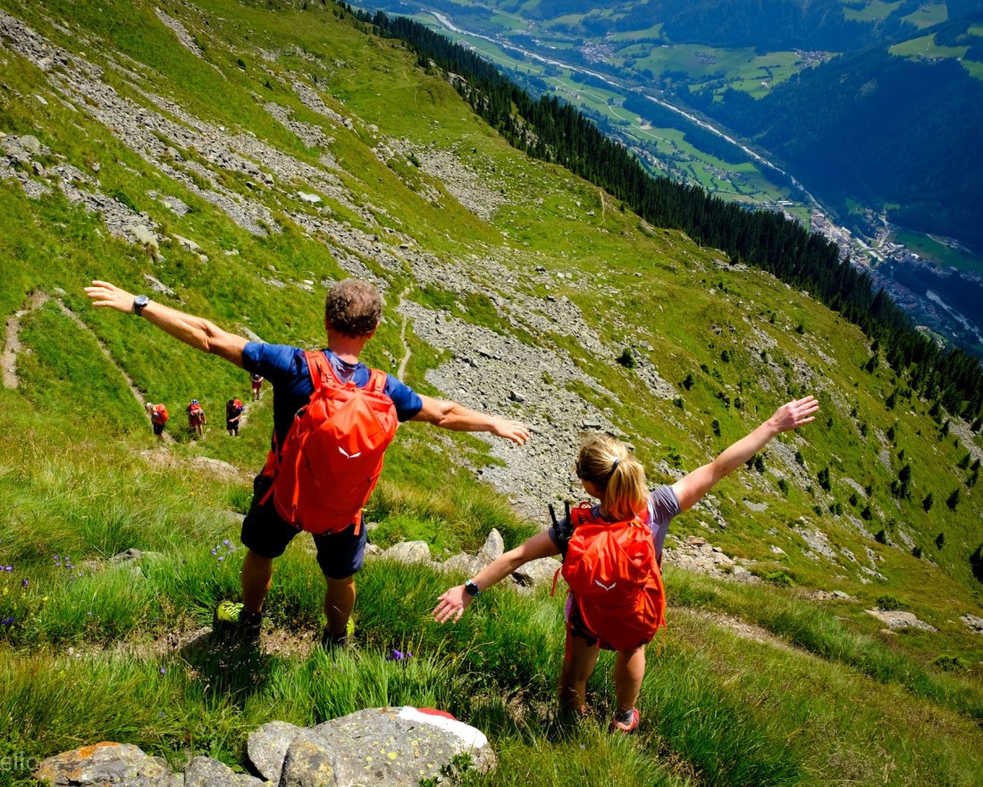
We started out adventure from the village of Gossensass (Colle Isarco in Italian), which is accessible by train. According to our guide, Egon, the first day was just a kind warm up for what to come on day two and three. This warm up still included 1692 meters of elevation and 19.7 kilometers on foot, and the introduction to the region’s apfelstrudel and speck, which should turn out to be our favorite go-to-fuels this week, as well as a wide variety of “schorle” (juice and sparkling water blends).
Endless green (photo: Andrea Cappello for Dolomistici)Glacier view (photo: Andrea Cappello for Dolomistici)
The first part of the hike took us uphill through the forest, before the landscape opened up just as we reached our first mountain refueling hut. I can still remember the taste and texture of the apfel strudel, which eventually turned out to be my lunch this day. Breaking up from the hut, we still had to overcome some uphill before reaching the first pass of the day at 2147 meter a.s.l. after 7.5 km. Looking to our left from the pass a velvet green ridge showed off and made our cameras click. After a short descent we more or less kept the height for 5-6 km turning corners with stunning views, including view of the glacier, which was to be our destination for the second day. After about 14.5 km we finally reached a refueling opportunity and loaded up on speck and bread before our knee-killing steep descent to Maiern.
More glacier views (photo: Andrea Cappello for Dolomistici)
Planning your own multi-day hike?
The transport system in South Tyrol allows you to plan your own multi-day destination to destination hike. The starting point for our trekking experience, Gossensass (Colle Isarco), is just off the Brenner highway, about one hour by train from Innsbruck.
In the heart of the Dolomites you find Passo Falzarego, a busy crossroad between Cortina, Alta Badia and Val di Fiemme, with several historical and nature wonder attractions nearby. This is also the starting point for two of the most beautiful mountain runs you can do, the Gran Lagazuoi circuit and the Nuvolau run. If you are fit, you can easily do both in one day. If you plan on doing the double, I would suggest starting from the Falzarego pass in the morning and run the circuit provided in my Strava link below in the opposite direction, have lunch at Rifugio Lagazuoi, and take the cable car down to the pass before you head in direction of Rifugio Nuvolau. For a unique experience, bring a light backpack with a sleeping liner and some dry clothing and stay overnight at Rifugion Nuvolau (reservations must be made in advance).
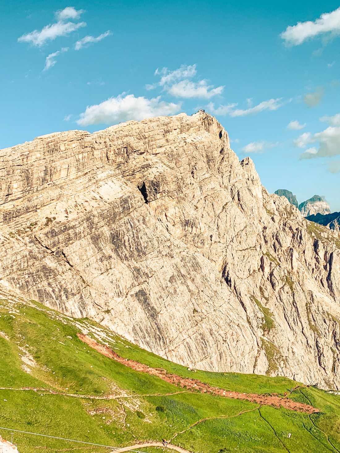
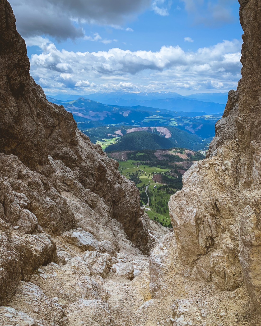
Can you spot the cabin on the edge?
The Lagazuoi run
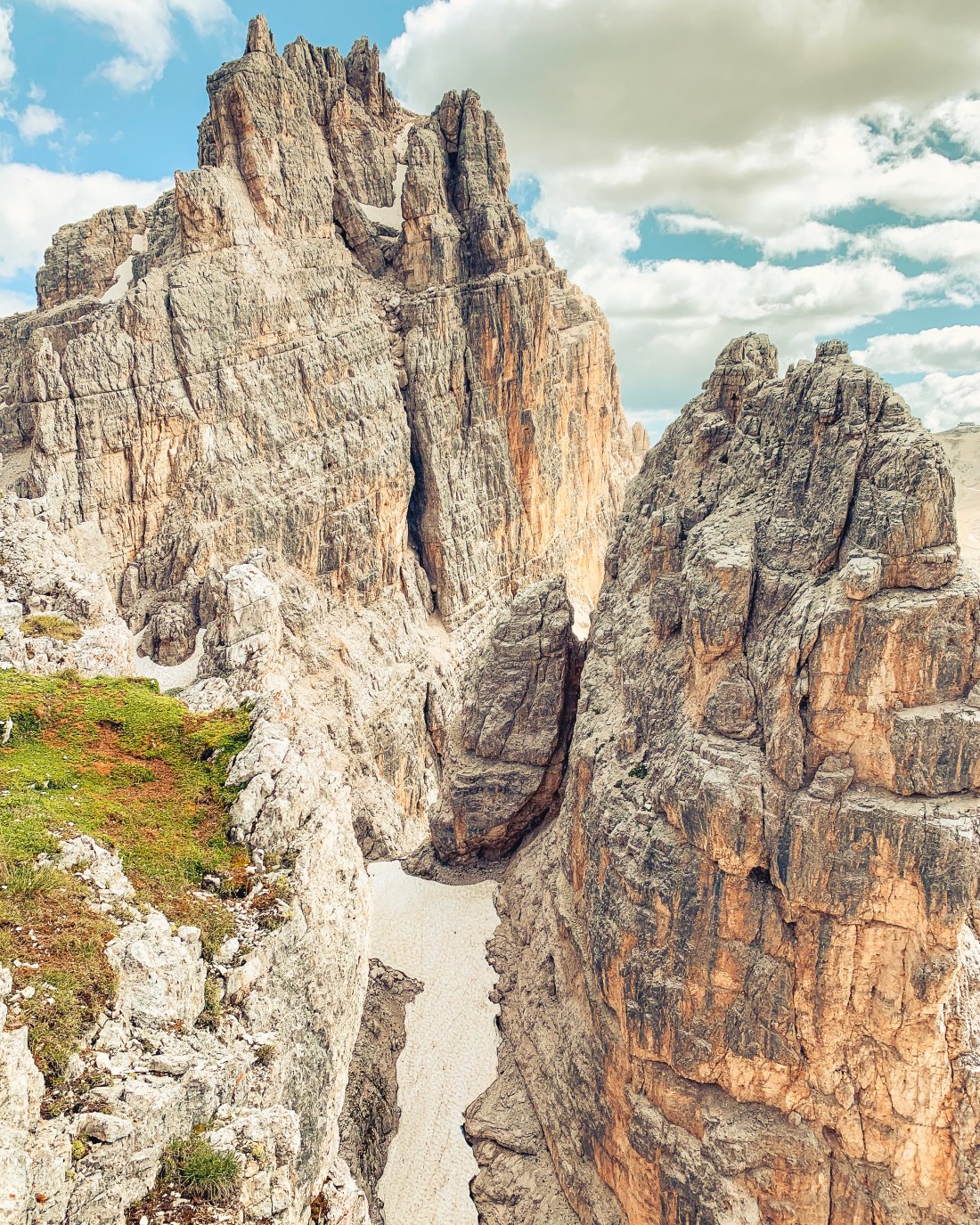
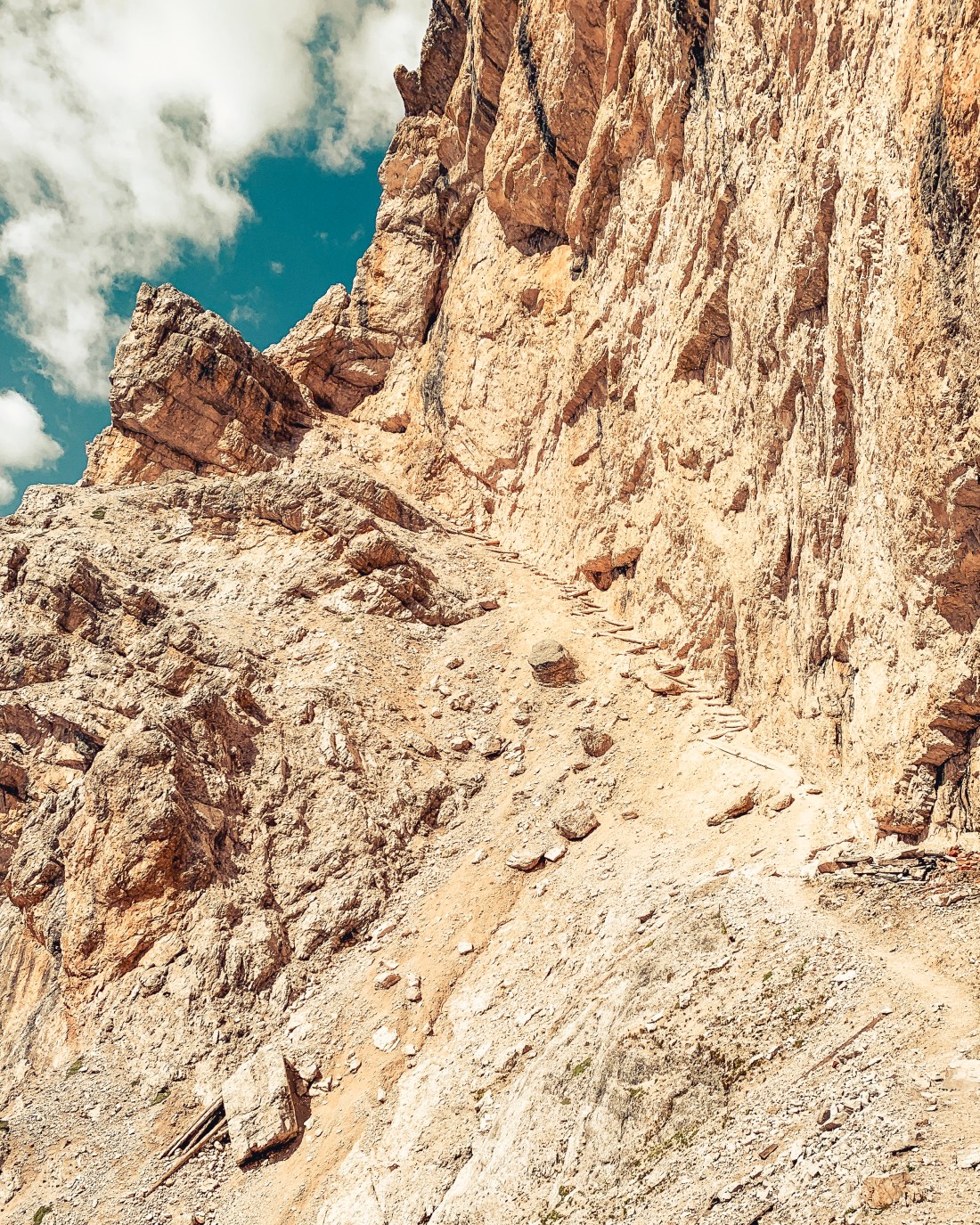
This run takes you around the impressive Gran Lagazuoi and provides some of the most spectacular views of the Dolomites. Take the trail on the right side of the cable car when facing the mountain. There are several trails going up, but for this run choose trail 402 (the Strava link shows the Babylon trail, but 402 is an easier option). Stay on 402 until you reach trail 20B at around 2500 m.a.s.l. and continue the climb on 20B until you reach its highest point, Gran Forcela at around 2650m.a.s.l. From here, again follow 20B going down on the other side and stay on this trail along the mountain wall, which will be on your left side. This is the most technical part of the trail and I have to admit I felt quite vulnerable and small running here alone. Continue on this trail towards Rif. Lagazuoi. As you are approaching the rifugio, the trails will get significantly more crowded. Unless you are very adventurous, don’t bother doing the detour shown on the Strava link, but save the energy for another detour following the Kaiserjägersteig trail towards the peak Piccolo Lagazuoi at 2778 m.a.s.l. Now you have earned your lunch at the Rifugio Lagazuoi.
View from Gran ForcelaDecent from Gran Forcela
After lunch, you have the option to run down, walk down through the war tunnels, or save your legs for the next run by taking the cable car down to Passo Falzarego.
From Piccolo Lagazuoi looking towards Gran Lagazuoi.
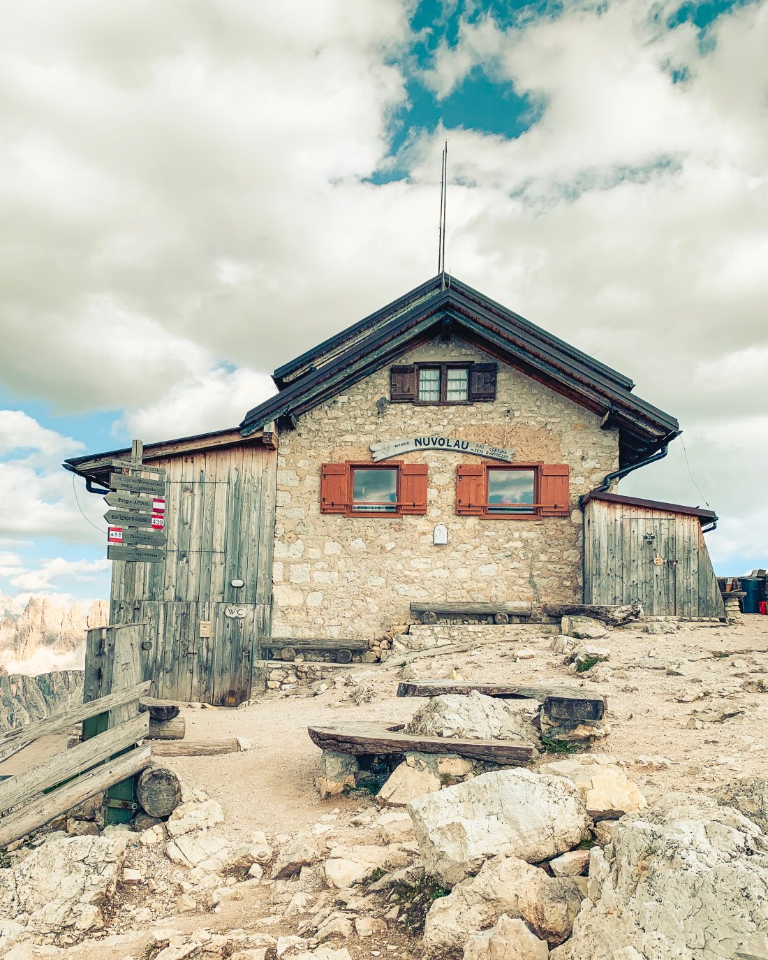
The Rifugio Nuvolau run
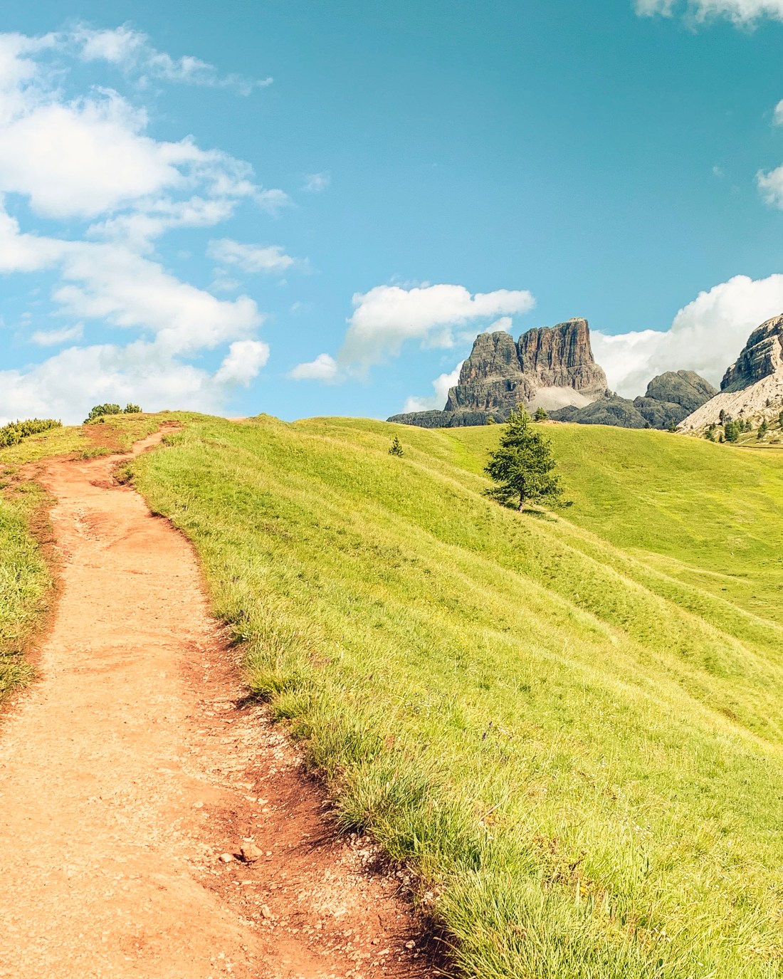
Rifugio Nuvolau is a small mountain cabin placed on the edge of the Nuvolau peak at 2574 m.a.s.l. The cabin can be reached from a multiple starting points and in different ways, one of them being by via ferrata. The alternative presented here is from Passo Falzarego, just across the street from where you descended from the Lagazuoi run. The trailhead is found at the parking next to the Rifugio Passo Falzarego, where you may also buy refreshments, if you need anything before the run.
At the beginning of the run to Rif. Nuvolau with Mount Averau at a distance.
The first kilometer is pretty easy, only ascending about 80 meters, while the next kilometer is more varied also with some steeper sections. The third kilometer is steep before you get one pretty chill kilometer, even with some downhill and new views as you run around the Averau. The last four hundred meters up to the cabin will make you sweat again as the excitement builds for reaching this amazing location. When I arrived last time, the sun was about to set while a guy was playing guitar and the hikers who were booked for the night arrived. I stayed as long as I could while still being able to do the descent in daylight, and decided to book a bed for next time.
Rifugio Nuvolau
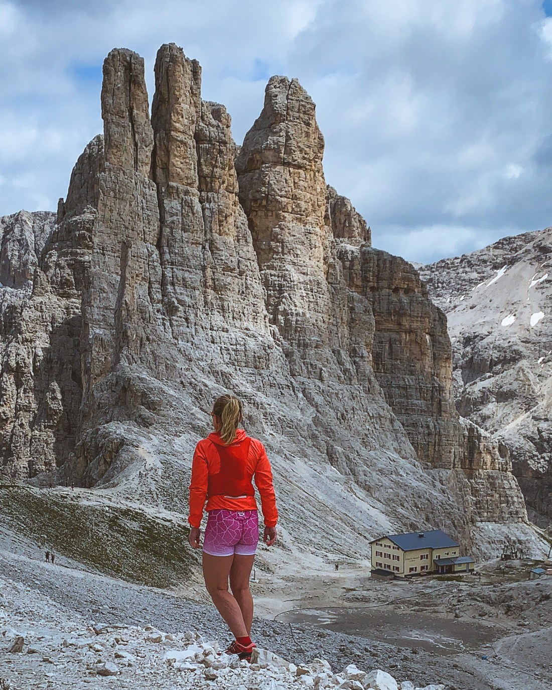
From the Nuvolau you have great views of the famous Five Towers, popular for mountain climbers. If you have the time, you can return via the towers, by taking a right turn at Rifugio Averau (400 meters from Nuvolau) and continue on trail 439 until you meet trail 440, which will take you back to your starting point.
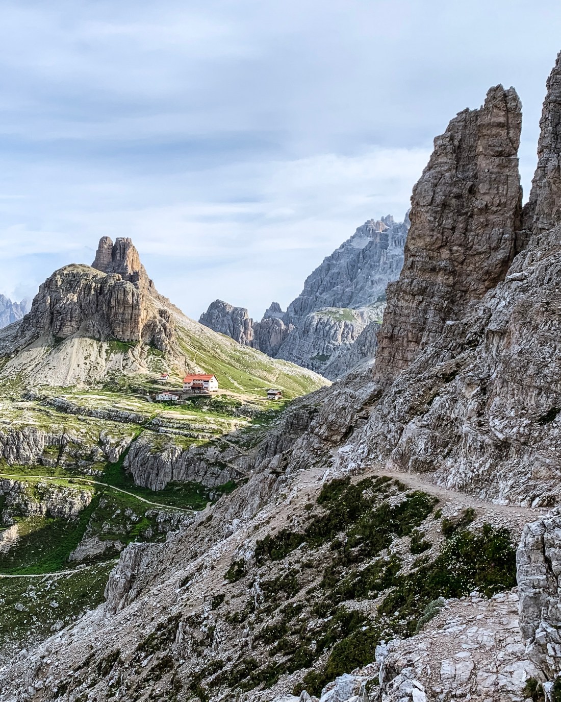
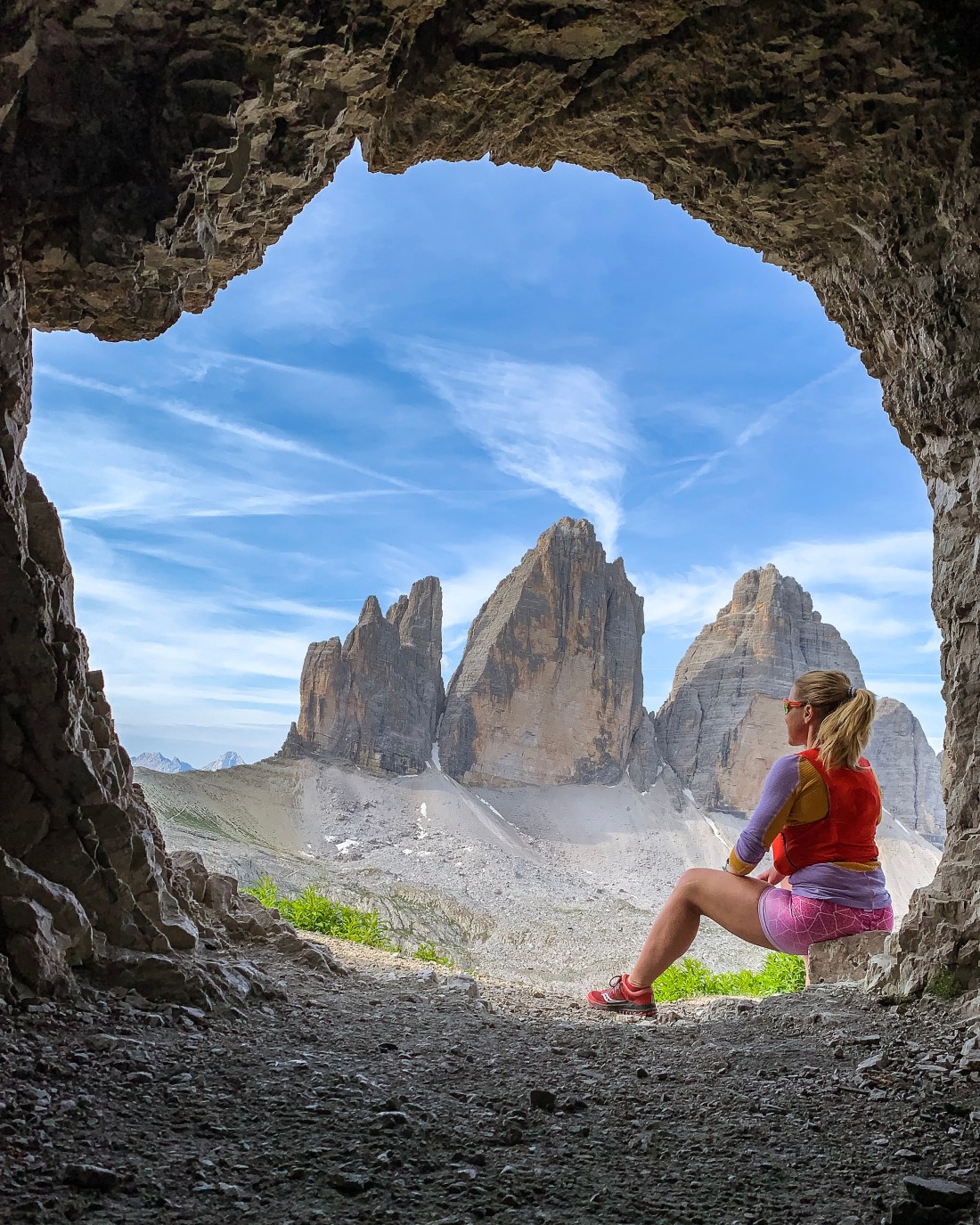
The Tre Cime di Lavaredo is maybe the most iconic landmark of the Dolomites and draws tons of tourists due to its easy (although fairly expensive) access by road. However, it is surprisingly easy to skip the crowds for one of the most memorable runs ever if you start early in the morning or in the late afternoon. Having done the circuit around the three peaks twice, I always think of it as fairly flat, but looking at the data from my run, it is certainly not. Still, it is one of the easiest runs you can do in the Dolomites, and with views second to none.
To get the most out of it, I suggest you stay overnight at one of the huts along the path. If you plan to run with a light backpack with easy logistics, stay at Rifugio Auronzo, which is right on the trailhead about 40 minutes drive from Cortina. You can park outside the hut, but it is advisable to arrive very early in the morning or in the late afternoon. Although it feels a bit like being on interrail or a backpacking trip, the hut is large, with clean rooms, most with amazing views. All rooms come with shared bathrooms, but you can book a private room. You can book your stay with breakfast or half board, but if you plan on going for a sunrise hike/run, depending on the season, you should bring some snacks, as breakfast opens at 7am.
Photographers flock to the Tre Cime area for shots of the famous peaks and the surrounding mountains, in particular the Cadini di Misurina, which are just in front of the Rifugion Auronzo. If you want to join the pack, plan for a sunset hike/run in the afternoon and a sunrise mission. You wont regret!
Sunset hike in the fog
The Tre Cime trail run
I prefer to do the Tre Cime run anti-clockwise. Starting from Rifugio Auronzo at about 2350 m.a.s. the first part is fairly flat on a wide easy path. After about 1.5 km you reach the first hut, Rifugio Lavaredo, where you can take a detour off track to take in the Cadini peaks before you start the ascent towards the run’s highest point. This is also where you get the first sight of the north wall of Tre Cime. From here you can also see the two paths continuing towards the Dreizinnenhütte/Rifugio Antonio Locatelli. Choose the upper path.
The trail towards the DreizinnenhütteDreizinnenhütte from the lake side
After 4 km and numerous photo stops you reach the Dreizinnenhütte. This is a great spot for a coffee break in the sun, but first I suggest you make a detour to the cave and the lakes behind the hut. Since the run is not very long, you want to linger as long as possible to take in the surroundings. If you have the time, and manage to get a reservation, do consider staying at the Dreizinnenhütte for a night.
From one of the caves behind the Dreizinnenhütte
Leaving the hut takes you downhill for about 1.5 km until you reach the run’s lowest point, all the time with the peaks in front of you. After a short, but steep, climb, you will probably meet more and more people as you approach your starting point, the Rifugio Auronzo.
Don’t miss out on a meal at San Brite while you are in the neighborhood. If you want something less fancy, head back to Cortina for a pizza at Pizzeria/Ristorante Ariston.
Race
If you want to add a race to your itinerary, consider joining the Misurina Skyrace or Sky Marathon in September.
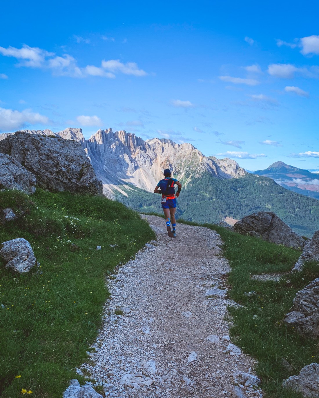
This summer I registered for Rosengarten Skymarathon in the Dolomites. This 45 km race around Rosengarten, is a no-brainer if you love the Dolomites, and you may even have run part of the track if you have been to Seiser Alm. Approaching the event I was struggling with plantar fascitt and had to withdraw from the race. However, as my friend, Barbro, was going to run and my foot could do some running, I got to explore the area anyway.
Easy start of the run.
When planning my long run I was eager to reach the amazing Vajolet Towers as well as testing a part of the race track and cheer for Barbro. I managed to combine both and looking back, this is one of the coolest runs I have ever done as it includes easy flow, unique landscape and views, some scrambling, a cozy mountain hut and a landmark like the Vajolet Towers.
The Run
I started the run from Kölnerhütte, the top of the König Laurin chairlift, which you hop on at Malga Frommer Alm (parking available). Of course, there is always the opportunity to start from Malga Frommer Alm, but the chairlift saves you about 600 meters of ascent and time you can rather spend in the higher altitude.
Rotwandhütte
From Kölnerhütte you run the Rosengarten Skymarathon track along trail 549 towards the Rotwandhütte. This is an easy trail, which allows you to focus on the amazing views. Your first refueling opportunity is the Rotwandhütte at 5 km. Leaving the hut, the climb towards the first pass starts and the run gets more demanding with technical downhills and uphills as you continue towards Rifugio Vajolet. This is where you leave the Rosengarten Skymarathon track in favor of a fun scramble up to Rifugio Alberto Primero, which rests at the feet of the Vajolet Towers. On a busy day, you can hear the adrenalin screams from the mountaineers climbing the towers.
Vajolet Towers and Rifugio Alberto Primero
After a rest at the hut, take a short detour towards the Santner Pass for a better view of the towers before you head back down towards Rifugio Vajolet. Pay attention as you are approaching Rifugio Vajolet for an alternative trail on your right, which will take to in the right direction towards Pas da le Colonele. If you miss the trail and find yourself at Rifugio Vajolet, don’t worry, just return on the same trail, and take the next right turn to get on path 550 towards Pas da le Colonele and the steep descent to Kölnerhütte.
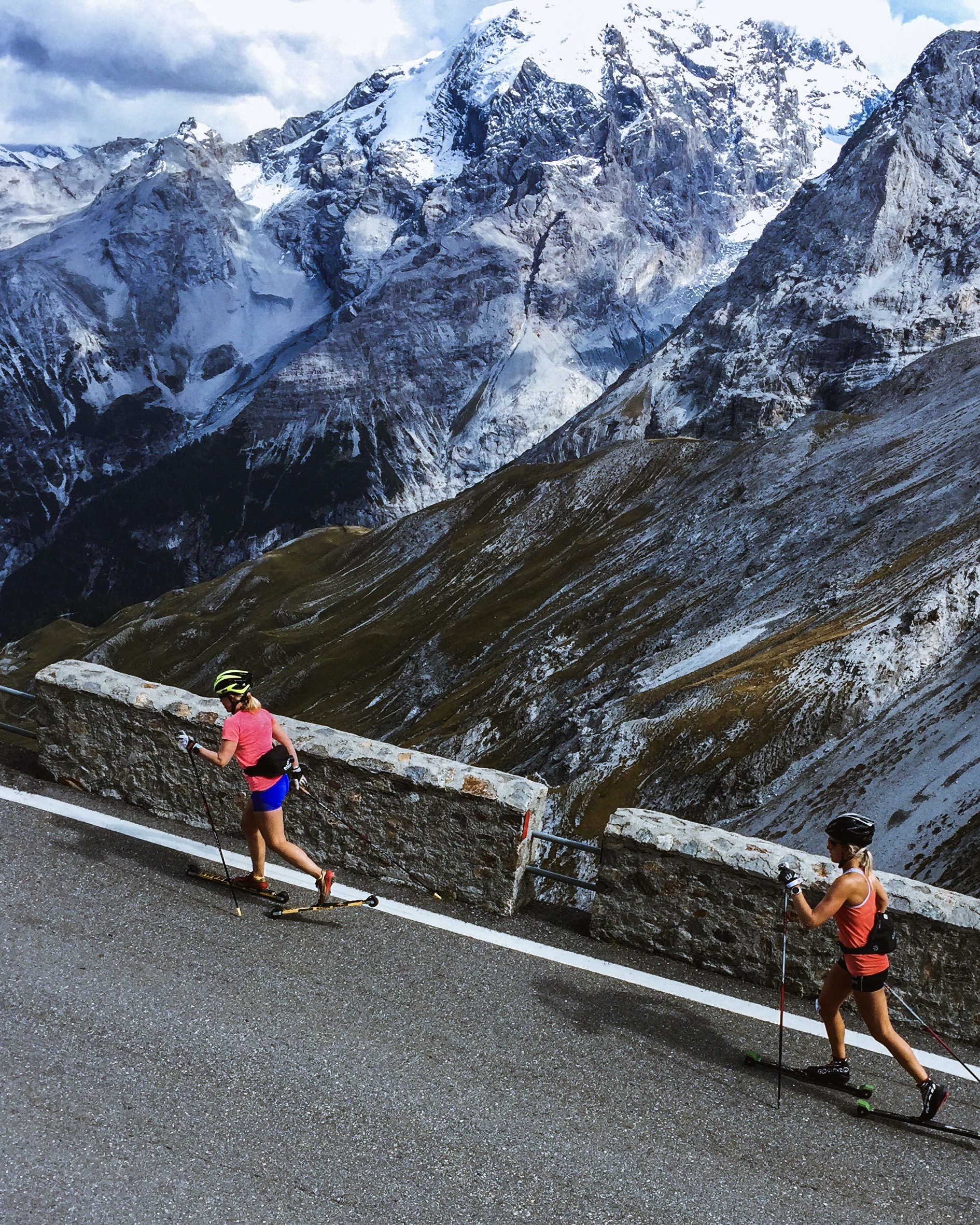
Seiser Alm and Livigno are both beloved destinations for cross country skiing athletes of all levels. These two Italian alp villages complement each other in terms of character and facilities and make a great combination for a training vacation/camp. While Seiser Alm is quiet (and out of this world beautiful) and has amazing trails and scenery for running, Livigno is more of a happening place with (tax free) shops, cafés/restaurants and the best roller ski and biking opportunities.
Here you will get the details of the training we did during a 9-day September training camp as well as some alternatives tried out over the years. The purpose is to guide you to the best locations for performing various sessions, such as interval training and long low intensity sessions. Non of us being top level athletes, our choice of activities has been guided by a desire to explore the beautiful surroundings as well as obtaining great workouts. You may (and should) of course use the information provided to tailor your activities to your own level of fitness and purpose of the trip.
Seiser Alm meadow.
Please note that both Seiser Alm and Livigno are high altitude destinations and your performance will be affected. In short this means you should go slower than you normally do on low-intensity activities and avoid doing much high intensity training, especially the first 3-4 days, and when introduced, preferably low threshold. More on high altitude training here (Norwegian). It is not uncommon to feel dizziness after a high altitude workout if you go too hard and you may not get full benefit of the rest of your training camp.
Day 1 – Seiser Alm (arrival day)
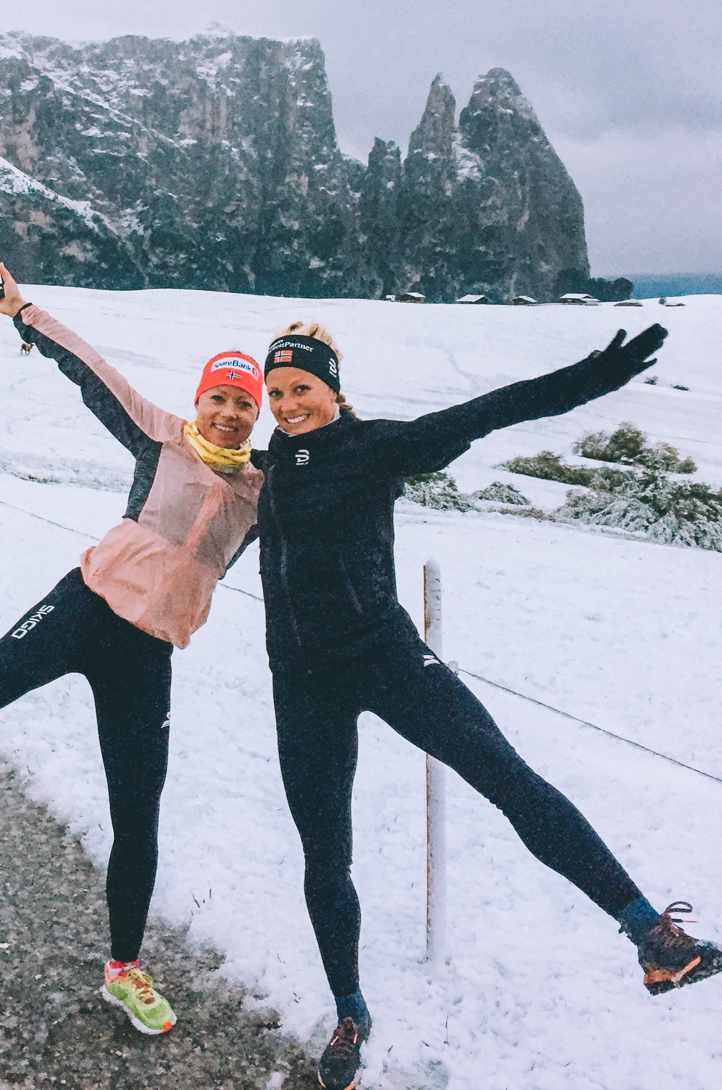
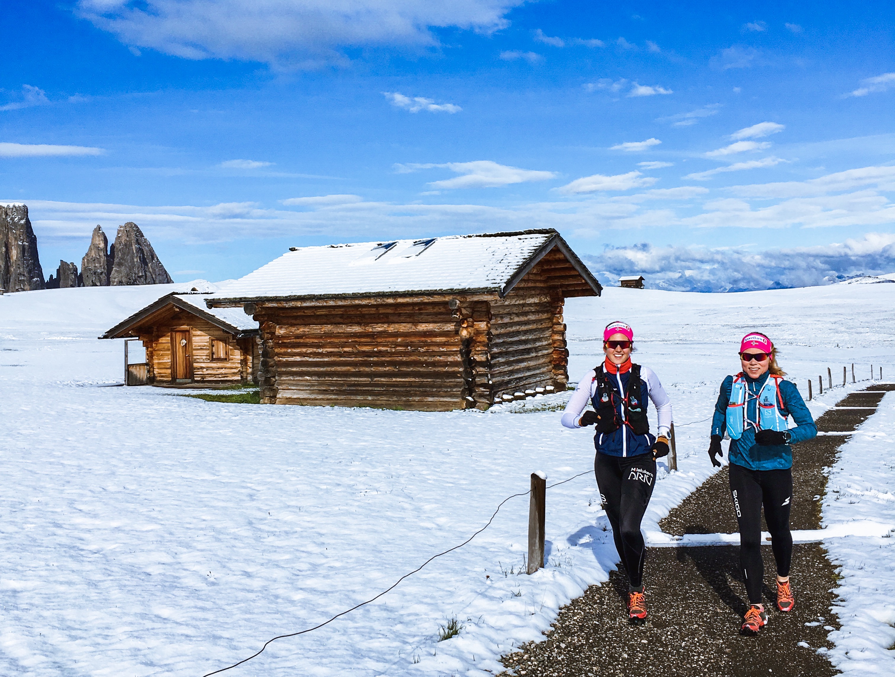
We started our camp in Seiser Alm. You can read more about Seiser Alm, including accommodation recommendations, here. Traveling to Seiser Alm from Norway (or any other place requiring you to fly) usually takes almost a day and you are lucky if you arrive by sunset. We arrived just in time to stretch our legs by doing a short and easy jog on the meadow which was covered with a thin layer of wet snow. That’s the thing about Seiser Alm. Its location more than 1800 meters above sea level means weather and temperatures change quickly and you can experience snow even during summer months.
Waking up on our first full day in Seiser Alm, the meadow was still covered in snow, but the sun was shining and we chose to go for the planned long run taking us over the Denti Rossi to Rifugio Alpe di Tires and the Schiliar/Schlern plateau. This is a beautiful long run which is always on my itinerary when in Seiser Alm. We started out running in snow, but by the time we were back on the meadow a few hours later summer temperatures had arrived. Take time for an espresso at Rifugio Alpe di Tires and lunch at Rifugio Bolzano
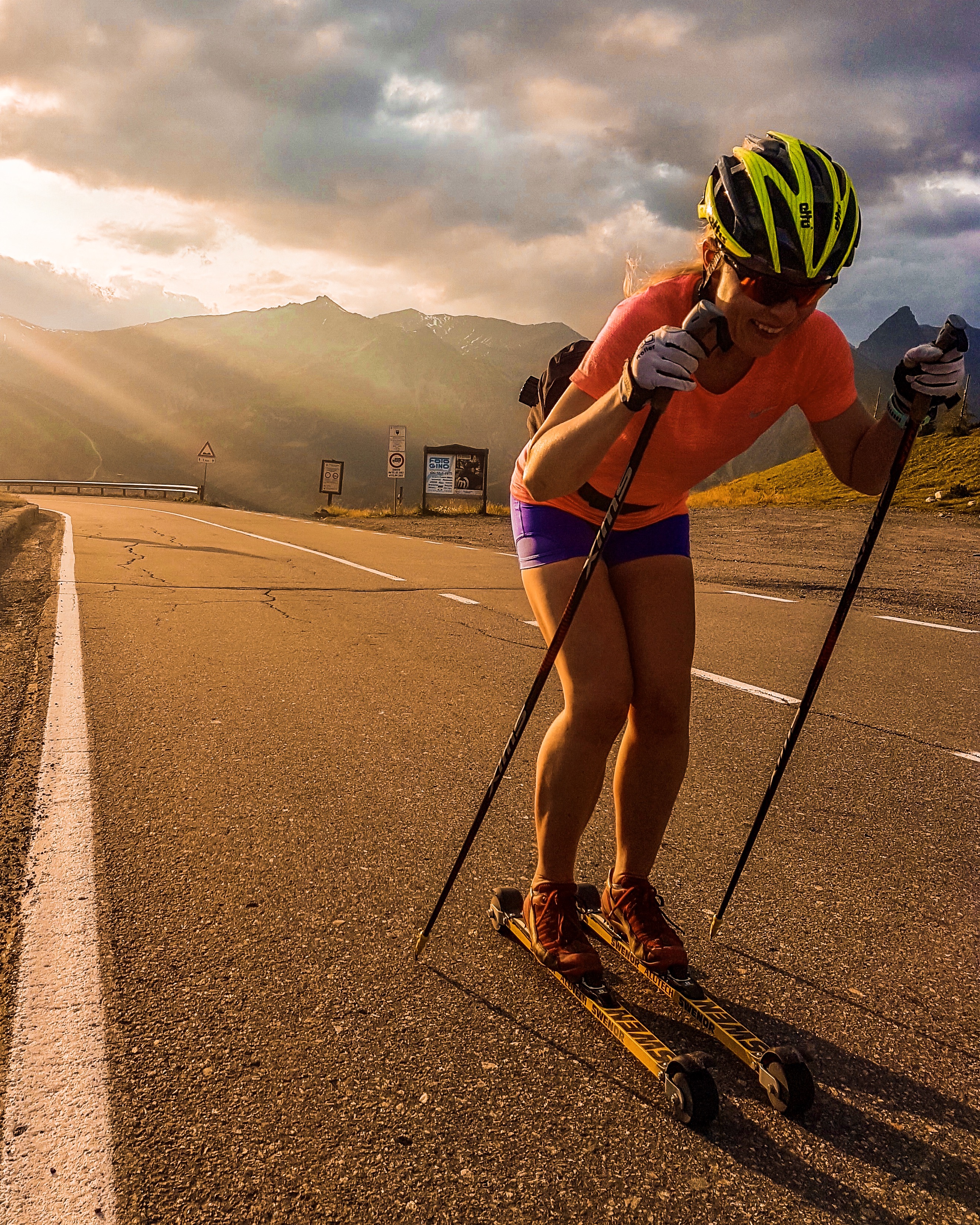
In the afternoon we took the bus down to Kastelruth and did an easy uphill roller ski session. You can also do the same hill workout by taking the cable car from Seiser Alm to Seis, which adds about 140 meters of ascent. The climb has been used for tempo stages during Giro d’Italia and has a profile great for interval training on roller skis and beautiful views.
On our third day we put on the roller skis again and took the cable car to Seis for an interval session. After warming up from Seis to Hotel Valentinerhof we did 7×6 minutes low threshold classic technique.
Bulaccia with a view of Sasso Lungo and Sasso Piatto
Our second session of the day we explored Bulaccia, the northern meadow of Seiser Alm, running with poles in the soft afternoon light. Some of us took the cable car going down to save the legs.
The highlight of our stay in Seiser Alm was the long run around Sasso Piatto and Sasso Lungo. I would say this is the running equivalent to Sella Ronda on bike, providing you with amazing views of the Dolomites from so many angles. We took the bus to Saltria (about 5-10 minutes from Compatsch) and the Florian chair lift to Williams Hütte, from where we started our run 2100 m.a.s.l. and clockwise around Sasso Piatto/Sasso Lungo. We stopped for lunch at Rifugio Sasso Piatto and continued to Rifugio Alpe di Tires and returned to Compatsch through the Denti Rossi pass. This is truly an amazing run, which of course may be divided in several parts if you are not up for the full length of it. You can also extend the run by either adding the climb to the peak of Sasso Piatto or/and continue over the Schiliar plateau after Rifugio Alpe di Tires.
The obligatory part of the transfer from Seiser Alm to Livigno is the mother of all roller ski workouts, the Stelvio climb. If you don’t have a support car, the practical way to do this session is to drive to the top of the Stelvio pass and take a bus down to your preferred side of the pass, either the Prato side or the Bormio side, leaving the car with warm clothes etc at the top. Each climb is great, with spectacular views and, if you can’t go easy on it, exhaustion guarantee. During this camp we did the Prato side, starting from Gomagoi at 1280 m.a.s.l., providing about 1500 meters of ascent and 18.5 km to the top of the Stelvio pass as 2575 m.a.s.l. We chose to tackle the climb by doing an interval session of 5×20 + 10 minutes below lactate threshold.
Please note that the bus service on the Bormio side is only available in July and August. You may contact the bus service Perego for information. For bus down from Stelvio on the Prato side, go here.
If you prefer to conquer Stelvio on bike, you can rent a bike at Mapo Bike in Valdidentro (a few kilometers from Bormio). If you want to stay a few days to explore the area and perhaps tackle Stelvio running, skiing and biking, one of my favorite hotels in the Alps is just next to Mapo Bike, Alpen Hotel. Personally I had my best session in Stelvio running up from Bormio.
Livigno is roller ski mecca with an extensive network of cycle paths protected from the traffic as well as mountain passes where you can work on your O2 levels and return safely by bus if you don’t want to ski down or have a support car. On our first day in Livigno we chose to do an easy flat roller ski session to recover from the Stelvio challenge.
Livigno also has a tremendous network of trails for running as well as mountain biking. There is no limit other than your fitness level as to where you can go, and even if I have visited 5-6 times there are new trails to explore. Our favorite trail for short recovery runs is the trail just above the centre providing you with great views of Livigno. You can enter the trail directly from several places in the village or my preferred entry at the south end of the village, where you can also find parking.
After a “rest” day it was time to do a longer session again and we decided on a run that would take us to a +3000 meter peak, Corna di Capra. We chose to drive to the trailhead just south of the village (you can also run directly from the village). Although containing a lot of ascent this run also has long runable sections and truly beautiful surroundings as well as the added satisfaction of reaching the peak at 3016 m.a.s.l.
For an alternative long run you can take the cable car to Costaccia from the city centre and run south along the ridge following trail 162 and then 157 passing Causello 3000 and Involt dali Resa before descending back to the city centre.
Our second workout of the day was a double poling session, which included the climb up to Passo Eira. From Passo Eira you can take a free bus down to Livigno (check the schedule in advance). As an alternative to the Eira ascent you can also roll up to the Forcola pass.
Towards the end of a training camp like this adjustments to the training plan may be adequate due to energy levels, strain on legs or other reasons. For some, including me, that meant replacing a running session with yet another roll to Passo Eira, this time using kicks and not just double poling. In the afternoon we did a strength session.
Last full day in Livigno and the training plan said low threshold running in Val Federia. Low on energy and with the rain pouring down, I chose to go easy on the trails instead. However, Val Federia is great for this kind of effort and having done a similar workout in 2016, I still have the appropriate Strava details to guide you. To reach Val Federia you can either drive to the parking provided at the trailhead, or run from the hotel as warm-up. Remember the altitude and go easy!
When in Livigno my choice of hotel is Hotel Larice, which is one of several hotels forming the Bivio Life Livigno group, where you can find Hotel Bivio (often used by the Norwegian national team) and Alpen Village Hotel, which specifically caters towards training groups of all sports. Larice is a small eco boutique hotel with amazing atmosphere, great rooms, personal service, superb breakfast and the best location. I love to hang out in the coffee bar out front in between training sessions.
My three favorite restaurants are all in or close to Hotel Larice: The burger restaurant Why Not, in via Botarel (across the street from Larice), Focolare, the pizzeria next door, and the restaurant at Larice, which serves sushi as well as Italian dishes.
Cycling in Livigno
Livigno has an amazing downhill bike park (never tried) and is often used for training camps by top level athletes of both road cycling and mtb. Bikes can be rented from several bike shops in Livigno. If you are into climbs and mountain passes see the strava link below for a beautiful ride my friend Maren did, going from Livigno over Passo Eira to Bormio and up to Passo Stelvio and via Passo Fuorn back to Livigno. Another alternative is the course of the ICON ironman triathlon taking place in Livigno in August, which takes you up to the Forcola pass, into Switzerland to climb the Bernina Pass before going down to St. Moritz and Zernez and via the Fuorn, Stelvio and Foscagno passes back to Livigno.
Munich, Zürich and Innsbruck are convenient airports to fly into if you would like to combine Seiser Alm and Livigno. Innsbruck makes for a shorter drive, but often you have to accept transfer flights to get there. You will need to rent a car.
Munich Airport – Seiser Alm: 3:30, Zürich Airport – Seiser Alm: 4:30 and Innsbruck – Seiser Alm 1:45. Munich Airport – Livigno: 4:30, Zürich Airport – Livigno: 3:15, Innsbruck – Livigno: 2:45. The drive from Seiser Alm to Livigno is about 3 hours.
I was recently invited by Raske Gutter Podden (podcast) to talk about cross-country skiing in the Alps (you can listen to the podcast, which is in Norwegian, here). I thought I would take the opportunity to share some information on my favorite places to do cross-country skiing in the Alps, as well as some fun races to attend.
So, let’s pretend we have a few weeks to hang around in the Alps with a fancy car loaded with our cross-country skiing equipment. Of course, you are allowed to bring alpine skis as well, and I will tell you where you can do both, but for the best information on downhill skiing you will have to find another guru.
Unless you already live in the Alps or nearby, you may choose to fly in to Munich Airport or, even better, Innsbruck. You can also fly to Zürich, Milan, Verona, or Venice. Make sure you rent a car with winter tires and enough space for your skis.
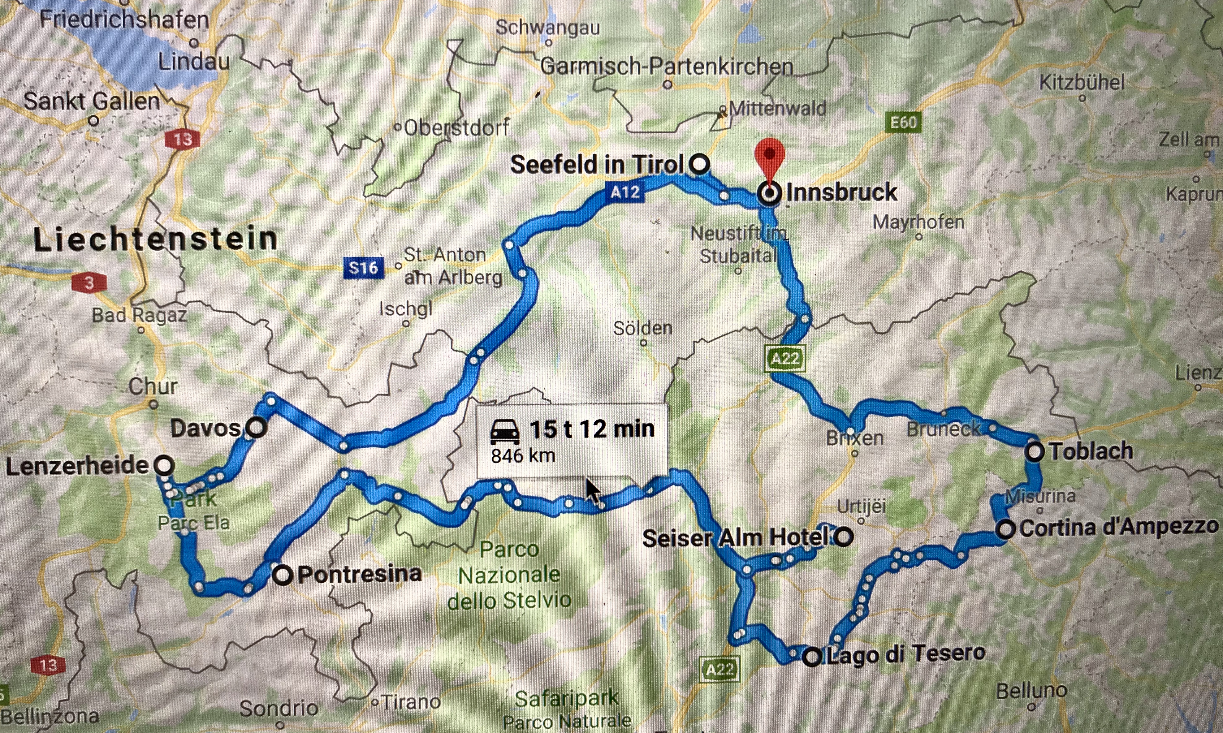
The Roundtrip
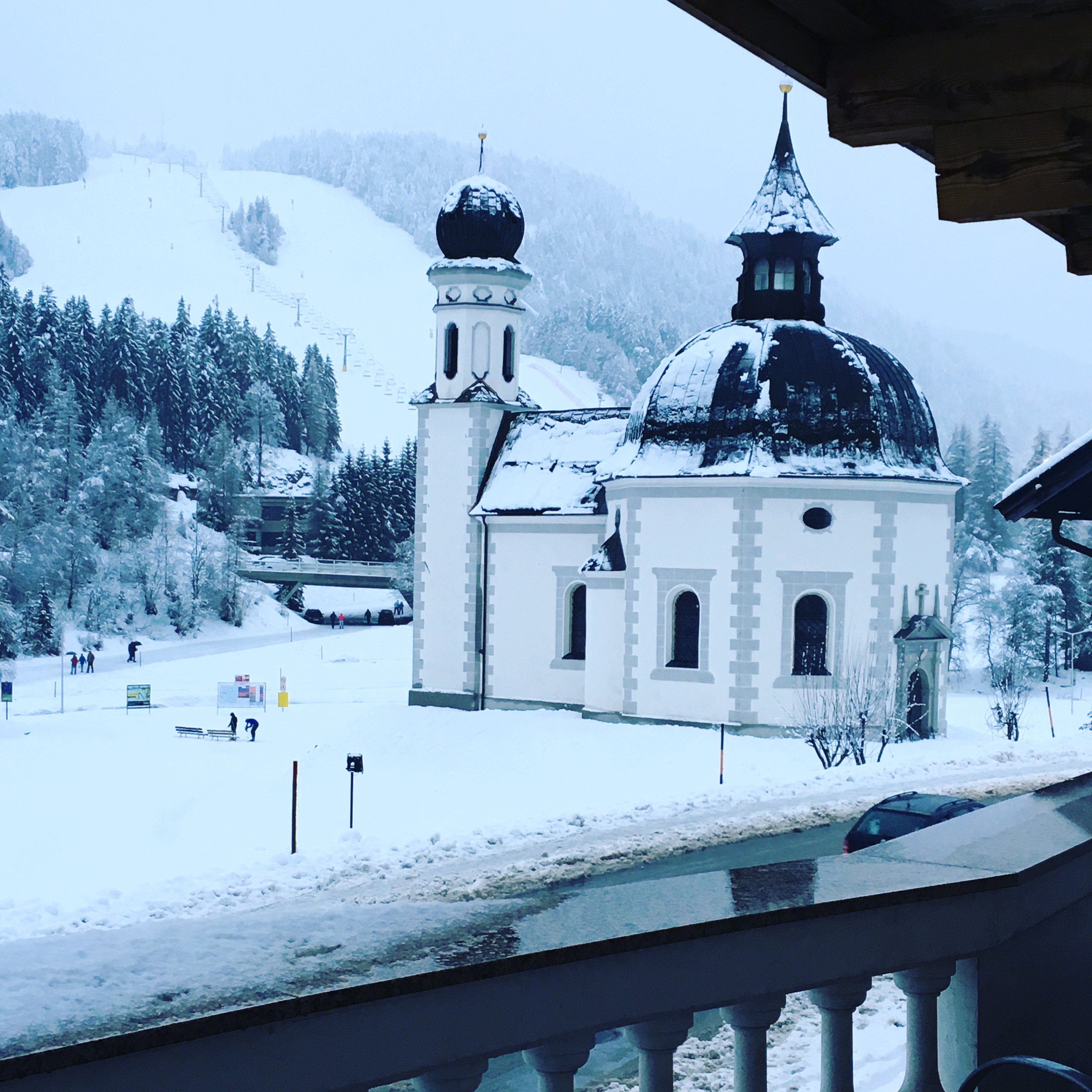
First stop: Seefeld
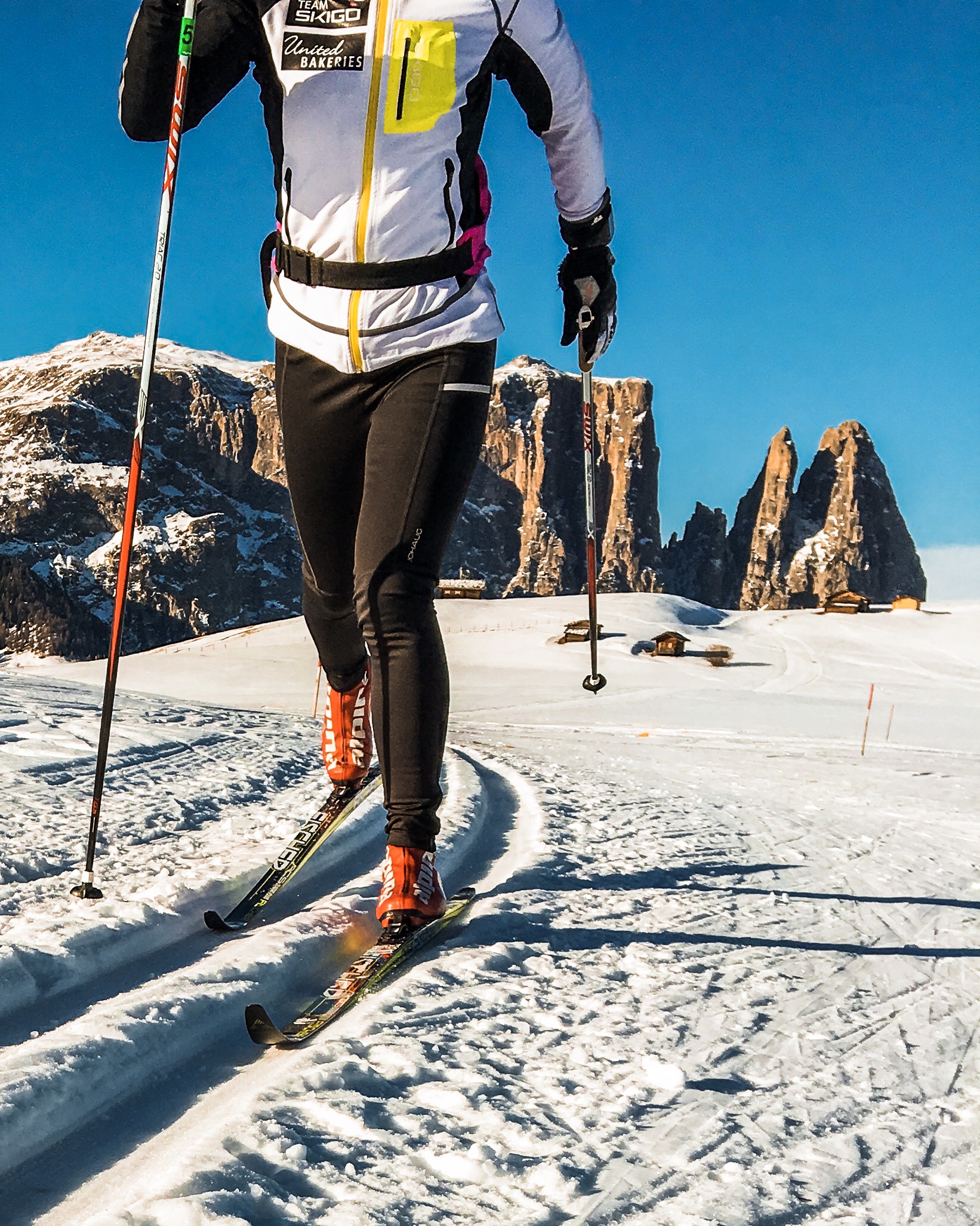
There’s no better place to start your adventure than the site of the 2019 cross-country World Championship, Seefeld in Tirol. Seefeld is situated on a sunny plateau high above Innsbruck, about 1200 meters above sea level and can be easily reached by train. The ski tracks start right in the middle of the city centre with several nearby hotels to choose from. We stayed at the four star St. Peter Hotel just across the street from the ski tracks and two conveniently located sport shops.
The ski tracks from the hotel.
Tirol claims to offer a total of 4000 km of tracks throughout the region, many of them accessible from Seefeld or nearby villages. You will find easy terrain as well as long and tough ascents and can also try out the world cup tracks which will be used during the world championship in February/March 2019.
When you are ready to leave Seefeld behind, the Italian village of Toblach in south Tirol is a great choice. The drive from Seefeld takes about two hours and I recommend that you make a short stop for lunch and some shopping in Innsbruck on your way there. Toblach traditionally hosts one or more races forming part of the legendary Tour de Ski in January every year. The events are free for spectators and have a great atmosphere. During race days the world cup tracks will be closed for other than the athletes, but there are many other nearby tracks to choose from, including my favorite, the track from Cortina (Fiames Ski Arena) to Toblach, which is the same track being used for the men’s long distance during Tour de Ski as well as the Visma Ski Classic event (see below).
Once in Toblach, your obvious choice of accommodation may be the perfectly located Hotel Santer, which is basically on the ski arena, Apparthotel Germania for great breakfast as well as easy access to the ski arena, or the friendly Hotel Stauder, which also serves great food. Don’t miss out on Pizzeria Hans while in town!
Races to join: Pustertaler Skimarathon, 11 January 2020 and Toblach-Cortina 1-2 February 2020 (classic technique and Visma Ski Classic on Saturday and free technique on Sunday) and Gsieser Tal Lauf 15-16 February 2020 (classic technique on Saturday and free technique on Sunday).
Third stop: Val di Fiemme
In Tour de Ski the races in Toblach are usually followed by the final races in Val di Fiemme, and I suggest you follow the same route. Leaving Toblach you should plan for a stop in the sophisticated village of Cortina, stroll the pedestrian street and have lunch at San Brite (reservations recommended) before you enjoy the beautiful drive via Passo Pordoi to Val di Fiemme. Passing by Cortina and Canazei, this is also your opportunity to add a day or two of downhill skiing.
In Val di Fiemme my choice of hotel is the Castelir Suite Hotel, a quiet, intimate hotel with large rooms, great service and walking distance of the world cup ski arena at Lago di Tesero. Another option would be Hotel La Stua, a hotel popular among Norwegian skiers and the location of the massive Marcialonga after party. For lunch or dinner, try out the wine bar El Molin or La Stua.
Watching Tour de Ski.
Although a traditional cross-country skiing race destination and the host of several world championships and the legendary Marcialonga, Val di Fiemme does not have that many options for cross-country skiing. In two days you have it covered, nevertheless, having a slightly more Italian flare to it compared to the other destinations, and the cozy village of Cavalese, it is worth a visit. On day one I suggest you try out the world cup tracks from the Lago di Tesero Nordic Ski Arena. If enough snow, tracks will also be open along the river from leaving the world cup arena. During Tour de Ski you may opt to participate in the Rampa con i Campioni, a race open to the public which is equal to the Tour de Ski finale and includes the monstrous climb up Alpe Cermis.
On day two the tracks on the beautiful plateau of Passo Lavazè is worth a visit. Passo Lavazè is a beloved destination for participants of Marcialonga in the days leading up to the race and has easy as well as more strenuous tracks. Be aware though, that the plateau is about 1800 meters above sea level, which adds additional strain on the body. Thus you should save your speed for later.
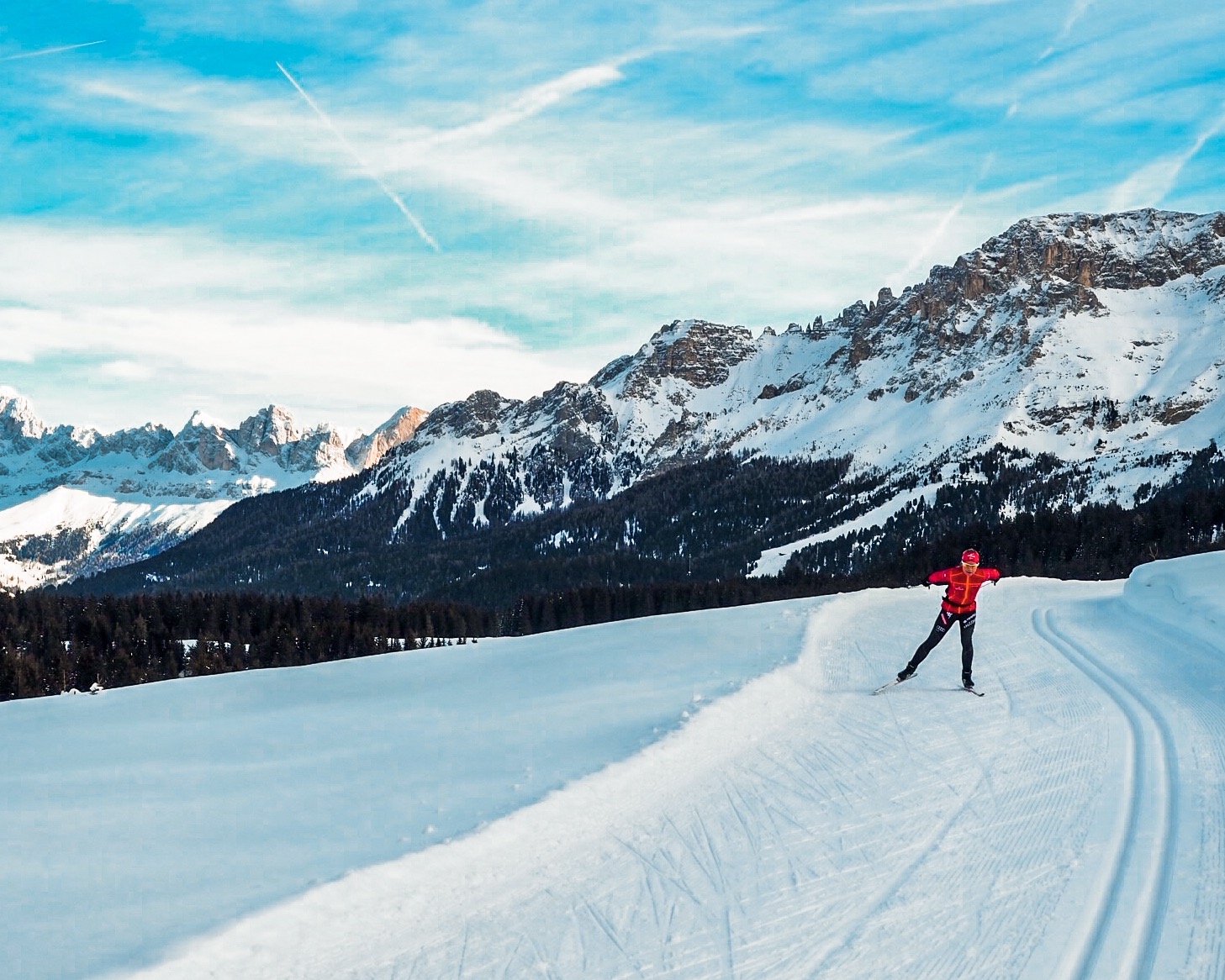
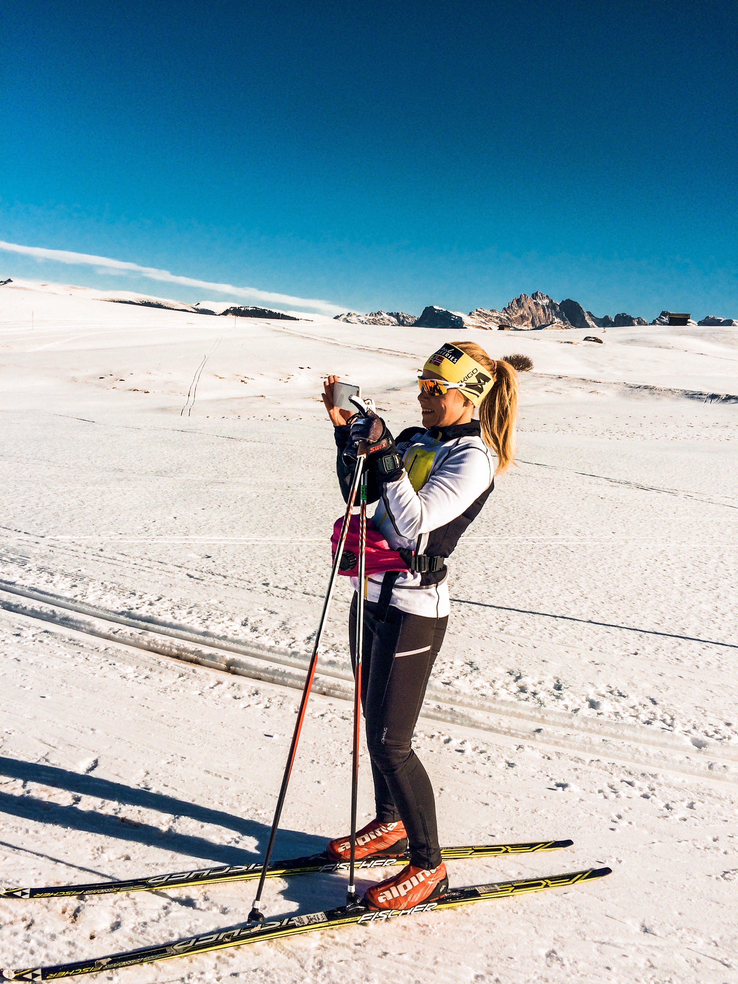
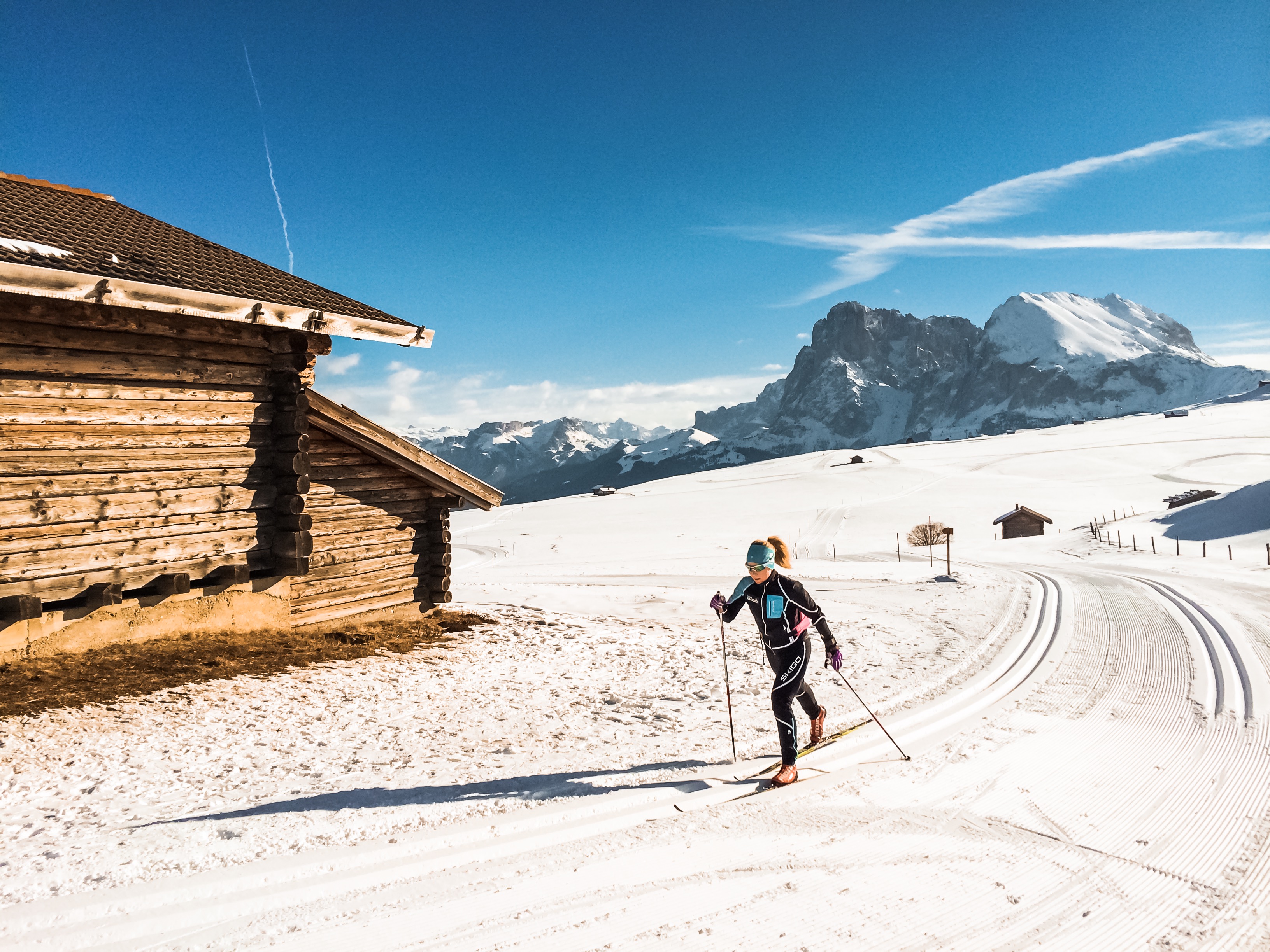
Having had a taste of the altitude at Passo Lavazè the natural next stop is the paradise-like destination of Seiser Alm. You can drive directly to Seiser Alm from Passo Lavazè, it is not the fastest route from Val di Fiemme, but for sure the most beautiful. For hotel options, check out my previous post on trailrunning in Seiser Alm here. I love staying at Ritsch Schwaige, but if money is no issue, you may want to check out Adler Mountain Lodge.
Grammable days in Seiser Alm.
Seiser Alm is the preferred location for many national teams when preparing for championships. On this high altitude plateau the perfectly groomed tracks are surrounded with spectacular mountains and huts and restaurants serving delicious food when taking a break in the sun. Highlights include sunset coloring the sky pink while cruising the longest loop facing the characteristic Schiliar mountain. If you did not know paradise, you do now. For more details on the about 80 km of tracks, go here and here.
If you are looking to do some downhill skiing on this road trip, Seiser Alm is a great starting point for skiing the Sella Ronda.
On your way from peaceful Seiser Alm to Pontresina in the Engadine valley in Switzerland I suggest you make a pitstop in either Bolzano or Meran for some nice Italian small-city vibe. The total driving time from Seiser Alm to Pontresina is about 3:30, mostly on regional roads. Take time to enjoy your surroundings. In Pontresina Hotel Rosatsch is a good option, located on the main street in short distance of my favorite hang out, Gianottis. Pontresina also has a few ok shops for cross-country skiing in case you find yourself in need of anything.
My personal winter experience of the Engadine valley is unfortunately limited to the Engadine Ski Marathon tracks, , which provide for a great high-speed skating experience on the lakes in the valley before more hilly parts take you to the finish line in Pontresina. However, this area has much more to offer, including illuminated night tracks, all of which is surrounded by spectacular mountains. And I have been told that you should not miss out on skiing in Val Roseg, tracks starting from the Nordic ski arena near the train station in Pontresina. For more information, turn to this site. With St. Moritz right in the middle of it, this is naturally also the place to leave your cross-country skis behind for some downhill skiing, and, if you wish, some shopping.
On our way to Zürich Airport after Engadin Skimarathon we stopped in Lenzerheide to ski in the sun in their fairly new Nordic ski arena, financed mainly by an enthusiastic local family. I suggest you do the same driving from Pontresina to your final cross-country skiing gemstone, Davos. Drive early in the morning from Pontresina and grab a coffee (or even breakfast) at Bio-Alp Alesch near the Albula pass on the way. The driving time from Pontresina to Lenzerheide is less than 90 minutes. See strava link below for where we parked. This is also one of the places where you can access changing rooms. For more information, go to this site.
After exploring the trails, which run along the main street cutting through Lenzerheide, find yourself a nice spot in the sun for lunch while enjoying the view of the mountain sides hosting the world cup final for the downhill skiers in 2014.
Saving the best for last! Davos is the centre of cross-country skiing in Switzerland and is regularly on the cross-country skiing world cup calendar. About 1550 meters above sea level, the altitude will have impact on your performance, but also ensures good skiing conditions during the winter season with some tracks opening already in October. This alpine resort town is surrounded with beautiful mountains providing great opportunities to take your alpine skis for a spin as well.
Although having visited Davos several times during summer, I have never been there in the winter. Thus I turned to former top cross-country skier Tor-Arne Hetland for guidance on how to best explore Davos on skis. Of the three beautiful valleys you can ski, his number one choice is skiing up the Sertig valley. For some extra uphill you can ski via Junkerboden. When finally reaching the end of the valley you will find yourself in the middle of this typical alp idyll we are all dreaming of, surrounded with wooden huts and magnificent mountains. Drop in at Walserhuus or Bergführer and load up on Apfelstrudel with vanilla sauce before you enjoy the downhill back to Davos. Note that the upper five kilometers are prepped only for classic technique.
Davos has loads of accommodation options. In the summertime, my choice has always been Walserhuus. During winter I would maybe opt for a hotel close to the Nordic ski arena, such as for example Hotel Bünda.
Go here for more on cross-country skiing in Davos.
Obviously, most of us are not in position to do the whole roundtrip described above and many of the destinations described are worthy of being your one-stop for cross-country skiing in the Alps. Create your own roundtrips or combine one of the destinations with one of the many long distance ski races in the area. Realizing that I have missed out on the great cross-country skiing possibilities in Davos, this will for sure be on my 2019 bucket list, maybe combined with participation in the Sertig Classic race.


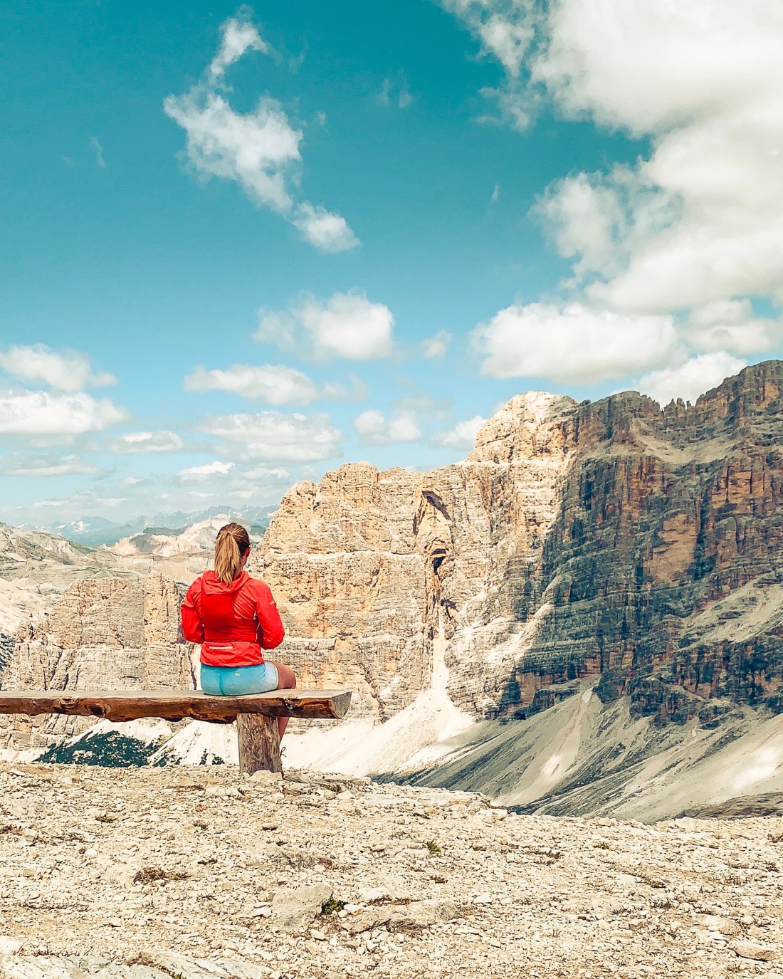
 From the Nuvolau you have great views of the famous Five Towers, popular for mountain climbers. If you have the time, you can return via the towers, by taking a right turn at Rifugio Averau (400 meters from Nuvolau) and continue on trail 439 until you meet trail 440, which will take you back to your starting point.


 My personal winter experience of the Engadine valley is unfortunately limited to the Engadine Ski Marathon tracks, , which provide for a great high-speed skating experience on the lakes in the valley before more hilly parts take you to the finish line in Pontresina. However, this area has much more to offer, including illuminated night tracks, all of which is surrounded by spectacular mountains. And I have been told that you should not miss out on skiing in Val Roseg, tracks starting from the Nordic ski arena near the train station in Pontresina. For more information, turn to